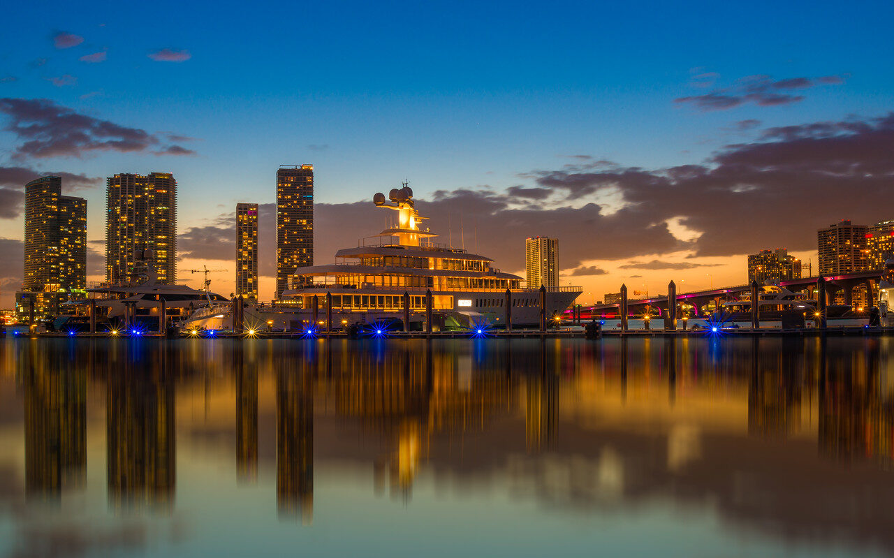
Miami photographs are built on contrast: pastel architecture against hard light, calm water against a lit skyline, quiet gardens twenty minutes from traffic. This guide names five iconic locations with landmark GPS and practical access notes, then adds working guidance for street, night and coastal photography across the city. It is a starting point, not the full paid guide.
Edin has photographed Miami for years, but this article does not claim that every illustration is his or that each venue’s current rules were personally re-tested this week. Miami and Miami Beach are separate cities, and a public street, a bridge corridor and a private garden do not share access rules. Use the operator links to check the visit you actually plan, and treat settings as starting points, not guarantees.
Plan your Miami photographs with the 12-location Miami Photography Guide.
The five iconic Miami photography spots (with GPS)
These five cover the range of the city: shoreline, architecture, bay views, gardens and a state-park lighthouse. Each entry has the named destination, GPS and a tappable Maps link. The remaining seven locations, with shot lists and timing, live in the full guide.
1. South Pointe Park
 Save
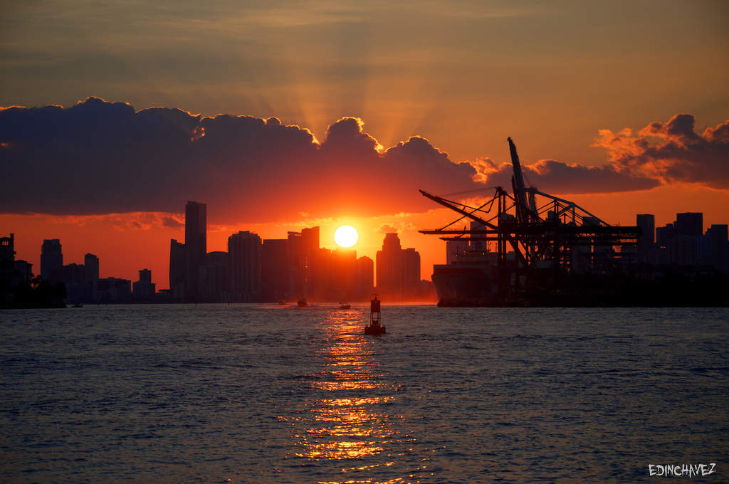
The southern tip of Miami Beach gives you shoreline, a pier, passing cruise ships and the downtown skyline across Government Cut in one compact park. Decide what the frame is primarily about: the landscape, or the people using it. A small figure on the path can establish scale, but avoid reducing every person to a silhouette just because the sky is attractive.
At sunrise, work the east-facing beach and pier; at sunset, shift to the west side, where the skyline catches warm light from the west; at night the lit buildings and passing vessels suit a long exposure from a stable position. The City of Miami Beach park listing owns current access and event restrictions; check pier access before a night visit and do not assume an ungated path means permission to stay after closing.
Landmark GPS: 25.7663809, -80.134671
Named destination: South Pointe Park
1 Washington Ave, Miami Beach, FL 33139, USA
Open South Pointe Park in Google Maps
Access: Public park at the south end of Miami Beach with paths, shoreline and pier. Confirm current hours, pier access and event restrictions on the city listing. Keep clear of path traffic, do not balance on barriers for a frame, and leave if the coastal plan becomes unsafe.
2. Ocean Drive and the Art Deco Historic District
 Save
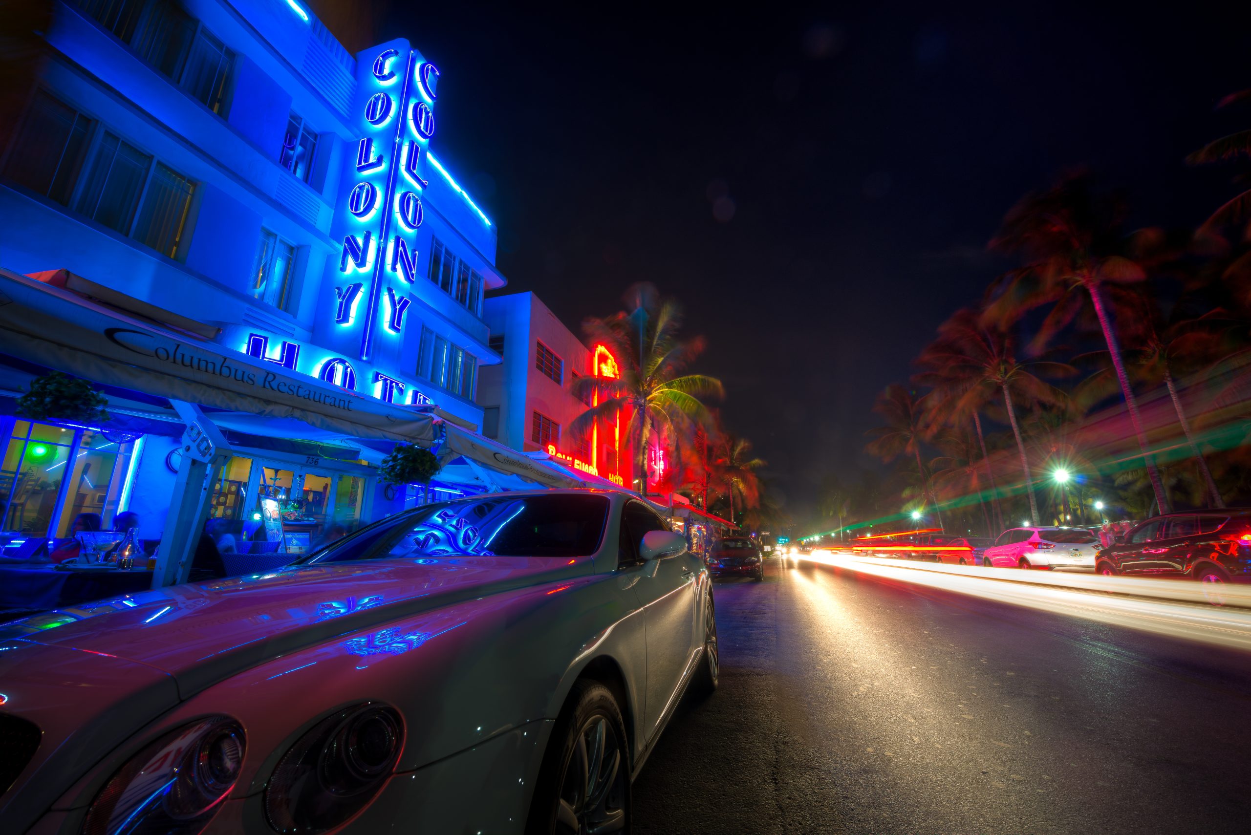
Ocean Drive is the architecture-first visit. The City of Miami Beach Art Deco page provides architectural context for the district; use it to recognize shapes, color and decorative features rather than labeling every building identically. Try one frame where the facade gives the structure and a passing person adds scale, then a pure architectural frame. Those are different jobs.
Strong midday light creates graphic shadows across the pastel facades; softer morning light makes the color relationships easier to read. At night the neon signs and mixed lighting bring a different set of exposure and white-balance decisions. A specific look in somebody else’s image is not a promise of your evening’s conditions. Stay aware of traffic and do not step backward into the road while looking through the viewfinder.
Landmark GPS: 25.7685206, -80.1332032
Named destination: Ocean Drive
Ocean Dr, Miami Beach, FL 33139, USA
Open Ocean Drive in Google Maps
Access: Public street along the beachfront; the historic district runs roughly along Ocean Drive between 5th and 15th Streets. Keep equipment out of pedestrian flow, check the city’s rules before planning a tripod setup, and respect business entrances along the strip.
For a guided look at the architecture behind your photographs, try the Art Deco and History Walking Tour. It is a history and architecture walk, not photography instruction; check the departure time before booking. Tour links are affiliate links; we may earn a commission if you book through them, at no extra cost to you.
3. Rickenbacker Causeway
 Save
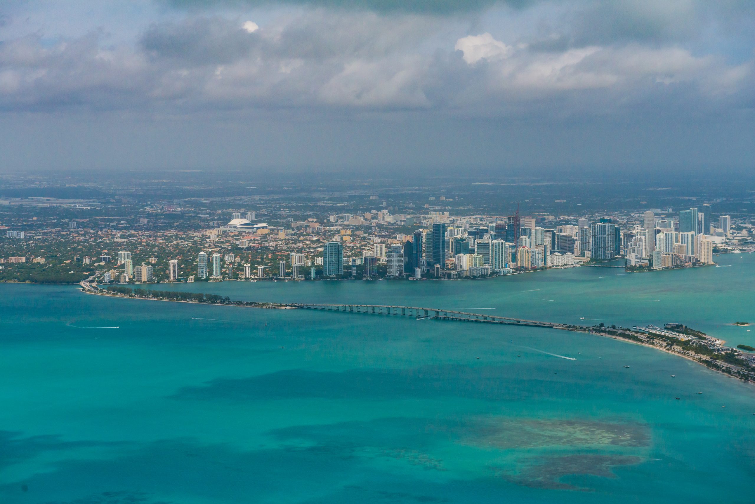
The Rickenbacker Causeway gives this five-stop route a different subject: the relationship between the bridge, open bay and skyline. Use the bridge as a leading line and leave enough water in the frame to show its scale. The aerial photograph above explains the geography; it is not a promise that you can reproduce that angle from the ground.
Plan a ground-level photograph from a permitted public shoreline or pedestrian area. Never stop on the roadway, stand in a cycle lane, climb barriers or treat a bridge shoulder as a tripod position. Check current access and use designated parking rather than improvising a roadside pull-off.
Late afternoon and blue hour are useful times to explore the skyline’s changing light. A wide lens emphasizes the bay and bridge; a longer lens separates the towers from the foreground. Wind and traffic vibration can soften long exposures, so review a test image at full magnification rather than trusting the rear-screen thumbnail.
Landmark GPS: 25.7373993, -80.1667303
Named destination: Rickenbacker Causeway
Rickenbacker Cswy, Florida, USA
Open Rickenbacker Causeway in Google Maps
Access: A transport corridor, not a photography platform. Check Miami-Dade’s Rickenbacker Causeway information for the corridor and safety context; obey current signs and closures. Drone access is not implied by the aerial illustration.
4. Vizcaya Museum and Gardens
 Save
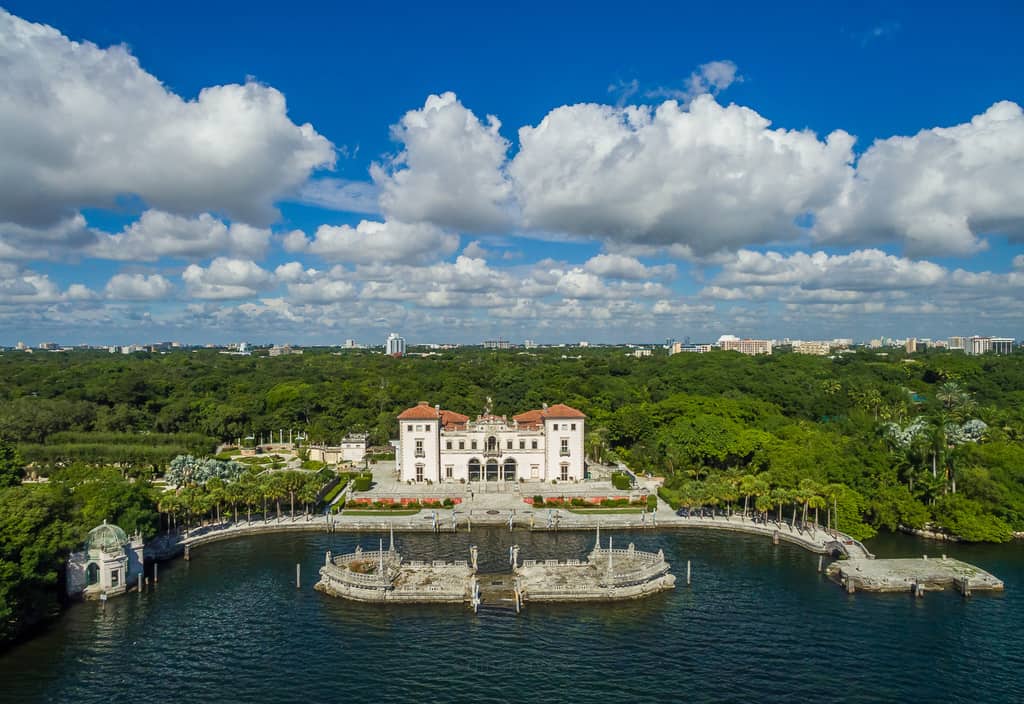
Vizcaya is the controlled-access visit: architecture, formal gardens and Biscayne Bay frontage in one estate. The museum’s photography and filming page distinguishes visitor photography, portrait permits, commercial still photography and filming, with conditions that trigger a permit. Check the exact activity rather than assuming that an amateur camera settles the question.
Architecture and gardens ask for a slower approach. Look at proportion, reflections and the direction of the frame, keep paths open and follow staff instructions. A permit does not give priority over other visitors or authority to enter excluded areas. If you plan a portrait, commissioned image or organized session, confirm the permit, reservation and permitted areas before committing time or money.
Landmark GPS: 25.7443866, -80.2104747
Named destination: Vizcaya Museum & Gardens
3251 S Miami Ave, Miami, FL 33129, USA
Open Vizcaya Museum & Gardens in Google Maps
Access: Ticketed museum estate on S Miami Ave in Coconut Grove. Visitor photography is generally allowed within stated limits; portrait, commercial and organized sessions need the matching permit. Check current restoration impacts, since a sample photograph can show a space temporarily changed or unavailable.
5. Bill Baggs Cape Florida State Park
 Save
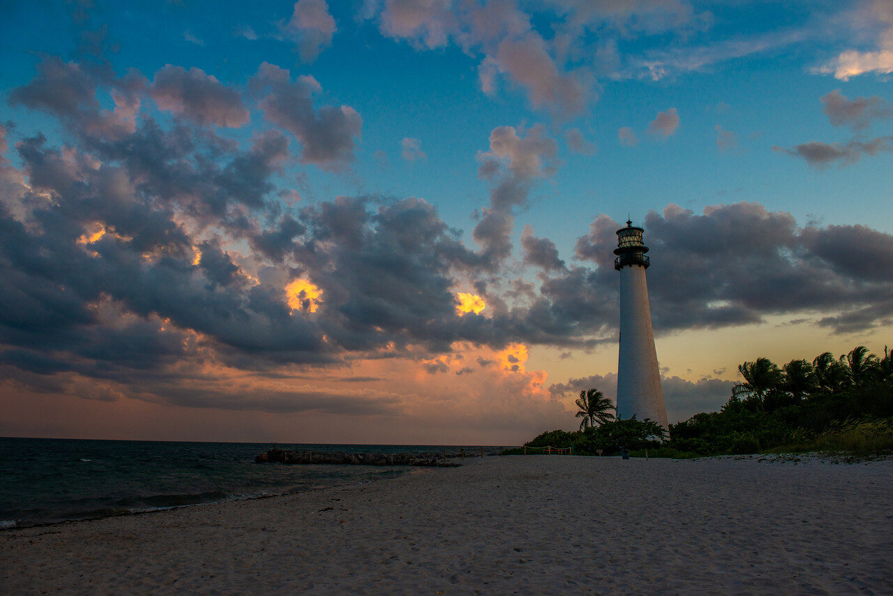
At the south end of Key Biscayne, this is the landscape outing: beach, dunes, sea grape and the 1825 lighthouse with the city visible across the water. The lighthouse works as a single strong vertical against sunrise or sunset color; the shoreline gives long-exposure foregrounds where permitted. Check the state park hours and fees and the separate lighthouse-tour information before planning around either.
Photograph only from areas open to visitors and do not assume after-sunset access; park hours, not your composition, decide when you leave. Keep gear above the splash line and rinse salt from your hands before handling controls.
Landmark GPS: 25.6755217, -80.1590677
Named destination: Bill Baggs Cape Florida State Park
1200 Crandon Blvd, Key Biscayne, FL 33149, USA
Open Bill Baggs Cape Florida State Park in Google Maps
Access: State park on Key Biscayne with an entrance fee; check current hours and any tour or access restrictions on the park page. Give wildlife and other visitors space, and plan the drive: it is a separate outing from the mainland spots, not a quick detour.
Street photography at the five locations
Use Ocean Drive for slow, deliberate street work. Find a background before chasing a subject, watch where people pass through usable light, and keep entrances clear. Ask before photographing inside a business or making a close portrait, and respect a refusal. A neighborhood is somebody’s daily life, not a themed stage.
For structured learning, the ShutYourAperture Academy’s Street Photography: The Decisive Moment course covers the craft behind these decisions.
Night photography in Miami
For night frames, choose places with a public viewing area and verify access after dark. Work Ocean Drive for neon and South Pointe for water and skyline compositions, subject to their current access rules. A shoreline view, a lit street or a skyline can make a strong frame, but access, safety and light change after sunset. Do not assume an ungated path means permission to stay after a posted closing time, and check the venue’s own listing rather than an old article’s claims about parking, pull-offs or after-midnight safety.
Plan the exposure from the scene, not from a recipe. For a stationary skyline, start with a stable camera, a timer or remote release, and a test frame; choose shutter speed to control moving light and water, then inspect highlight clipping, focus and motion. A fixed “20-30 seconds at f/8” recipe is not reliable across all scenes. See the shutter-speed guide and ISO guide for the underlying trade-offs. Humidity can fog a cold lens when you step out of air conditioning, so give gear time to acclimate before judging focus.
The ShutYourAperture Academy’s Night Photography course (7 modules, 28+ lessons) covers the full range from blue hour to city lights.
Coastal photography: weather and access
At South Pointe and Cape Florida, plan around wind, cloud and changing water conditions. Check the operator’s current access rules before setting out. If the shoreline is unsafe or closed, postpone the coastal session rather than moving around a barrier.
When to photograph Miami: a year-round breakdown
 Save
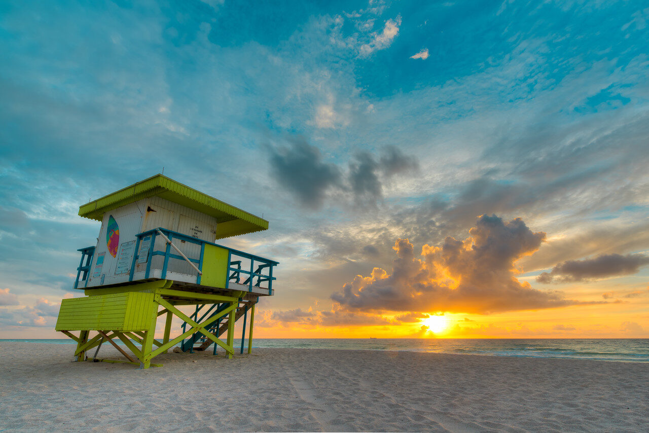
Dry season (roughly November-April): lower humidity, milder temperatures and clearer mornings make this the comfortable working season. Sunrise over the Atlantic suits the beach and shoreline spots; winter fronts can bring crisp, clear air after they pass. This is also the busiest visitor season, so popular spots need earlier arrivals.
Wet season (roughly May-October): heat, humidity and fast-building afternoon storms. The storms are also the opportunity: dramatic cloud build-ups, rain-washed streets for reflections at night and clean air after a downpour. Plan morning sessions, watch radar, and treat lightning as a hard stop, not a backdrop to outlast.
Hurricane season (June-November): overlaps the wet season. Most days are ordinary, but check forecasts before booking travel around a shoot and follow official guidance if a storm is named. No photograph justifies ignoring an evacuation or closure.
Photographer safety and etiquette in Miami
Heat and sun are the everyday hazard: carry water, use shade and accept that midday in summer shortens a session. Sudden rain is a gear threat as much as a comfort issue, and salt spray near the water attacks equipment; keep gear above the splash line and wipe down after a coastal session.
In the city, traffic is the background, not something you control. Do not step backward into the road while looking through the viewfinder, do not stop in a crossing, and keep a tripod out of pedestrian flow. At night, work in public viewing areas, stay aware of your surroundings and leave when an area empties out.
With people, the rule is respect: ask before a close portrait, accept a no, and caption only what you know. A consent-based portrait and a candid street image are different approaches, and both require judgment.
Frequently asked questions
Do I need a permit to photograph at Vizcaya?
It depends on the session. Vizcaya distinguishes visitor photography from portrait sessions, commercial still photography and filming. Normal admission does not automatically authorize a client production. Check the photography and filming rules linked above and confirm your exact activity with the venue before arriving.
Can I photograph from the Rickenbacker Causeway?
Use only permitted public pedestrian or shoreline areas and designated parking. Do not stop on the roadway or occupy cycle lanes and bridge shoulders. Check current signs and closures before setting up; the aerial photograph here does not imply permission to fly a drone.
What is the best time of day to photograph Miami?
Early morning gives you the softest light, the emptiest beaches and the calmest water for skyline reflections. Late afternoon to sunset works for the skyline from South Pointe and for warm light on the Art Deco facades. Night opens the neon and long-exposure work, with the access checks described above. Midday in summer is harsh and hot; use it for scouting, not for your keeper frames.
Can I photograph people on the street in Miami?
Public street photography is a normal practice, but legal is the floor, not the craft. Photograph people with respect: no directing unsuspecting passersby into your imagined scene, ask when a portrait is the goal, respect a refusal immediately, and never attach a guessed identity or story to a real person’s face in a caption.
Is Miami worth photographing in hurricane season?
Visit with flexible plans, check the current forecast, and follow official weather warnings and closure notices. Do not treat dramatic storm clouds as a reason to remain on an exposed shoreline. Postpone a session when conditions are unsafe.
Get the full Miami photography guide
The $47 PDF has 12 distinct Miami photography locations with landmark GPS, tappable Maps links, shot lists, composition tips and access notes for each. The five spots above are the free starting set; the guide is the complete route. Updates are included free.
Get the Miami Photography Guide – $47
Related photography spots in Florida
If you found this guide useful, our other curated Florida location guides: