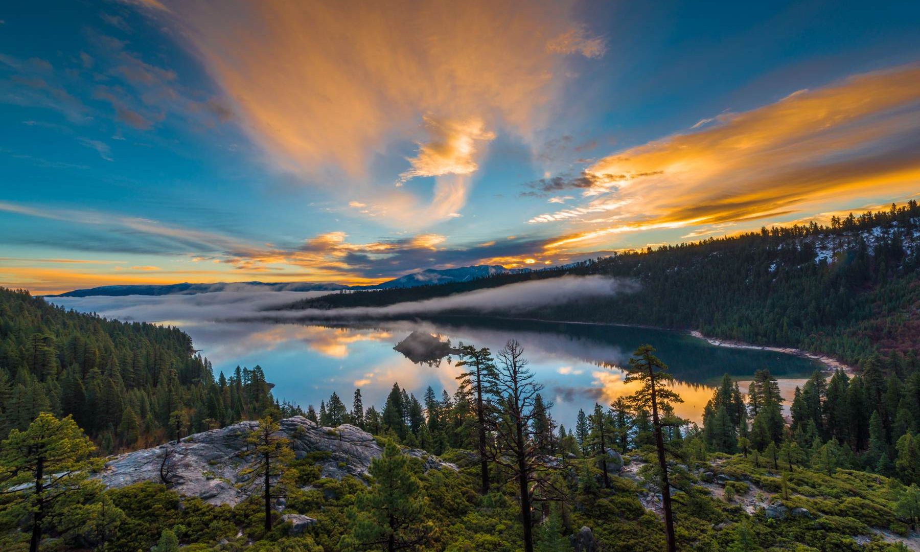
Lake Tahoe rewards a smaller plan. Rock, water, forest and distant ridges can all be photographed within a single area, but access matters as much as light. Sand Harbor has entry rules; Emerald Bay has steep routes and limited parking; some pier photographs depend on private access. Choose the session you can reach lawfully and safely, then work the light that is actually there.
 Save
Plan by area, not by the length of a checklist
These are researched planning notes paired with Edin Chavez’s own photographs. Conditions, prices and access can change. The examples show how a place can photograph, not a guaranteed alignment or exact camera position. Check the linked operator before visiting. Admission, permits, transport and third-party costs are separate.
Start with one main subject and a backup. Allow time to find the open route, compare compositions and return before a park or venue closes. A smaller session often leaves more time for useful photographs than a list of distant stops. Check sunrise, sunset and sun direction for your actual date rather than copying the time of another person’s image.
Choose exposure for the scene
Set shutter speed for movement and camera stability, aperture for the depth you need, and ISO to support those choices. Check focus and important highlights at full magnification. No single aperture guarantees sharpness everywhere. A tripod is useful only where it is permitted and where it leaves a safe route for others. At restricted venues, plan handheld rather than hoping a small support will be overlooked.
1. Sand Harbor beach
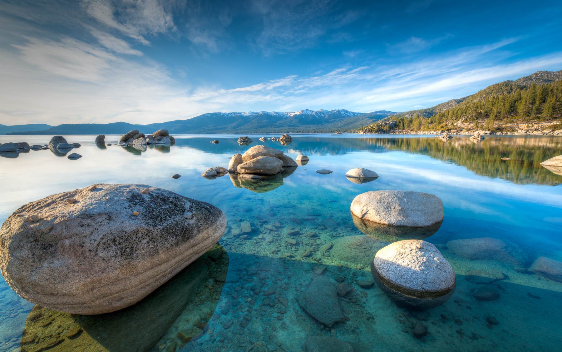
Sand Harbor is the main east-shore park stop in this guide. Rounded granite, shallow water and forested edges give you several subjects without needing to chase an exact tripod position. Edin’s photograph is a reference for composition, not a promise that the same water level or empty beach will be waiting.
Composition: Start with a wide or standard lens. Choose one foreground rock, then move until its outline is separate from the next rock. Look for a diagonal route through the water. A polarizer can reduce surface reflection, but check its effect across the frame before committing.
Light and timing: Compare calm water with small wind-driven ripples. Calm conditions favor reflections and clear views into the shallows. Soft light can make the stone and water easier to balance. Sunset color may work, but do not assume that every evening produces it.
Access: The park lists opening at 8 a.m. and closing one hour after sunset. Vehicle entry is $10 for Nevada vehicles and $15 for non-Nevada vehicles when checked. Seasonal vehicle reservations apply; official pages disagree on parts of the date and morning window. Confirm your exact visit in the reservation system. Do not plan a pre-opening sunrise entry.
Nevada State Parks: Sand Harbor
 Save
GPS landmark: Sand Harbor State Park. Open Sand Harbor State Park in Google Maps
2. Bonsai Rock
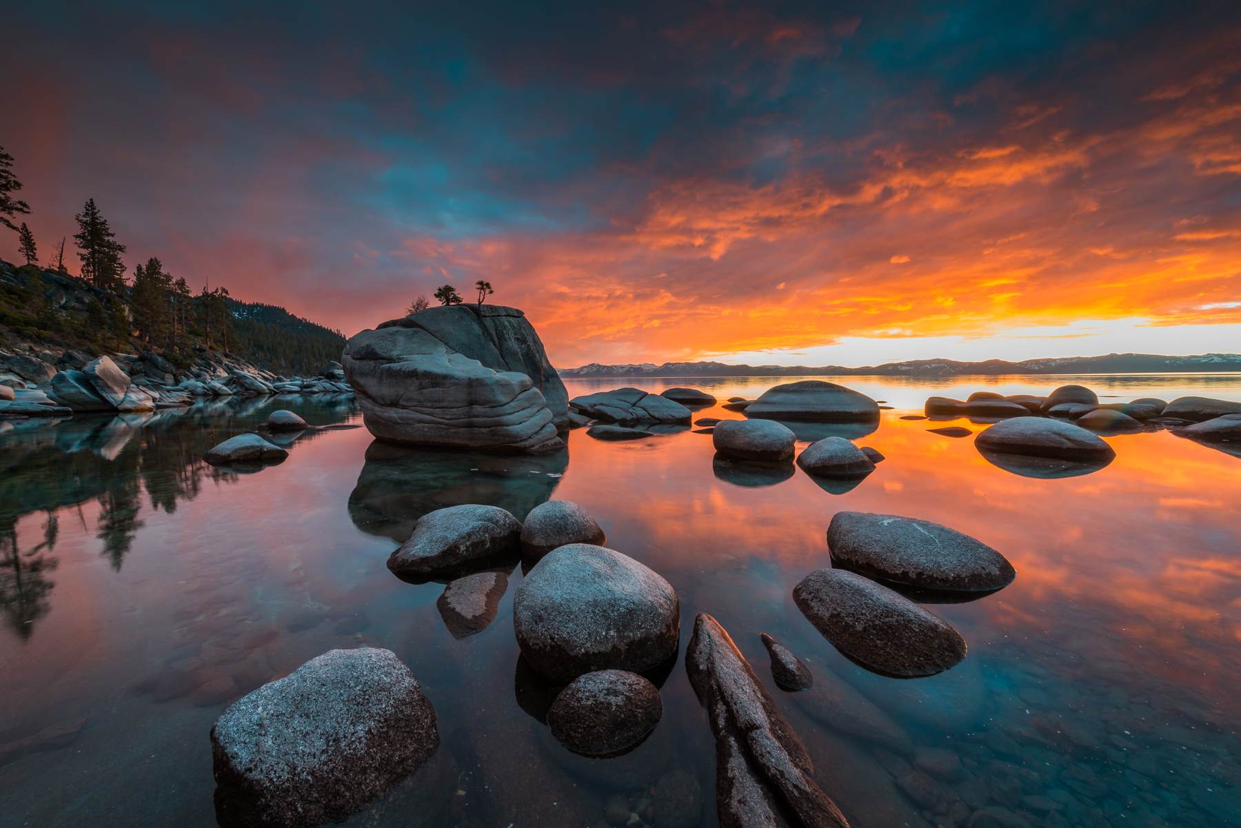
Bonsai Rock is a distinctive rock-and-tree subject on Tahoe’s east shore. Edin’s frames show two different relationships between the rock, water and sun. They demonstrate why returning under different conditions can be more useful than repeating one famous composition.
Composition: Keep the tree silhouette separate from the distant shoreline. Try a wide view with a near rock, then a tighter view in which Bonsai Rock is the only strong shape. Compare water texture at different shutter speeds. Never touch or climb the tree-bearing rock.
Light and timing: The sample sunset frames are examples, not a fixed schedule. Cloud, water level, wind and the seasonal sun position change the scene. Scout the way back in daylight; darkness makes a steep, rocky return harder.
Access: Do not assume that an informal roadside pin identifies legal parking or a maintained, accessible path. Check current land-manager guidance and signs before attempting access. If you cannot confirm legal parking and a safe route, skip the descent and photograph from a managed public shore instead.
Nevada State Parks: Sand Harbor
 Save
GPS landmark: Bonsai Rock Lake Tahoe. Open Bonsai Rock Lake Tahoe in Google Maps
3. Cave Rock area
The guide groups lake views near Cave Rock under one name. The state park waterfront and the uphill Cave Rock trail are different access points. Decide which experience you want before driving, rather than assuming the boat-launch parking serves the trail.
Composition: For lake views, use a normal or telephoto lens to isolate tree-covered points and receding shorelines. Look for contrast between dark forest and lighter water. A wide view can work when clouds add structure, but do not include a large empty foreground by habit.
Light and timing: Soft light and clear air help distant shorelines separate. Strong wind may make an exposed viewpoint uncomfortable or unsafe. Keep the session short when conditions deteriorate and do not climb higher merely to match an old photograph.
Access: Nevada State Parks states that the trail cannot currently be accessed from Cave Rock State Park; the trailhead is across the highway on Cave Rock Drive. The waterfront day-use fee is $10 for Nevada vehicles and $15 for non-Nevada vehicles when checked. Treat these as separate destinations, follow the actual road route and do not cross the highway casually.
GPS landmark: Cave Rock – Lake Tahoe Nevada State Park. Open Cave Rock – Lake Tahoe Nevada State Park in Google Maps
4. Emerald Bay overlook
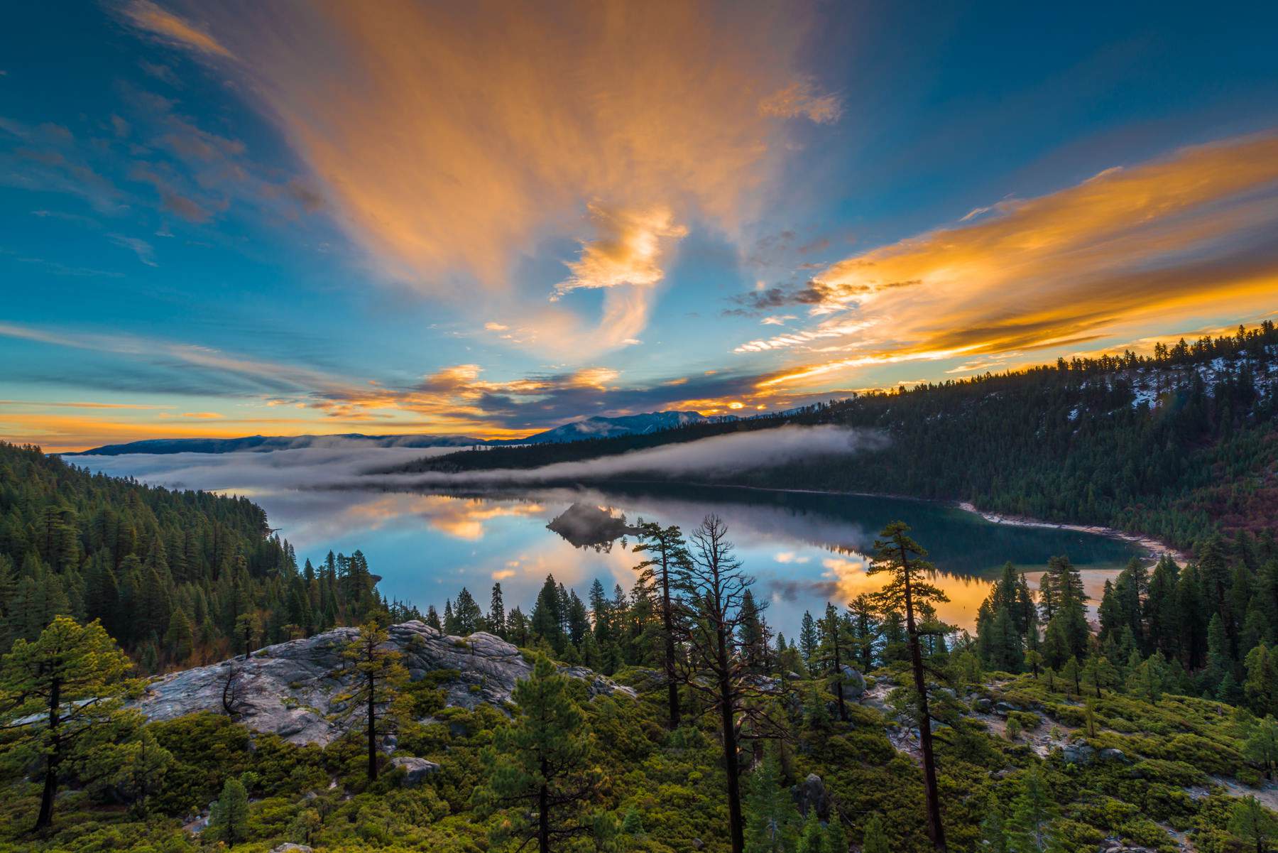
The overlook gives a broad view of Emerald Bay and Fannette Island. Edin’s sample cover photograph shows the strength of a foreground that leads into the bay. Similar light is never guaranteed, so begin by building a composition that works without dramatic color.
Composition: Use a wide lens only when the foreground is doing useful work. Keep the island distinct from shorelines behind it. A standard lens can simplify the view and avoid exaggerating empty foreground. Make a second exposure that protects the bright sky if the contrast exceeds your camera’s range.
Light and timing: Sunrise, clearing weather and autumn conditions can all produce different looks. Check the date-specific sun direction and actual park access hours. Snow, ice and smoke may change the plan. Do not go beyond a barrier for a cleaner frame.
Access: The Vikingsholm parking lot is listed as sunrise to sunset, with no overnight parking. Current posted rates are $10 per vehicle for the day or $3 for one hour. California State Parks warns against parking on Highway 89 and says illegally parked vehicles may be towed. Arrive with a backup rather than forcing a roadside stop.
California State Parks: Emerald Bay
GPS landmark: Emerald Bay State Park Lookout. Open Emerald Bay State Park Lookout in Google Maps
5. Eagle Falls
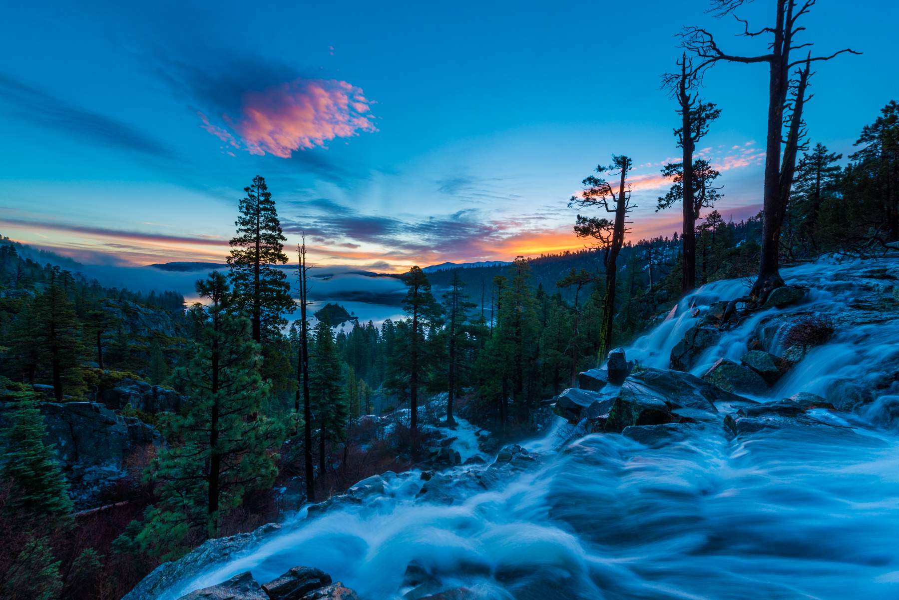
Edin’s photograph places falling water against the wider Emerald Bay landscape. Upper and lower falls, the trailhead and the roadside viewpoint are not interchangeable destinations. Choose a signed route and do not approach the lip of a waterfall.
Composition: Include enough rock or forest to show scale. Compare a shorter exposure that keeps detail in the water with a longer exposure that softens it. Keep spray off the lens and recheck the frame for droplets. A bright waterfall can clip well before the surrounding forest looks properly exposed.
Light and timing: Flow varies through the year. Snowmelt may strengthen it, while dry periods can leave a quieter subject. Wet rock, ice and sudden changes in footing are more important than getting a particular shutter speed.
Access: The Forest Service lists Eagle Falls Picnic Area and Trailhead on Highway 89 with a $5 vehicle day-use parking fee and seasonal facilities, typically mid-May to mid-October depending on weather. Check wilderness requirements if continuing into Desolation Wilderness. Do not confuse this parking fee with the separate state-park lot across the road.
Forest Service: Eagle Falls trailhead
 Save
GPS landmark: Eagle Falls Trailhead Lake Tahoe. Open Eagle Falls Trailhead Lake Tahoe in Google Maps
The full Lake Tahoe Photography Guide adds 10 more spots – each with its GPS landmark, composition teaching, light notes and source-linked access checks.
The Lake Tahoe Photography Guide
The Lake Tahoe Photography Guide brings all 15 spots into a black-and-gold PDF, with Edin Chavez’s photographs, composition teaching, light notes and source-linked access checks. The guide is $47. It does not include admission, permits, tours, presets or Academy membership. Every spot carries its GPS landmark and a tappable Google Maps link; light and conditions are never guaranteed.
Get the Lake Tahoe Photography Guide – $47
Keep learning
For photography lessons beyond this destination, visit Shut Your Aperture Academy. Academy access is separate from the guide.
Questions photographers ask
Can I photograph sunrise inside Sand Harbor?
Sand Harbor lists opening at 8 a.m., so do not plan an entry before opening. Check the current reservation rules and visit hours for your date.
How much does Sand Harbor cost?
When checked October 8, 2026, vehicle day use was $10 for Nevada vehicles and $15 for non-Nevada vehicles. Reservation processing costs and policies are separate and can change.
Can I walk onto the Rubicon Bay piers?
Not without lawful access. The Rubicon Tahoe Owners association limits its beaches to eligible homeowners, cabin renters and guests. A photograph or road address does not grant permission.
Is Vikingsholm an easy drive-down stop?
No. The park describes a steep two-mile round-trip hike with about 400 feet of climb on return, and no public vehicle access or ride out.
Can I swim to Fannette Island?
No. Emerald Bay State Park prohibits swimming to the island because of dangerous boat traffic. The island is accessible only by watercraft and is closed in April and May for wildlife breeding. Check current conditions before planning any landing.
Does the guide include admission or GPS pins?
No. The $47 guide includes photo-led spots with GPS landmarks and Google Maps links, plus planning notes. Admission, permits and transport are separate, and conditions and light are never guaranteed.
Affiliate disclosure: This post includes Amazon and B&H affiliate links. If you buy through them, Shut Your Aperture may earn a commission at no extra cost to you. As an Amazon Associate, I earn from qualifying purchases.