Make one deliberate picture, not a checklist
The Keys can make a photographer impatient. Water, bridges, evening color and neon all seem available at once. They are not. A bridge sunset depends on the position of the sun and a legal place to stand. A night street depends on signs, pedestrians, weather and an entrance that still needs to work as an entrance. Trying to collect every scene can leave you driving while the one useful light window passes.
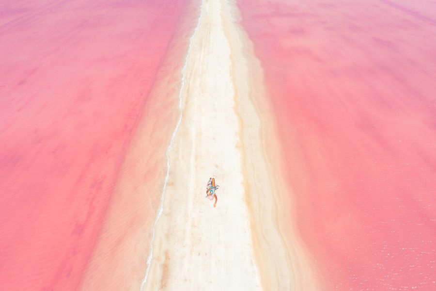
This article describes four spots: Bahia Honda old bridge, Strand/Walgreens, Sloppy Joe’s and Mallory Square sunset. The full guide covers ten real spots, adding Old Seven Mile Bridge, Tropic Cinema, Higgs Beach Memorial Pier, 801 Bourbon Bar, San Carlos Institute and Smathers Beach, each with its own named GPS reference. Multiple photographs of the same bridge remain one spot. Aerial pictures teach line and color, but do not become ground-camera recipes or authorization to launch a drone. Four ocean images with unverified exact places were excluded rather than assigned invented piers or beaches.
The photographs are historic work by Edin Chavez. The planning text is researched and the exposure suggestions are proposed tests, not the source files’ EXIF. A named map reference helps you orient, but it is not the position of the photographer or a promise that a particular shoreline, staircase or bridge section is open. Read current signs and check the actual manager’s rules before settling into a session.
Choose a subject before choosing a route. At Bahia Honda, decide whether you want the gap, a single truss-and-pier study or the wider bridge profile. In Key West, decide whether the photograph is about lettering, a reflection or a person passing through the light. Each choice makes the frame clearer and the fallback easier. You do not have to reproduce an old image for the new visit to be worthwhile.
1. Bahia Honda old bridge: identify the bridge before planning the frame
GPS reference: Bahia Honda State Park, Florida 33043, USA. 24.669021, -81.259051. Open named spot in Google Maps. Orientation, not an exact historic camera position.
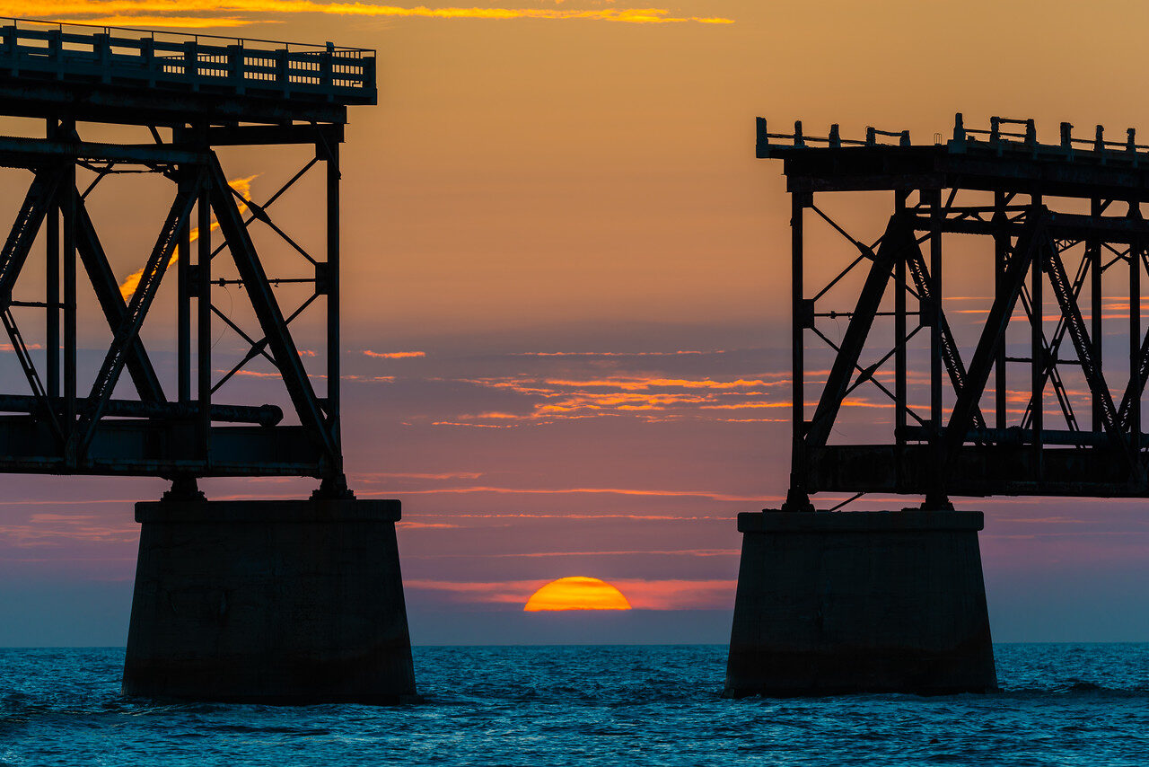
Photo: Edin Chavez. Historic photograph. Bahia Honda subject verified by truss, gap and pier comparison, not inferred from the gallery title.
The old bridge is easy to misname when a collection contains several Keys structures. Two wide photographs appear in a Seven Mile gallery but show the same steel-truss Bahia Honda structure as the missing-span sunset. The useful identification features are the elevated roadway above the trusses, the deep concrete piers and the missing span. The park’s history describes the steel construction and the roadway built on top; a named University of South Florida photograph shows the same gap.
That distinction matters because the visit follows the location, not the filename. Bahia Honda State Park’s day-use hours are eight in the morning until sundown. The operator can close day-use access when capacity is reached. A historical sunset frame does not authorize staying after closing, entering a closed lookout or crossing a missing span. Park admission is separate from any campsite, commercial arrangement or other paid activity.
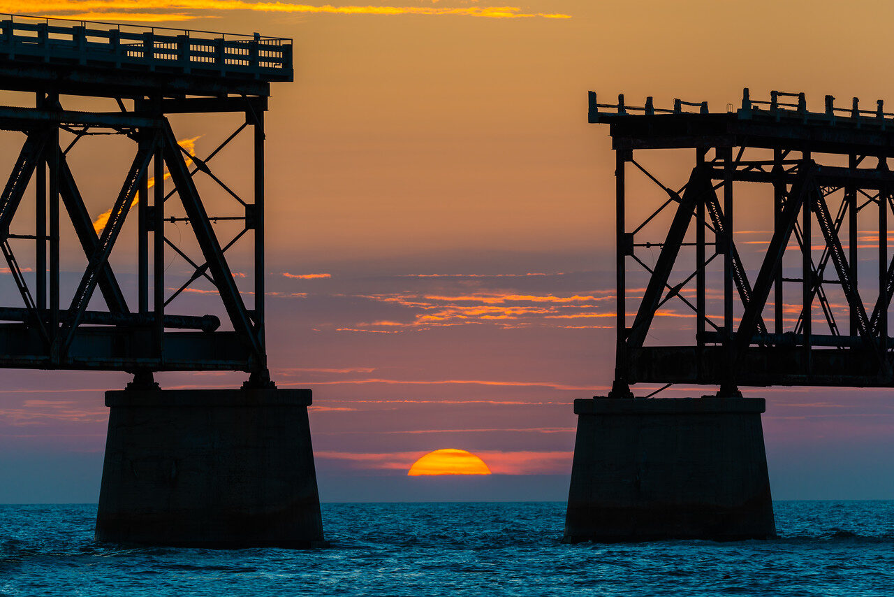
Read the wide gap frame as a balance of shapes. Two dark bridge ends hold the sides while the sun supplies a small bright center. If the disc clips a pier by accident, the tension can disappear. If the structure occupies too little of the frame, the picture becomes a generic sunset with a bridge fragment. Make the gap and the piers deliberate, then check where the water, horizon and steel meet.
The alignment is seasonal and position-dependent. It is not a daily appointment described by the word sunset. Date, the sun’s path, clouds and the permitted camera position decide whether the disc fits. Scout from a lawful area in good light and choose a steel-and-sky alternative before waiting. Do not move into water, onto a closed path or toward a traffic shoulder because the sun is a little to one side.
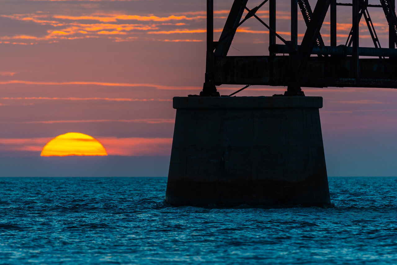
Photo: Edin Chavez. Exact camera position and source exposure unverified.
The closer frame uses a single pier as the weight on one side. It does not need the whole gap to explain the bridge. Compare the sun’s edge with the hard outline of concrete and steel; enough separation gives both a role. This is a different composition, not simply a tighter crop counted as another place. It is still the same Bahia Honda spot.
Start a handheld truss detail near 1/250 second, f/5.6 to f/8 and Auto ISO. A long lens makes shake and heat shimmer more visible, so check the metal and horizon at full magnification. Where stable support is actually permitted and does not block the path, compare a short sharp exposure with a slower water test around a quarter second to two seconds. Protect bright sky and the sun’s edge rather than judge only the average screen brightness.
Never look at the sun through an optical viewfinder, and do not leave a long lens pointed at it for prolonged periods. The photograph is not worth eye or equipment damage. A scene with the disc behind cloud can still make a clear bridge-and-sky study; a scene without the sun in the gap can still use the truss rhythm. A careful fallback is a change in composition, not a lower standard of safety.
Use the wide profile as a real alternative
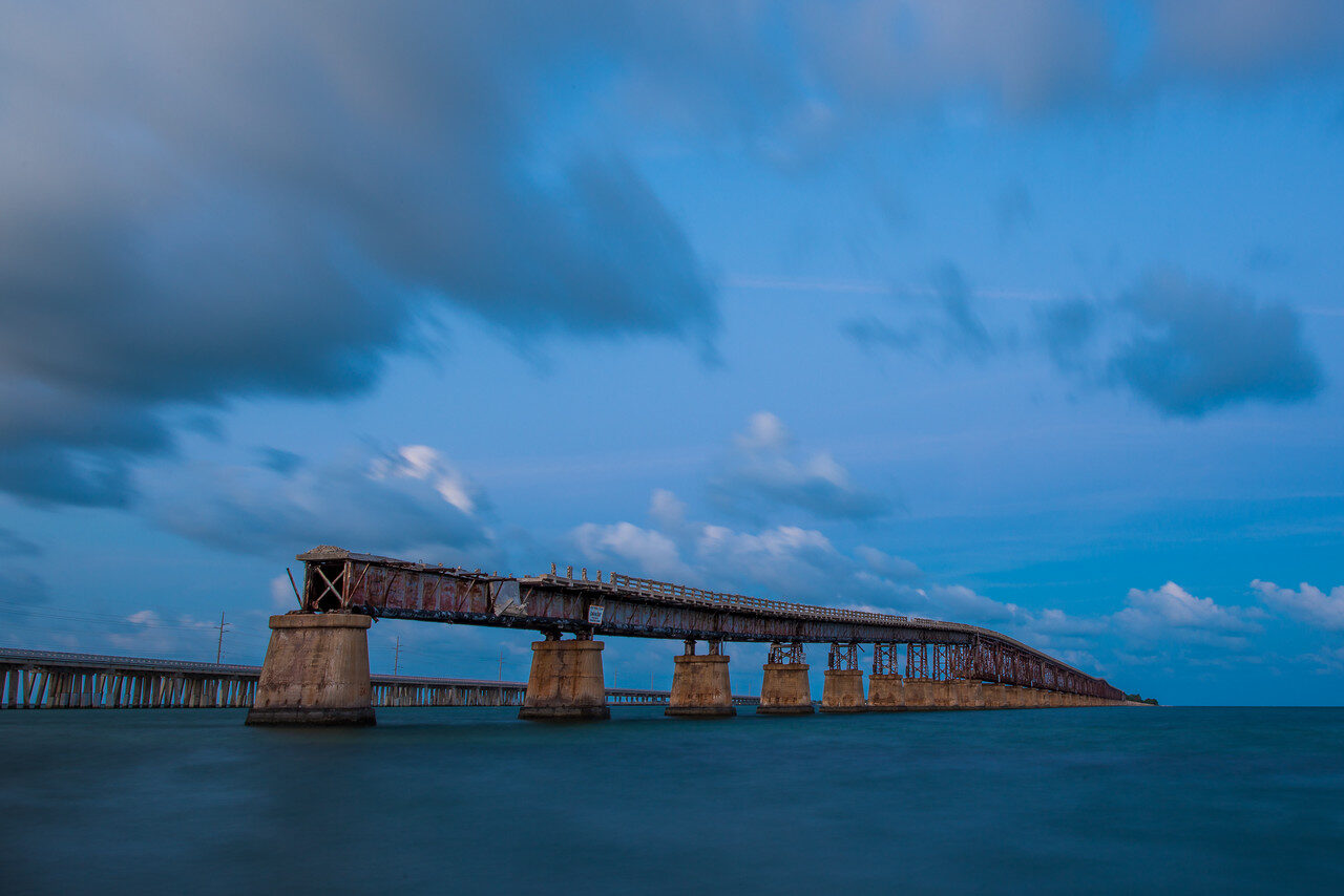
Photo: Edin Chavez. This image shows Bahia Honda despite its Seven Mile collection path. Historic visual reference, not current access proof.
The wide profile reveals the bridge’s structure without depending on a small solar alignment. Repeated piers, trusses and the elevated road deck give the eye a route across the frame. Decide whether the sky or water supplies the stronger lower-contrast area, then use that space to make the bridge readable. A heavy cloud can be useful when it separates from the steel rather than merges into it.
Keep verticals believable and do not force the horizon level by cropping away the entire structure. Review both ends. An accidental cutoff of a pier or a little strip of bright cloud at the edge can pull attention from the intended rhythm. A wide architectural image needs those edge decisions even when the sky is doing something dramatic.
Begin the visit at the ranger station or current official information point. Ask about today’s paths, lookout access and exit time. Follow signed open paths and confirm any closure before approaching. This is a single park session, not a route across the old bridge. No swimming to a viewpoint, climbing steel or walking over a removed span is part of the plan.
Florida State Parks prohibits drone launch and landing except in rare circumstances, such as authorized official use. An older aerial elsewhere in the collection does not change that rule. Organized commercial work also needs the park’s permit check. A camera or a campsite does not create permission to enter closed structures, occupy a working roadway or ignore wildlife restrictions.
When the park is full, return later as directed or choose another confirmed open session. When wind or spray makes the footing or equipment unsafe, shorten the shutter and the visit. If a path is closed, make a picture from open ground or leave. The guide supplies a way to make decisions, not a guarantee that every historic angle remains available.
2. Strand/Walgreens: readable signs come before effects
GPS reference: Walgreens, 527 Duval St, Key West, FL 33040, USA. 24.555245, -81.802070. Open named spot in Google Maps. Orientation, not an exact historic camera position.
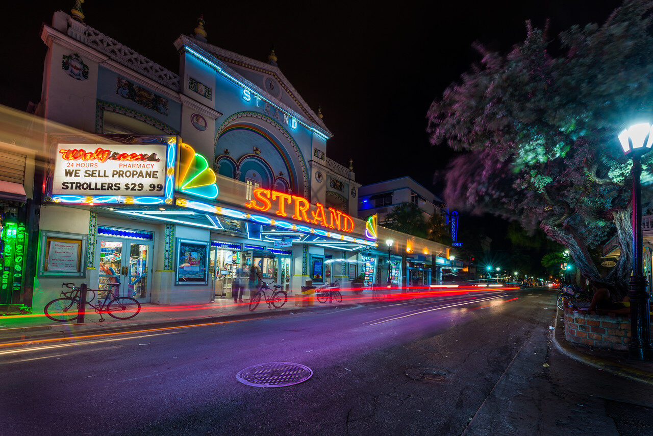
Photo: Edin Chavez. Historic exterior reference. Current lighting and operations may differ.
The Strand frame uses a marquee as a stable anchor while a light trail moves along the street below it. The sign needs to remain readable. A bright trail that cuts through the most useful lettering is not an improvement simply because it looks energetic. Make a clean still version before trying movement so that the picture is not lost while waiting for a particular car.
For a handheld sign study, begin near 1/125 second, f/2.8 to f/4 and Auto ISO. Check bright letters for clipping and the building for sharpness. If a pedestrian should remain clear, a faster shutter around 1/250 second can be more useful than trying to keep ISO low. Different lamp colors do not all need to turn white. Preserve the actual warm and cool relationships before adding contrast or saturation.
A stable light-trail experiment is conditional on site permission and a clear place to stand. If that is available, compare a quarter second to two seconds at f/5.6 to f/8 with a low ISO, then inspect the result. The useful duration depends on the traffic and distance. If support is not permitted or a path is busy, stay handheld and make a different picture.
Use the named Strand/Walgreens reference at 527 Duval Street for orientation, not as an exact camera pin. Do not enter the business, block the doorway or place equipment in a crossing to duplicate the old angle. A sidewalk is a working public space. It should still work for the person who never asked to participate in your photograph.
3. Sloppy Joe’s: connect the reflection to the sign
GPS reference: Sloppy Joe’s Bar, 201 Duval St, Key West, FL 33040, USA. 24.559085, -81.804971. Open named spot in Google Maps. Orientation, not an exact historic camera position.
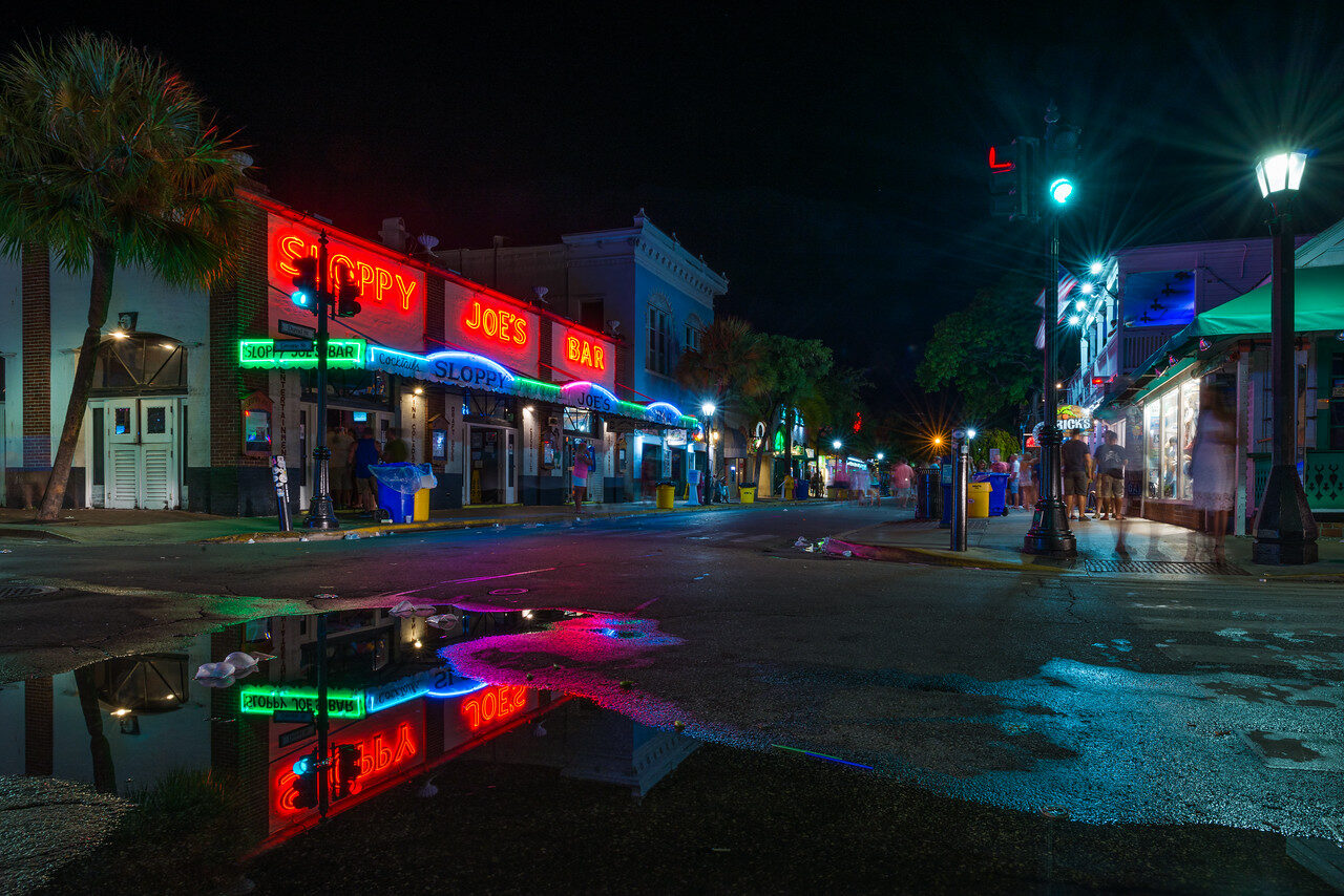
Photo: Edin Chavez. Historic rain reflection; no current puddle or sign promise.
The reflection frame works because the foreground color is connected to an actual light source. It gives the viewer a reason to look at the pavement before arriving at the façade. Check the shape and placement of the reflection, not merely whether it is colorful. An unhelpful patch of water at the wrong edge does not become a strong foreground automatically.
Rainwater is not guaranteed. Do not create a puddle, stand in traffic or move a barrier to make the picture. If the pavement is dry, a clean sign-and-façade frame is the right alternative. If the entrance is busy, move to a smaller detail rather than wait in the flow of customers. A short considerate study can produce a better result than holding the same position for an hour.
Sloppy Joe’s at 201 Duval is this article’s third spot. Tropic Cinema at 416 Eaton is a separate spot in the full guide. Those are central-street orientation points, not verified walking times or guaranteed open camera positions. Scout crossings in daylight, choose a main frame and set a return point before concentrating on the viewfinder. A cinema ticket is separate from its exterior and is not included in the guide.
Ask before close portraits and shop interiors. No blanket tripod permission has been established for this spot; a small handheld footprint is the default. Current staff, police and event directions control the available space. If the façade is closed or a sign is off, make an architectural detail only when present light supports it, or return at another time. Do not add neon in the edit and present it as evidence of current operation.
4. Mallory Square: sunset and sails need their own space
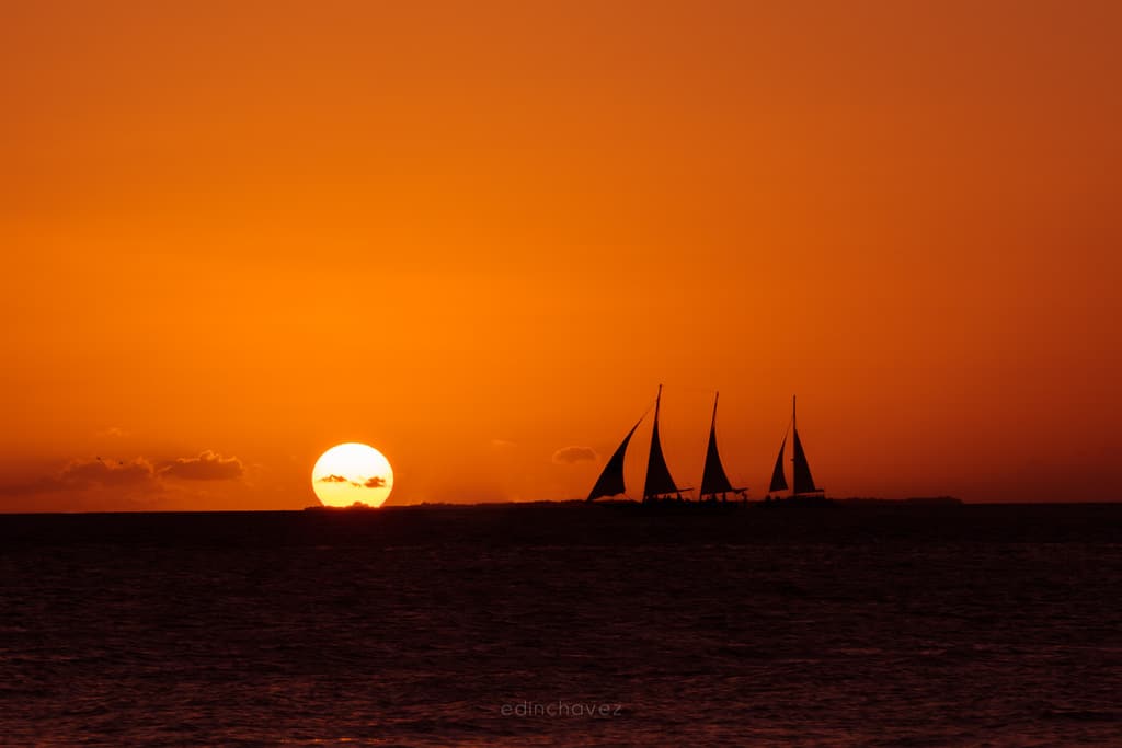
Photo: Edin Chavez. His Key West blog assigns this sunset study to Mallory Square. The exact seawall camera position is not established.
The sun and sailboat are two strong shapes. Give each enough space to stay readable. Keep the horizon level, leave room around the masts and watch the sun’s edge rather than judge the frame by orange color alone. A silhouette works best when it is a clear shape, not a collection of objects merged accidentally together.
Arrive while there is enough daylight to choose an open lawful view. The sunset celebration attracts other viewers and performers; leave their space clear. A moving boat may need a starting test around 1/250 second, f/8 and Auto ISO. Check bright clouds and the sun for clipping, then the mast edges for shake. Never look at the sun through an optical viewfinder or keep a long lens aimed at it for prolonged periods.
The sun will not always sit beside a boat. Cloud cover, season and traffic change the picture. Use layered evening sky and a clean vessel silhouette if the disc is blocked. A packed waterfront is a reason to change the view, not to step over a barrier, block an exit or claim someone else’s space. The named square is an orientation point, not a guarantee of tripod or commercial-shoot permission.
GPS reference: Mallory Square, 420 Wall St, Key West, FL 33040. 24.559868, -81.807677. Open Mallory Square in Google Maps.
Keep the bridge and street plans separate
Bahia Honda and Key West belong to separate sessions. No all-in-one sunset drive or unverified arrival time is promised. Give the chosen subject the main light window, and give the return route attention before leaving. A park closing time is a real limit, not an inconvenient footnote beneath a dramatic picture.
Review one frame at full size before moving on. Check focus first, bright lamps or sky next, then all four edges. Keep batteries charged, carry drinking water for a bridge walk and protect equipment from spray. A larger file cannot repair a soft original, and a heavily edited sky cannot validate a route that was never open.
The full guide covers ten photography spots with fourteen owner photographs and current named-map references. This article deliberately describes fewer spots. No campsite, tour, transport or flight is included.
Frequently asked questions
Is the broken bridge Seven Mile Bridge?
The two Broken Bridge sunset frames and the wide Miami-26/27 truss frames show the old Bahia Honda bridge. Subject identity was checked against named independent photographs and the park’s construction history, not a filename or generic gallery description.
Can I stay in Bahia Honda after sunset for a photograph?
The published day-use window is 8am until sundown. Do not infer after-hours permission from a historic photo. Confirm any separate camping or other arrangement with the operator, and follow closures and exit directions.
Can I launch a drone in the park?
Florida State Parks prohibits drone launch and landing except rare circumstances. An older aerial photo does not authorize a visitor launch. Other locations still require their own current airspace, landowner and wildlife checks.
Are the map references exact camera positions?
No. They are named landmark references for orientation. They do not establish a tested camera angle, legal foreshore access or an aerial launch point. Use current signs, paths and boundaries.
Do I need rain to photograph Key West at night?
No. Rainwater can supply reflections, but readable signs and façade geometry can hold a strong dry-pavement image. Never create a traffic-lane puddle or block an entrance to repeat a historical picture.
Is there a live purchase link for this new guide?
Yes. The Best Photography Spots in the Florida Keys Guide is available for $47. The 26-page PDF covers ten named spots, fourteen historic photographs by Edin Chavez and a GPS reference for every spot.
What to Pack
A landscape kit built around wide views, steady support, and changing light is a useful starting point. Compare the gear and choose what fits your camera, budget, and conditions. These links lead to B&H Photo Video and Amazon.
| What & Why | B&H | Amazon |
|---|---|---|
Sony 16-35mm f/2.8 GM Check the camera mount before buying. Choose a focal length that fits the photos you plan to make. | Shop B&H → | Shop Amazon → |
Peak Design Travel Tripod Check the load rating, packed size and local tripod rules before buying. | Shop B&H → | Shop Amazon → |
Breakthrough X4 CPL Check the filter type and lens thread size before buying. Use a filter only when the effect fits your photo. | Shop B&H → | Shop Amazon → |
Breakthrough X4 10-stop ND Check the filter type and lens thread size before buying. Use a filter only when the effect fits your photo. | Shop B&H → | Shop Amazon → |
Sony NP-FZ100 battery Use the battery type specified for your camera. Bring a spare if your shooting plan calls for one. | Shop B&H → | Shop Amazon → |
SanDisk Extreme Pro 128GB Check the card format and speed requirements specified for your camera. | Shop B&H → | Shop Amazon → |
Koh microfiber cloths Compare this option with your current kit. Check compatibility and the product details before buying. | Shop B&H → | Shop Amazon → |
B&H and Amazon links are affiliate links. We earn a small commission on purchases at no extra cost to you.