Bryce Canyon is not a canyon. It is the eroded eastern edge of the Paunsaugunt Plateau, a series of natural amphitheaters filled with hoodoos, and it photographs like nowhere else on earth: thousands of limestone spires catching first light in bands of pink, orange and white. The challenge is not finding a subject. It is that the obvious subjects are behind you by 9 a.m., in the wrong light, with forty other tripods.
The useful question is not simply where to stand. It is which amphitheater, which hour, and how deep into the hoodoos you want to walk. A famous hoodoo at sunrise. A switchback slot from directly above. A garden of spires at eye level. Pick the statement first, then pick the hour.
These are researched photography spots, illustrated with public-domain National Park Service, USGS and free-stock photographs, each credited on the image. The GPS references mark named viewpoints and trailheads, not surveyed tripod positions, and a published photograph is not proof a camera position is open or allowed today.
1. Sunrise Point: first light on the amphitheater
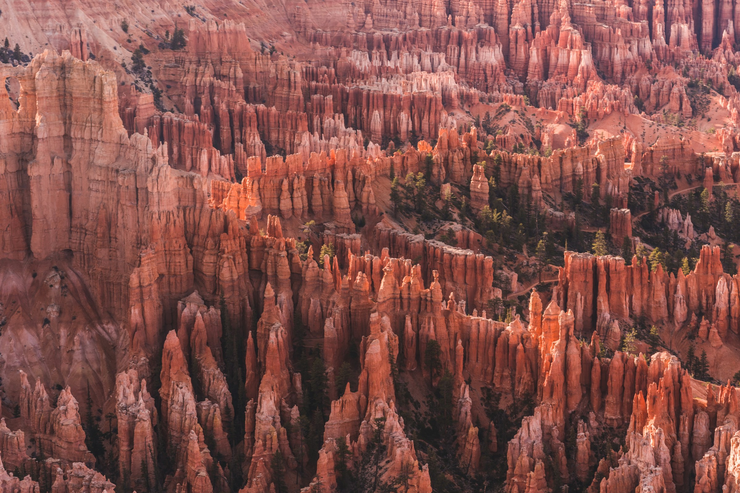
Photo: Zhanjiang Chen / Unsplash (unsplash.com/license)
Sunrise Point does exactly what its name promises: it faces east across Bryce Amphitheater, and the first direct light of the day strikes the tops of the hoodoos while the amphitheater floor stays in cool blue shadow. For about twenty minutes the spires glow from the top down, and then the show is over.
Arrive 30 to 40 minutes before sunrise and watch the light walk down the towers. Let the lit hoodoo tips carry the frame against the shadowed bowl, or use a mid-range zoom to isolate single glowing spires. Start at f/8, ISO 100 on a tripod, expose for the lit tips, and bracket a stop or two for the shadows.
In shuttle season (April through mid-October) ride the free shuttle to the Sunrise Point stop; outside the season, park at the viewpoint. Sunrise Point is also the trailhead for the Queen’s Garden Trail, which makes it the natural start of a full morning: shoot the rim at dawn, then descend among the hoodoos.
2. Thor’s Hammer: the icon, at sunrise
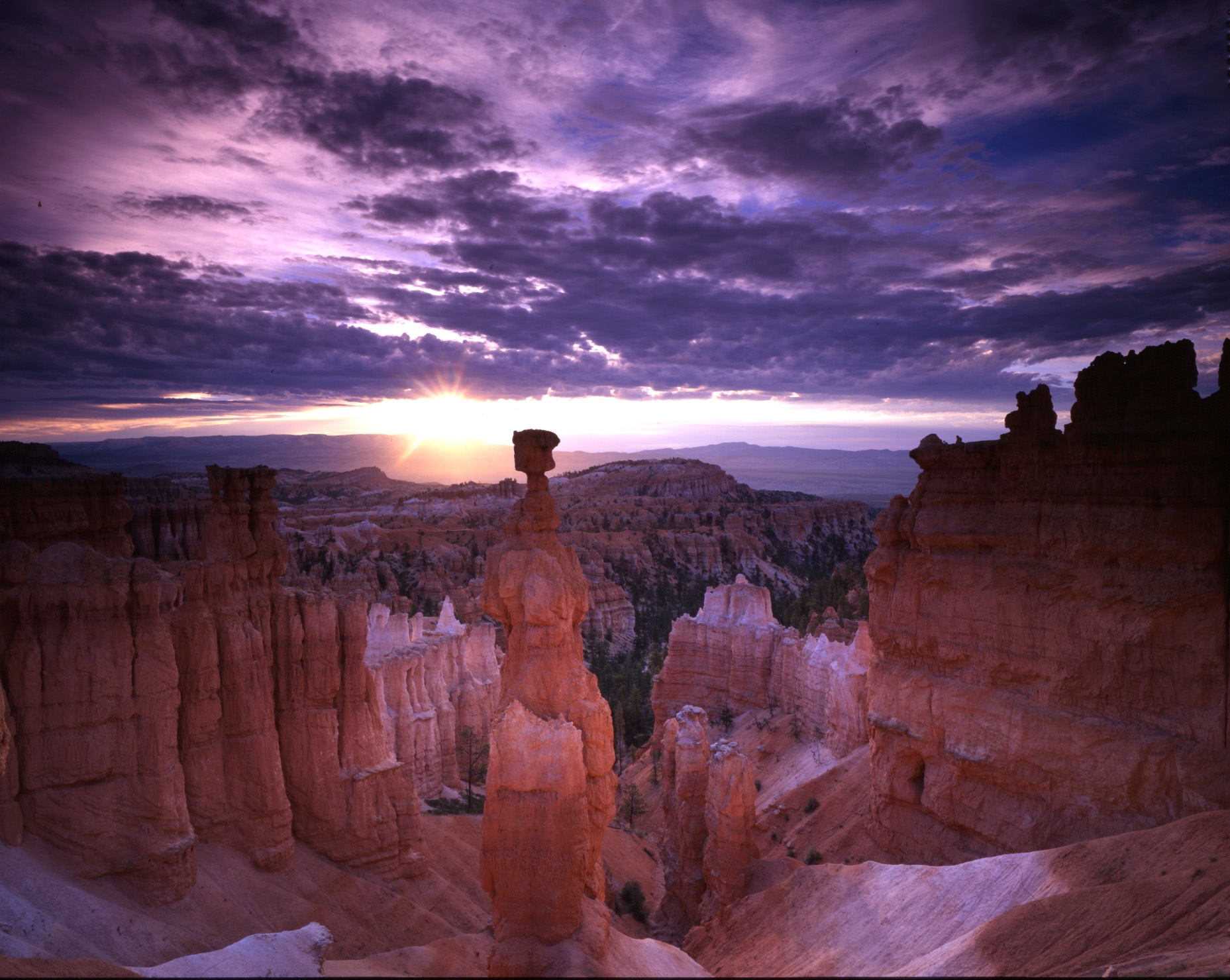
Photo: NPS Photo, public domain (NPS Gallery)
Thor’s Hammer is Bryce’s most famous hoodoo, a balanced caprock on a narrowing neck just below Sunset Point. Despite the name, Sunset Point faces the amphitheater to the east, and it is a classic sunrise position: the upper hoodoos take the light first while the bowl below stays deep in shadow.
Isolate the hammer against the sky or set it against the layered amphitheater behind. Start at f/11, ISO 100 on a tripod; expose for the lit rock and let the shadows stay dark, or bracket for a blend.
The hammer stands on the Navajo Loop, which begins and ends at Sunset Point and runs 1.3 miles. The Wall Street side of the loop closes in winter, but the Two Bridges side is open year-round, so this shot is available in every season if the road is plowed.
3. Wall Street: straight down the slot
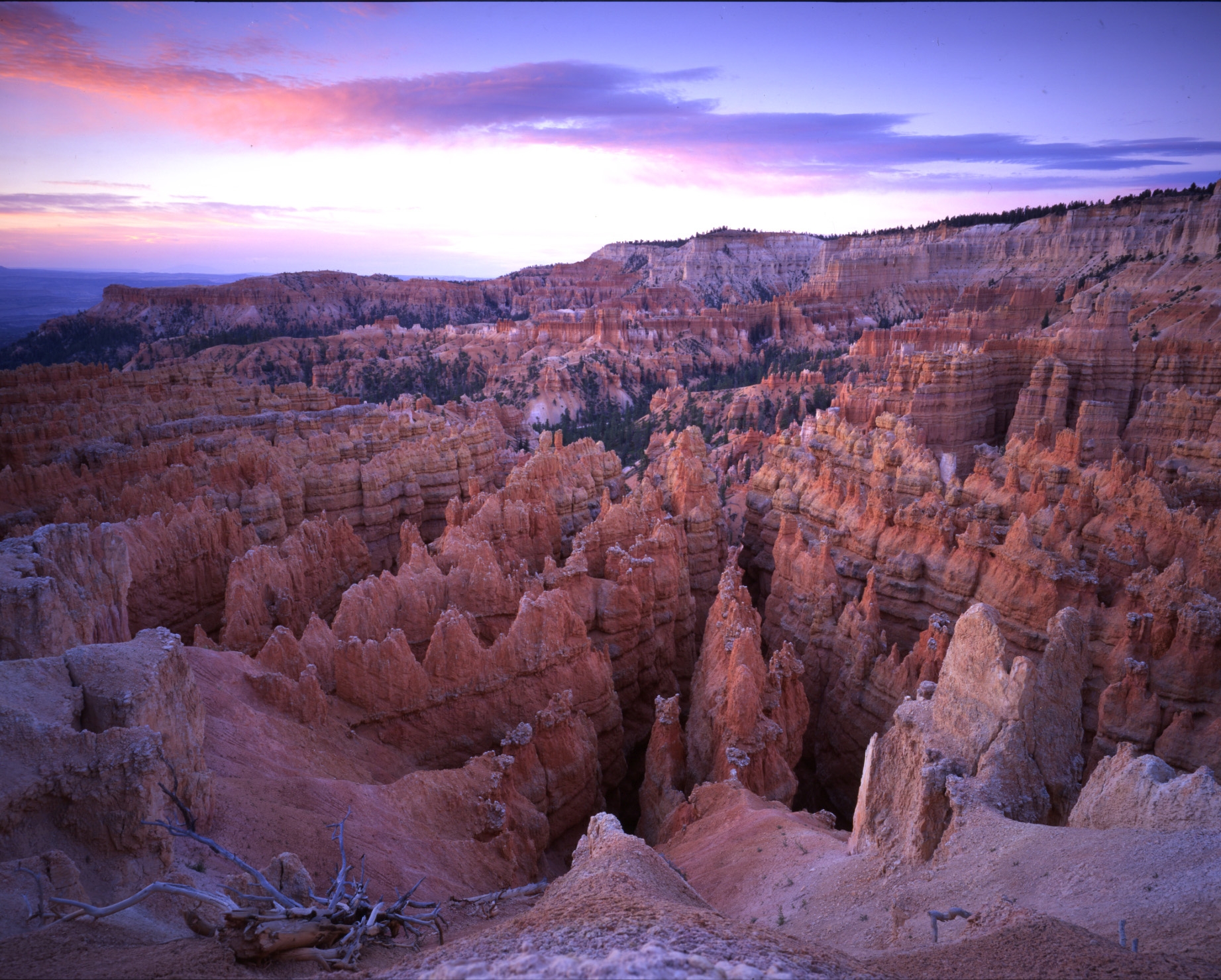
Photo: NPS Photo, public domain (NPS Gallery)
From the rim above, Wall Street is the Navajo Loop’s most dramatic mile: a series of tight switchbacks dropping between narrow walls of limestone, with towering Douglas-firs rising from the slot floor. It is one of the few places in the park where you photograph down instead of across.
Shoot straight down the slot so the walls converge; the switchbacks and firs give scale. Midday light reaches the slot floor and overcast evens the walls, so this is a rare Bryce subject that does not demand golden hour. Start at f/8, ISO 100 on a tripod and expose for the lit rims while holding shadow detail.
Wall Street is the west side of the Navajo Loop from Sunset Point. Important: NPS closes the Wall Street side during the winter months; the Two Bridges side stays open year-round as an out-and-back. Combine with the Queen’s Garden Trail for a 2.9-mile round trip between Sunrise and Sunset Points.
4. Queen’s Garden: hoodoos at eye level
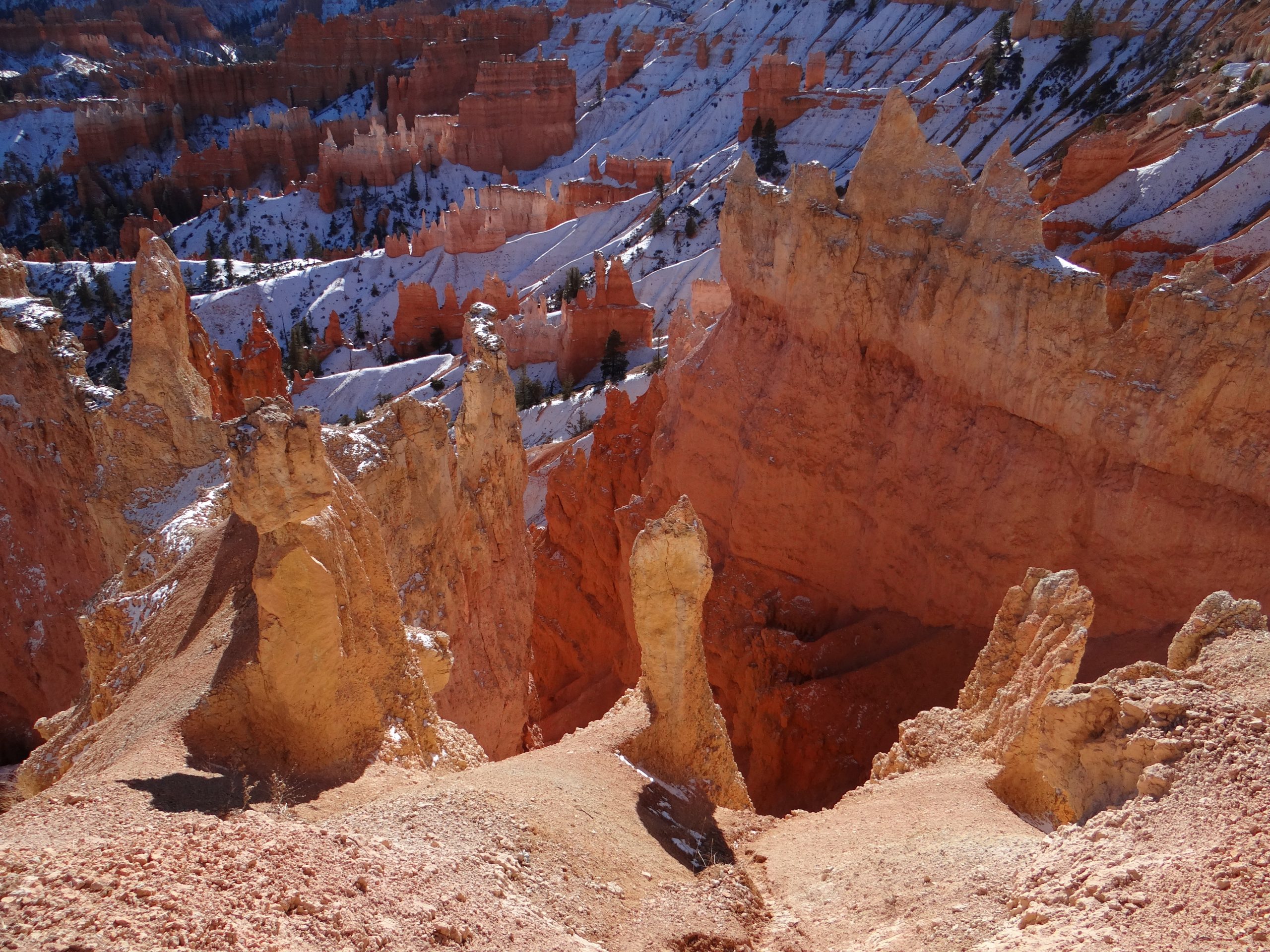
Photo: USGS, public domain (snow on the hoodoos)
Most Bryce photographs are taken from the rim looking down. The Queen’s Garden puts you inside the amphitheater at eye level with the hoodoos, on the gentlest descent below Sunrise Point. Fins and spires crowd the trail, and every turn reframes the towers against the sky.
Use the trail itself as a leading line into the hoodoos, and wait for a hiker to add scale. Morning light reaches the garden before the bowl fills with hard midday contrast. Start at f/8, ISO 100; in the shade between fins, expose for the lit hoodoos and let the path stay dark.
The trail begins at Sunrise Point, a shuttle stop in season, and combines naturally with the Navajo Loop for the classic 2.9-mile circuit: descend Queen’s Garden, cross the amphitheater floor, and climb out past Thor’s Hammer to Sunset Point.
5. Inspiration Point: storm light and rainbows
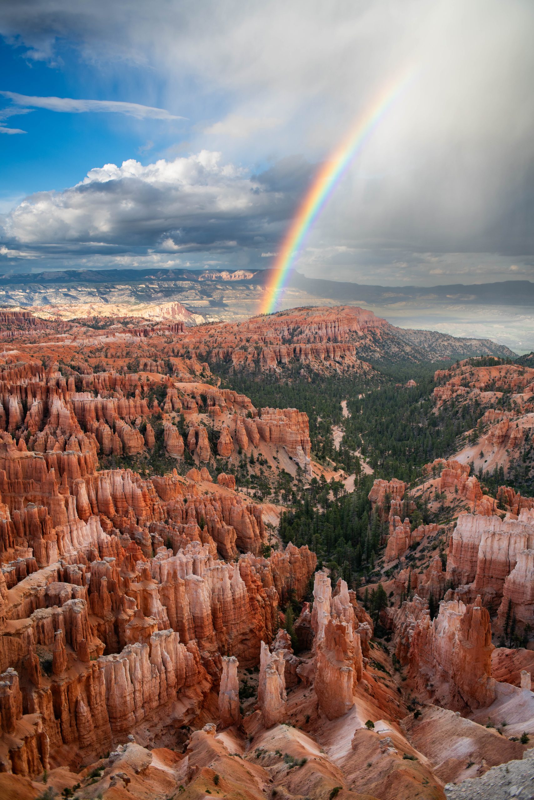
Photo: NPS / Peter Densmore, public domain (NPS Gallery)
Inspiration Point gives the widest of the amphitheater views, three rim levels stacked above the hoodoo city. In calm weather it is a panorama; in storm weather it is the best seat in the park. Mid-to-late summer monsoons bring afternoon storms, and when rain and sun arrive together the amphitheater takes rainbows end to end.
Keep the horizon high and let the rainbow arc over the hoodoos. A polariser deepens rainbows; rotate it to taste, but do not kill the bow. Storm light changes by the second, so work fast. Start at f/8, ISO 100, expose for the lit cliffs, and bracket if the light is patchy.
In shuttle season ride to the Inspiration Point stop, or walk the Rim Trail 1.5 miles from Bryce Point. Note for winter trips: the Rim Trail section between Bryce Point and Inspiration Point closes in winter, though the viewpoint itself stays reachable by road when the road is plowed.
A smaller kit makes a better rim day
Bryce’s amphitheater viewpoints are short walks from parking and shuttle stops, and the classic trails are short by national-park standards. You do not need an expedition pack. A wide zoom for the amphitheater, a mid-range for isolating hoodoos, a tripod for dawn and storm light, and layers for the wind at 8,000 to 9,000 feet will cover every spot in this article.
What to Pack
For rim and trail days, a flexible focal range and a light kit can help you move between shuttle stops, overlooks and below-rim trails. See the B&H Photo Video and Amazon options below, then choose what fits your setup.
| What & Why | B&H | Amazon |
|---|---|---|
|
Sony 24-70mm f/2.8 GM II
Check the camera mount before buying. Choose a focal length that fits the photos you plan to make.
|
Shop B&H → | Shop Amazon → |
|
Sony 16-35mm f/2.8 GM II
Check the camera mount before buying. A wide zoom earns its place at the amphitheater rim and inside Wall Street.
|
Shop B&H → | Shop Amazon → |
|
Peak Design Travel Tripod
Check the load rating, packed size and local tripod rules before buying.
|
Shop B&H → | Shop Amazon → |
|
Tiffen 77mm Circular Polarizer
Deepens rainbows over the amphitheater and cuts glare on wet limestone after storms. Check the filter thread size before buying.
|
Shop B&H → | Shop Amazon → |
|
Sony NP-FZ100 battery
Use the battery type specified for your camera. Bring a spare if your shooting plan calls for one.
|
Shop B&H → | Shop Amazon → |
|
LensPen NLTP-1
Follow the cleaning instructions for your lens and this kit. Remove loose dust before cleaning the optical surface.
|
Shop B&H → | Shop Amazon → |
|
Sea to Summit 8L Dry Bag
Summer monsoon protection: the camera stays dry when the afternoon storm rolls over the rim. Check the size against your camera and lens before buying.
|
Shop B&H → | Shop Amazon → |
B&H and Amazon links are affiliate links. We earn a small commission on purchases at no extra cost to you.
Weather, timing and an honest backup
Bryce sits high: the Visitor Center is at 7,894 ft and Rainbow Point tops 9,100 ft, so weather arrives faster and colder than the desert towns below. Summer afternoons bring monsoon storms; that is a feature, not a bug, because storm light and rainbows are the park’s signature images. Winter brings the best snow-capped hoodoo photographs of the year, along with real logistics: NPS warns of temporary road closures during and after winter storms until plowing is completed, the high southern road can close at the Mile 3 gate, and the Wall Street side of the Navajo Loop and the Rim Trail between Bryce Point and Inspiration Point close for the season.
If conditions close your plan, the honest backup is the Southern Scenic Drive: 18 miles of road climbing to Rainbow and Yovimpa Points, the park’s highest viewpoints at 9,115 ft, with nine overlooks including Natural Bridge. Drive to the end first, then stop on the way back north so every pullout is on your right. Mossy Cave, the park’s northernmost and lowest-elevation hike just off SR-12 near Tropic, sits outside the amphitheater crowds and is an easy 30 to 60 minute walk to Water Canyon and a sheltered, icicle-hung overhang. Check nps.gov/brca for current alerts before you commit.
If you want someone else to handle the logistics
A guided day handles the driving, parking and timing, and a good guide knows where the light is going. Two well-reviewed options on Viator (affiliate links):
- Bryce Canyon Daily Tour — a full-day guided loop of the amphitheater viewpoints and the southern overlooks.
- Hiking Experience in Bryce Canyon National Park — a guided hike below the rim for eye-level hoodoo photography.
Frequently asked questions
What is the best time of day to photograph Bryce Canyon?
Sunrise, and it is not close. The amphitheater faces east, so first light strikes the hoodoo tops while the bowl stays in shadow; by mid-morning the contrast flattens. Sunset Point and Sunrise Point are both sunrise positions despite their names. Storm light on summer monsoon afternoons is the other premium window.
Are the suggested settings exact settings from the photographs?
No. They are researched starting points for each scene, not the EXIF of the images shown. Treat them as a first frame: expose for the lit rock, protect the sky, and bracket when the storm light is patchy.
Do I need a permit to photograph in Bryce Canyon?
No permit is needed for ordinary photography at the viewpoints and trails in this article. The park charges an entrance fee (a private vehicle is $35, valid 7 days), and the free shuttle runs April through mid-October. Commercial filming and some organized workshops follow separate NPS rules.
Can I photograph Bryce Canyon in winter?
Yes, and the snow-capped hoodoos are worth it. The park is open 24 hours a day year-round. Plan around temporary road closures during and after storms until plowing completes, the winter closure of the Wall Street side of the Navajo Loop, and the Rim Trail closure between Bryce Point and Inspiration Point. Carry traction for icy paths.
What does the paid PDF add?
Depth and portability. This article covers five spots; the guide covers ten, each with a full-page photograph, a read-the-scene breakdown, composition and starting-settings guidance, landmark GPS with a tappable Google Maps link, and arrival notes grounded in current NPS information, plus entry fees, shuttle and Southern Scenic Drive logistics and a field checklist in a print-ready 36-page PDF.
Photography spot GPS references
The five spots in this article each have their own GPS reference. These arrival references do not claim an exact historical camera position.
- Sunrise Point: 37.62826, -112.16300. Open Google Maps. Viewpoint and Queen’s Garden trailhead.
- Sunset Point (Thor’s Hammer): 37.62335, -112.16721. Open Google Maps. Viewpoint above the Navajo Loop.
- Navajo Loop Trail (Wall Street): 37.62064, -112.16377. Open Google Maps. Begins and ends at Sunset Point.
- Queens Garden Trail: 37.62380, -112.16064. Open Google Maps. Descends from Sunrise Point.
- Inspiration Point: 37.61332, -112.16881. Open Google Maps. Shuttle stop in season.