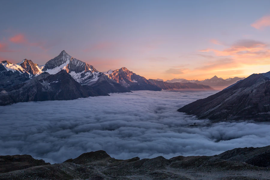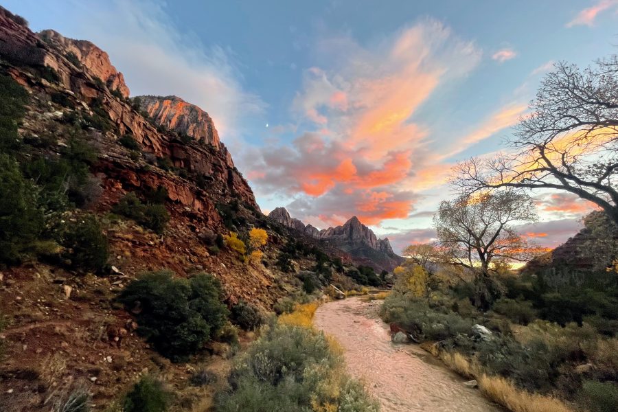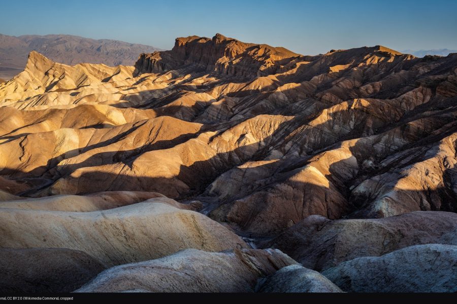
Olympic is three national parks wearing one coat: glacier-capped ridgelines at Hurricane Ridge, the moss-drowned halls of the Hoh Rain Forest, and a wild Pacific coast strung with sea stacks. The challenge is not finding a subject. It is that the subjects are hours apart, in different weather systems, and the light you want rarely happens where you happen to be standing.
The useful question is not simply where to go. It is which region, which hour, and what the sky is doing on that side of the peninsula. Last light on a ridge stack. A mirror-still glacial lake at dawn. A waterfall under flat overcast that saturates the moss. Pick the statement first, then pick the hour.
These are researched photography spots, illustrated with public-domain National Park Service and free-stock photographs, each credited on the image. The GPS references mark named viewpoints and trailheads, not surveyed tripod positions, and a published photograph is not proof a camera position is open or allowed today.
1. Hurricane Ridge: last light on the ridge stack
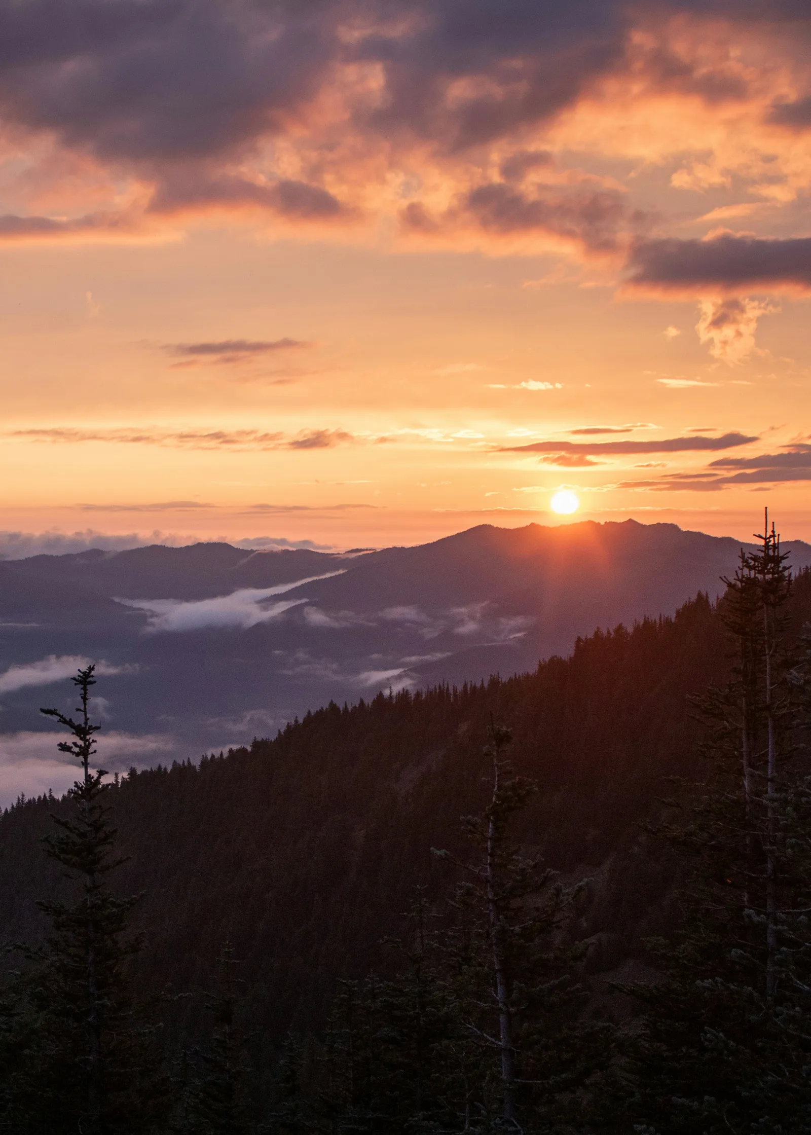
Photo: Zoshua Colah / Unsplash (unsplash.com/license)
Hurricane Ridge is the park’s easiest alpine viewpoint: at 5,242 feet you stand eye-level with the Olympic range, ridgelines stacked behind ridgelines with weather moving through the valleys between them. The reward is layering – foreground ridge, then peak behind peak, with cloud filling the gaps. Sunrise and sunset both fire here, and after dark this is a certified dark-sky terrace.
Work the rim at golden hour and let the last light walk across the ridge stack. Start at f/11, ISO 100 on a tripod; a polarizer cleans the haze, and bracketing the sky against the dark forest protects the highlights.
Hurricane Ridge Road climbs 17 miles from Port Angeles to the visitor center. Per NPS, the road is open to Hurricane Ridge, with 2026 construction in the main parking lot and possible temporary rolling closures; the day lodge burned down in May 2023, and while rebuilding continues the ridge has restrooms but no drinking water, so carry your own. Check the NPS road line at 360-565-3131 before driving up. Entrance pass required ($30 per vehicle, 7 days).
2. Lake Crescent: the deep blue mirror
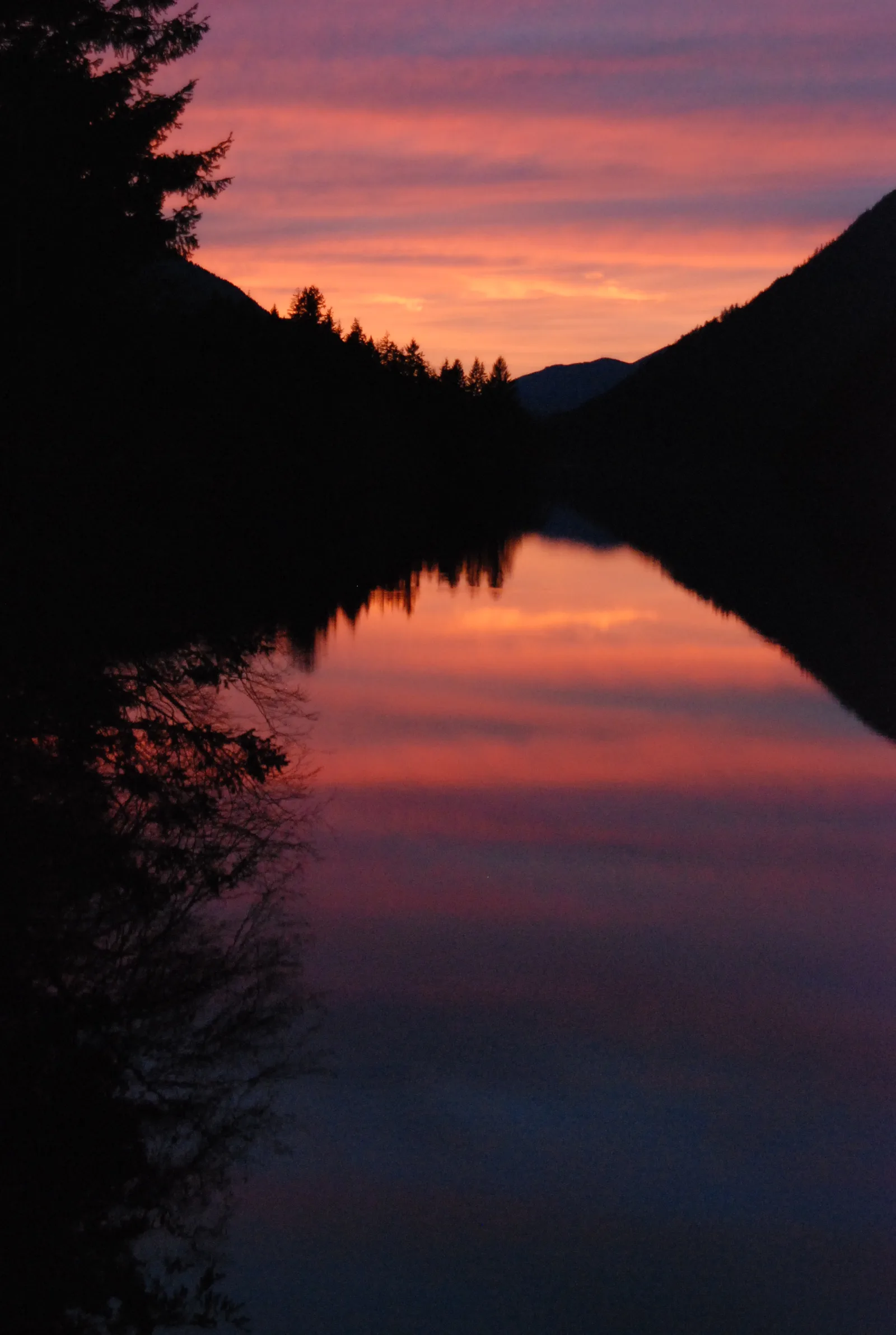
Photo: NPS/J. Burger, public domain (NPS Gallery)
Lake Crescent is a long glacial lake held between forested ridges, deep enough and clear enough that its blue looks manufactured. Calm water is the story: at dawn and dusk the surface holds the sky, and under mist the same shoreline reads as pure mood.
Shoot at first light, before the wind, from a low position near the shore with the ridgelines closing in at both ends – or at sunset, when the pink-and-purple show reflects off the surface. Start at f/11, ISO 100 on a tripod; a polarizer deepens the blue and cuts glare off the water.
The Lake Crescent Lodge area on the south shore is the easy base. Per NPS the Lake Crescent area is open, including the Barnes Point area, Bovee’s Meadow picnic area and the Storm King and Fairholme boat launches. Entrance pass required ($30 per vehicle, 7 days). US-101 runs the length of the south shore, so pullouts give you quick dawn access.
3. Sol Duc Falls: the gorge under old forest
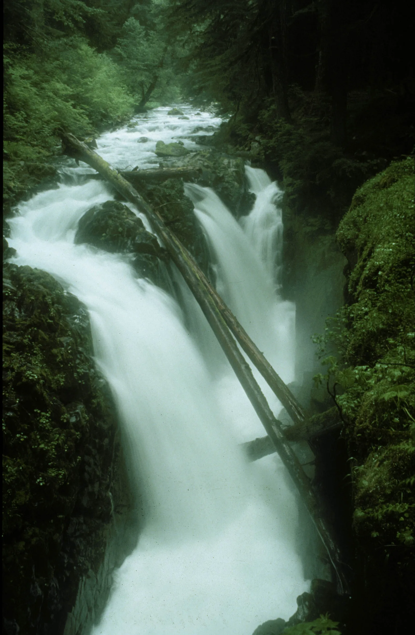
Photo: NPS, public domain (NPS Gallery)
Sol Duc Falls is the park’s waterfall statement: the Sol Duc River splits into channels as it drops into a narrow, moss-lined slot under old-growth forest. The 1.6-mile roundtrip walk in is flat enough that the falls stay busy, so the light, not the hike, is your planning problem.
Compose from the bridge and the viewpoints so the white water cuts diagonally through the green. Overcast gives the best rendering of water and moss; patches of sun will burn the highlights, so a gray day is a gift here. Start at f/11, ISO 100, 1/2 second on a tripod, and use a polarizer to control glare on wet rock and leaves.
The falls are reached on the forest trail from the Sol Duc trailhead at the end of Sol Duc Hot Springs Road; per NPS the Sol Duc area, including the road, is open. Entrance pass required ($30 per vehicle, 7 days). Sol Duc pairs naturally with Lake Crescent on the same day – they are minutes apart by car.
4. Hoh Rain Forest: the moss cathedral
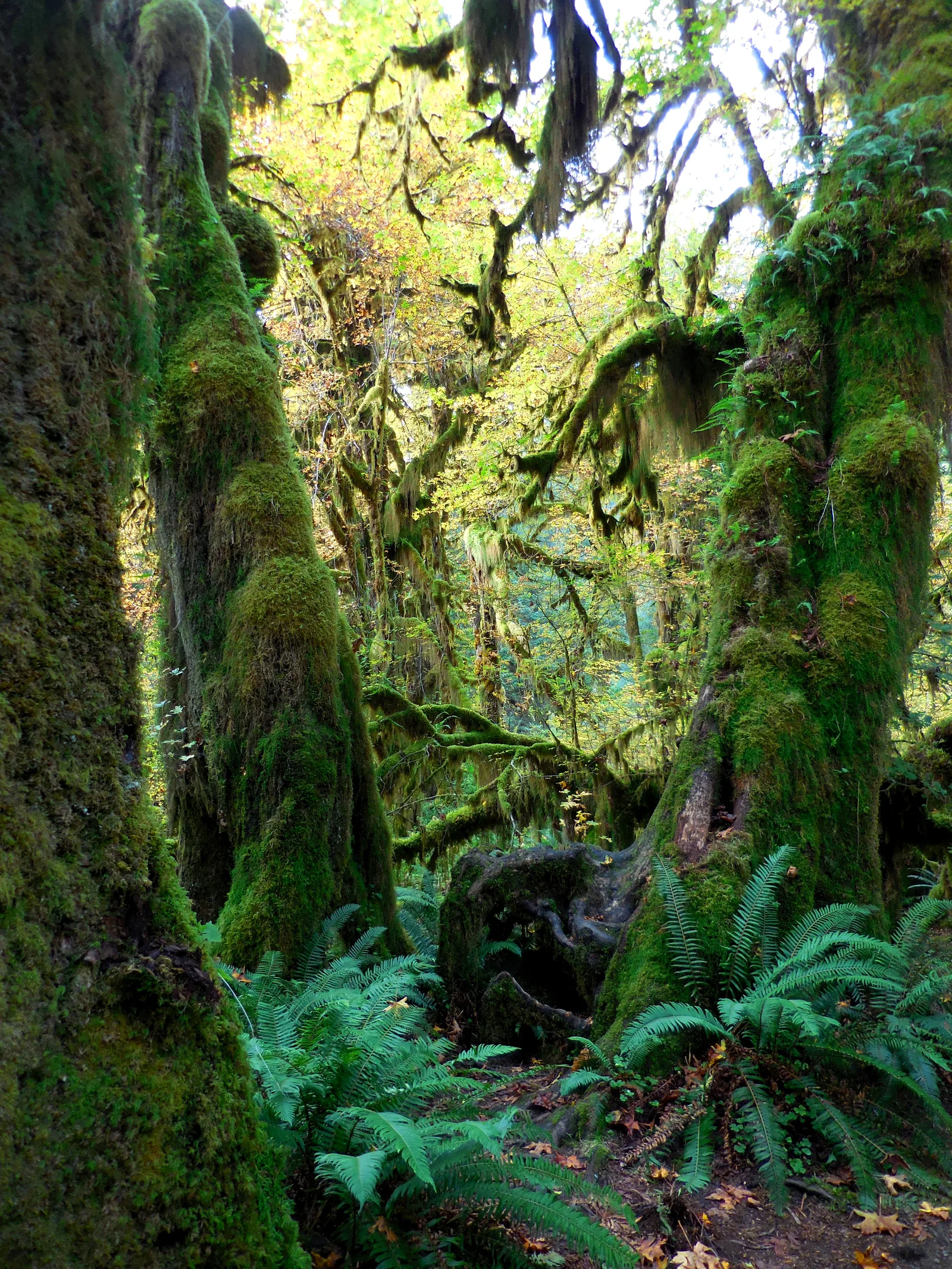
Photo: NPS/C. Bubar, public domain (NPS Gallery)
Up to 14 feet of rain a year grows this: bigleaf maples draped in club moss, ferns on every surface, and trails that tunnel through green light. The Hoh is one of the finest temperate rainforests on earth, and it photographs best in the weather that makes it.
Look for frames with a path or a log to lead the eye, and stack ferns, trunks and hanging moss in one vertical. Flat overcast saturates the greens; a bright patch of sun breaks the scene. The Hall of Mosses loop is the densest quarter-mile of it. Start at f/8, ISO 400 on a tripod, with a polarizer to deepen the greens and cut the sheen on wet leaves.
Per NPS the Hoh Rain Forest area, including trails, parking and restrooms, is open; parking is limited in summer, so arrive before 8 am or after 5 pm to avoid waits of up to 2 hours at the entrance station. The visitor center is open Friday through Sunday. Entrance pass required ($30 per vehicle, 7 days).
5. Ruby Beach: sea stacks and fog
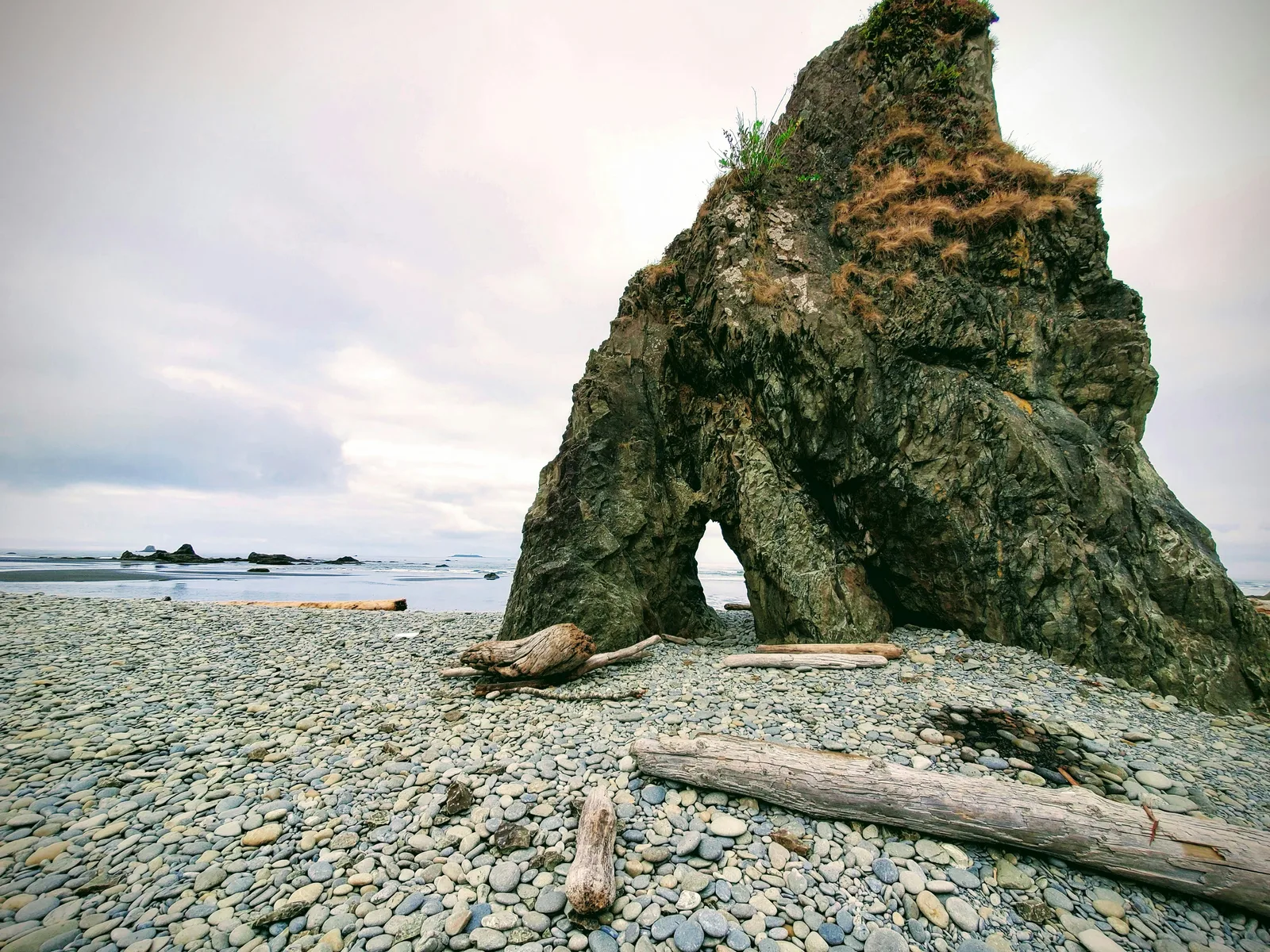
Photo: Kedar Gadge / Unsplash (unsplash.com/license)
Ruby is the most photographed beach in the park for a reason: dark sea stacks rise from the surf, driftwood stacks along the tide line, and fog steps the stacks back into layers of gray. It is a short walk from the parking area on the Olympic coast, and every tide changes the foreground.
Get low across the cobbles for foreground weight and work the shore-level angles on the sea-arch rock. Fog is a gift here, and the tidepools at low tide are a whole second subject. Start at f/11, ISO 100 on a tripod; for silky surf try 1/2 second with a neutral-density filter.
Check the tide table before going and never turn your back on the surf; driftwood logs can roll. Entrance pass required ($30 per vehicle, 7 days). Ruby Beach sits directly on US-101 about 27 miles south of Forks, so it pairs with the Hoh or with Kalaloch on the same coastal day.
A smaller kit makes a better peninsula day
Olympic’s spots are short walks from parking, but the drives between regions are long and the weather is wet more often than not. You do not need an expedition pack. A wide zoom for the sea stacks and ridge layers, a mid-range for the forest, a tripod for waterfalls and dusk, a polarizer for wet rock and glare, and real rain protection for you and the camera will cover every spot in this article.
What to Pack
For ridge, forest and coast days, a flexible focal range and a weather-sealed kit can help you move between regions in changing conditions. See the B&H Photo Video and Amazon options below, then choose what fits your setup.
| What & Why | B&H | Amazon |
|---|---|---|
|
Sony 24-70mm f/2.8 GM II
Check the camera mount before buying. Choose a focal length that fits the photos you plan to make.
|
Shop B&H → | Shop Amazon → |
|
Sony 16-35mm f/2.8 GM II
Check the camera mount before buying. A wide zoom earns its place on the sea-stack beaches and the ridge rim.
|
Shop B&H → | Shop Amazon → |
|
Peak Design Travel Tripod
Check the load rating, packed size and local tripod rules before buying.
|
Shop B&H → | Shop Amazon → |
|
Tiffen 77mm Circular Polarizer
Deepens the greens of the rain forest and cuts glare on wet rock and lake water. Check the filter thread size before buying.
|
Shop B&H → | Shop Amazon → |
|
Sony NP-FZ100 battery
Use the battery type specified for your camera. Bring a spare if your shooting plan calls for one.
|
Shop B&H → | Shop Amazon → |
|
LensPen NLTP-1
Follow the cleaning instructions for your lens and this kit. Salt spray and rainforest mist mean you will use it.
|
Shop B&H → | Shop Amazon → |
|
Sea to Summit 8L Dry Bag
Rainforest and coast protection: the camera stays dry when the weather rolls in off the Pacific. Check the size against your camera and lens before buying.
|
Shop B&H → | Shop Amazon → |
B&H and Amazon links are affiliate links. We earn a small commission on purchases at no extra cost to you.
Weather, timing and an honest backup
Olympic is a weather park. The Hoh sees up to 14 feet of rain a year while Sequim, in the rain shadow just northeast of the ridge, is one of the driest places in western Washington – conditions can be completely different an hour apart, so check each region separately. Summer fog is a feature on the coast, stepping the sea stacks into layers. Hurricane Ridge Road is open to the ridge, but 2026 construction in the main parking lot can bring temporary rolling closures, there is no potable water at the ridge while the lodge rebuild continues, and storms can close the road without notice – check the NPS road line at 360-565-3131 before you commit. On the coast, the tide table is a safety document, not a suggestion: a rising tide can trap a beach walk, so plan beach sessions around a falling tide.
If conditions close your plan, the honest backup is to switch regions, not to force it. Ridge socked in? Drop to sea level: Lake Crescent and Madison Falls sit low and work in flat light. Coast drowned in rain? That same flat light is exactly what Sol Duc Falls and the Hoh want. The peninsula is big enough that something is always working. Check nps.gov/olym for current alerts before you drive.
If you want someone else to handle the logistics
A guided day handles the driving, ferry and timing from Seattle. These are full-day sightseeing tours, not dedicated photography tours, and none of the itineraries we checked guarantees a golden-hour photo stop, so check what the owning itinerary schedules before booking. Two well-reviewed options (affiliate links):
- Olympic National Park Day Tour from Seattle on Viator – a roughly 13-hour day from Seattle including the Bainbridge ferry, with 401 reviews and 97% of travelers recommending it.
- Olympic National Park Small-Group Tour on GetYourGuide – a roughly 12-hour small-group day from Seattle, rated 4.9 across 145 reviews.
Frequently asked questions
What is the best time of day to photograph Olympic National Park?
It depends on the region. Hurricane Ridge fires at sunrise and sunset, when low light walks across the ridge stack. Lake Crescent mirrors best at dawn before the wind. Sol Duc Falls and the Hoh Rain Forest want flat overcast, which is common all day. The sea-stack beaches are strongest at golden hour and sunset, and fog is a feature, not a failure.
Are the suggested settings exact settings from the photographs?
No. They are researched starting points for each scene, not the EXIF of the images shown. Treat them as a first frame: expose for the lit elements, protect the sky, and bracket when the light is patchy.
Do I need a permit to photograph in Olympic National Park?
No permit is needed for ordinary photography at the viewpoints and trails in this article. The park charges an entrance fee (a private vehicle is $30, valid 7 days). Commercial filming and some organized workshops follow separate NPS rules.
Can I photograph Olympic National Park in winter?
Yes. The rainforest and the coast are open year-round, and winter storm light on the beaches is a signature look. Higher elevations get real snow: Hurricane Ridge Road can close temporarily during and after storms, so check the NPS road line at 360-565-3131 and the park’s current conditions before driving up. On the coast, watch the tide tables and never turn your back on the surf.
What does the paid PDF add?
Depth and portability. This article covers five spots; the guide covers twelve, each with a full-page photograph, a read-the-scene breakdown, composition and starting-settings guidance, landmark GPS with a tappable Google Maps link, and arrival notes grounded in current NPS information, plus entry fees, road and region logistics and a field checklist in a print-ready 50-page PDF.
Photography spot GPS references
The five spots in this article each have their own GPS reference. These arrival references do not claim an exact historical camera position.
- Hurricane Ridge (visitor center): 47.96899, -123.50160. Open Google Maps. Alpine viewpoint at the end of Hurricane Ridge Road.
- Lake Crescent (Lake Crescent Lodge): 48.05708, -123.79999. Open Google Maps. South-shore base for dawn and sunset on the lake.
- Sol Duc Falls: 47.95176, -123.81986. Open Google Maps. Waterfall in a moss-lined gorge, 1.6-mile roundtrip trail.
- Hoh Rain Forest (Hall of Mosses trailhead): 47.86089, -123.93700. Open Google Maps. The densest moss and fern walking in the park.
- Ruby Beach: 47.71095, -124.41575. Open Google Maps. Sea stacks, driftwood and tidepools on the open coast.