Asheville is a working photographer’s town. Not in the wedding-industrial-complex sense — though that exists here too — but in the sense that the city was built into a bowl of the Blue Ridge Mountains and you can shoot a different five-star vista every twenty minutes by car. Downtown’s brick warehouses, Biltmore’s French Renaissance monster of a house, the parkway’s overlooks, the French Broad River cutting through it all. Three days here and your only problem is choosing what to leave out of the edit.
This guide is the working shot list — the spots that earn the tripod weight, the timing that turns them from postcard to portfolio, and what to pack so you’re not buying a polarizer at the airport. Travel photography in western North Carolina is a study in atmosphere — fog mornings most of October, golden hour that stretches twenty-five minutes long because the mountains cut the sun line at an angle. Stay flexible.
Asheville Photography Spots Map (GPS Coordinates)
Drop these into Google Maps before you fly out. All coordinates clickable.
| # | Spot | Coordinates | Working Notes |
|---|---|---|---|
| 1 | Blue Ridge Parkway — Craggy Pinnacle Overlook | 35.7036, -82.3789 | Mile 364. Cloud-sea sunrise above 5,640 ft. Arrive 30 min before first light. |
| 2 | Biltmore Estate | 35.5402, -82.5515 | Front facade hero at 9–10am from east-southeast. Gardens better than the house. |
| 3 | Downtown Asheville Historic District (Pack Square) | 35.5951, -82.5515 | Art Deco core. Blue hour walk Jackson Building → Public Service Building → City Hall. |
| 4 | Craggy Gardens Summit | 35.6989, -82.3792 | Mile 364 trailhead. 20-min hike to 360° alpine bald. June rhododendron peak. |
| 5 | Looking Glass Falls | 35.2956, -82.7681 | Pisgah National Forest. 60-ft falls. Mid-morning shade + 6-stop ND for water blur. |
| 6 | Black Balsam Knob | 35.3239, -82.8767 | Mile 420 parkway, Black Balsam Rd. Bortle 3 Milky Way location. 0.6-mile hike in. |
| 7 | River Arts District (RAD) | 35.5847, -82.5717 | 200+ studios + murals along French Broad River. 35mm/50mm prime work. |
| 8 | Folk Art Center | 35.6189, -82.4575 | Mile 382 parkway. Trailhead for Mountains-to-Sea Trail. 50–85mm understory work. |
| 9 | Mount Mitchell State Park Summit | 35.7648, -82.2652 | 6,684 ft — highest east of Mississippi. Shoot from parking lot south at sunset. |
| 10 | North Carolina Arboretum | 35.4961, -82.6122 | 434 acres. Bonsai garden is the asset — 90/100mm macro at any season. |
{“@context”:”https://schema.org”,”@type”:”ItemList”,”name”:”Best Photography Spots in Asheville, NC”,”itemListElement”:[{“@type”:”ListItem”,”position”:1,”item”:{“@type”:”TouristAttraction”,”name”:”Blue Ridge Parkway u2014 Craggy Pinnacle Overlook”,”description”:”Mile 364. Cloud-sea sunrise above 5,640 ft. Arrive 30 min before first light.”,”geo”:{“@type”:”GeoCoordinates”,”latitude”:35.7036,”longitude”:-82.3789},”address”:{“@type”:”PostalAddress”,”addressLocality”:”Asheville”,”addressRegion”:”NC”,”addressCountry”:”US”}}},{“@type”:”ListItem”,”position”:2,”item”:{“@type”:”TouristAttraction”,”name”:”Biltmore Estate”,”description”:”Front facade hero at 9u201310am from east-southeast. Gardens better than the house.”,”geo”:{“@type”:”GeoCoordinates”,”latitude”:35.5402,”longitude”:-82.5515},”address”:{“@type”:”PostalAddress”,”addressLocality”:”Asheville”,”addressRegion”:”NC”,”addressCountry”:”US”}}},{“@type”:”ListItem”,”position”:3,”item”:{“@type”:”TouristAttraction”,”name”:”Downtown Asheville Historic District (Pack Square)”,”description”:”Art Deco core. Blue hour walk Jackson Building u2192 Public Service Building u2192 City Hall.”,”geo”:{“@type”:”GeoCoordinates”,”latitude”:35.5951,”longitude”:-82.5515},”address”:{“@type”:”PostalAddress”,”addressLocality”:”Asheville”,”addressRegion”:”NC”,”addressCountry”:”US”}}},{“@type”:”ListItem”,”position”:4,”item”:{“@type”:”TouristAttraction”,”name”:”Craggy Gardens Summit”,”description”:”Mile 364 trailhead. 20-min hike to 360u00b0 alpine bald. June rhododendron peak.”,”geo”:{“@type”:”GeoCoordinates”,”latitude”:35.6989,”longitude”:-82.3792},”address”:{“@type”:”PostalAddress”,”addressLocality”:”Asheville”,”addressRegion”:”NC”,”addressCountry”:”US”}}},{“@type”:”ListItem”,”position”:5,”item”:{“@type”:”TouristAttraction”,”name”:”Looking Glass Falls”,”description”:”Pisgah National Forest. 60-ft falls. Mid-morning shade + 6-stop ND for water blur.”,”geo”:{“@type”:”GeoCoordinates”,”latitude”:35.2956,”longitude”:-82.7681},”address”:{“@type”:”PostalAddress”,”addressLocality”:”Asheville”,”addressRegion”:”NC”,”addressCountry”:”US”}}},{“@type”:”ListItem”,”position”:6,”item”:{“@type”:”TouristAttraction”,”name”:”Black Balsam Knob”,”description”:”Mile 420 parkway, Black Balsam Rd. Bortle 3 Milky Way location. 0.6-mile hike in.”,”geo”:{“@type”:”GeoCoordinates”,”latitude”:35.3239,”longitude”:-82.8767},”address”:{“@type”:”PostalAddress”,”addressLocality”:”Asheville”,”addressRegion”:”NC”,”addressCountry”:”US”}}},{“@type”:”ListItem”,”position”:7,”item”:{“@type”:”TouristAttraction”,”name”:”River Arts District (RAD)”,”description”:”200+ studios + murals along French Broad River. 35mm/50mm prime work.”,”geo”:{“@type”:”GeoCoordinates”,”latitude”:35.5847,”longitude”:-82.5717},”address”:{“@type”:”PostalAddress”,”addressLocality”:”Asheville”,”addressRegion”:”NC”,”addressCountry”:”US”}}},{“@type”:”ListItem”,”position”:8,”item”:{“@type”:”TouristAttraction”,”name”:”Folk Art Center”,”description”:”Mile 382 parkway. Trailhead for Mountains-to-Sea Trail. 50u201385mm understory work.”,”geo”:{“@type”:”GeoCoordinates”,”latitude”:35.6189,”longitude”:-82.4575},”address”:{“@type”:”PostalAddress”,”addressLocality”:”Asheville”,”addressRegion”:”NC”,”addressCountry”:”US”}}},{“@type”:”ListItem”,”position”:9,”item”:{“@type”:”TouristAttraction”,”name”:”Mount Mitchell State Park Summit”,”description”:”6,684 ft u2014 highest east of Mississippi. Shoot from parking lot south at sunset.”,”geo”:{“@type”:”GeoCoordinates”,”latitude”:35.7648,”longitude”:-82.2652},”address”:{“@type”:”PostalAddress”,”addressLocality”:”Asheville”,”addressRegion”:”NC”,”addressCountry”:”US”}}},{“@type”:”ListItem”,”position”:10,”item”:{“@type”:”TouristAttraction”,”name”:”North Carolina Arboretum”,”description”:”434 acres. Bonsai garden is the asset u2014 90/100mm macro at any season.”,”geo”:{“@type”:”GeoCoordinates”,”latitude”:35.4961,”longitude”:-82.6122},”address”:{“@type”:”PostalAddress”,”addressLocality”:”Asheville”,”addressRegion”:”NC”,”addressCountry”:”US”}}}]}
 Save
Save1. Blue Ridge Parkway Overlooks
Start here. The parkway runs north and south out of Asheville and every five miles is another pull-off built specifically for the view you want. The high-value overlooks within an hour of the city: Craggy Pinnacle (mile 364, north), Graveyard Fields (mile 418, south), Mount Pisgah (mile 408, south), Pounding Mill (mile 413, south), and Stoney Fork (mile 369, north). Each has a different look. Craggy gets you above the cloud line; Graveyard Fields gives you alpine meadow with a stream foreground; Mount Pisgah is the pyramid-peak hero shot.
 Save
SaveFog mornings here are the assignment. The parkway sits at 4,000-6,000 feet and the valleys below routinely fill with cloud sea between October and April. Get to your chosen overlook thirty minutes before sunrise, set up at f/11, and wait. A wide-angle (16-35) handles the panorama and a 70-200 isolates ridge layers. The aperture choice matters more than you think — f/16 introduces diffraction at the focal lengths you’ll use, f/8 doesn’t give you the foreground sharpness you need on a multi-ridge composition.
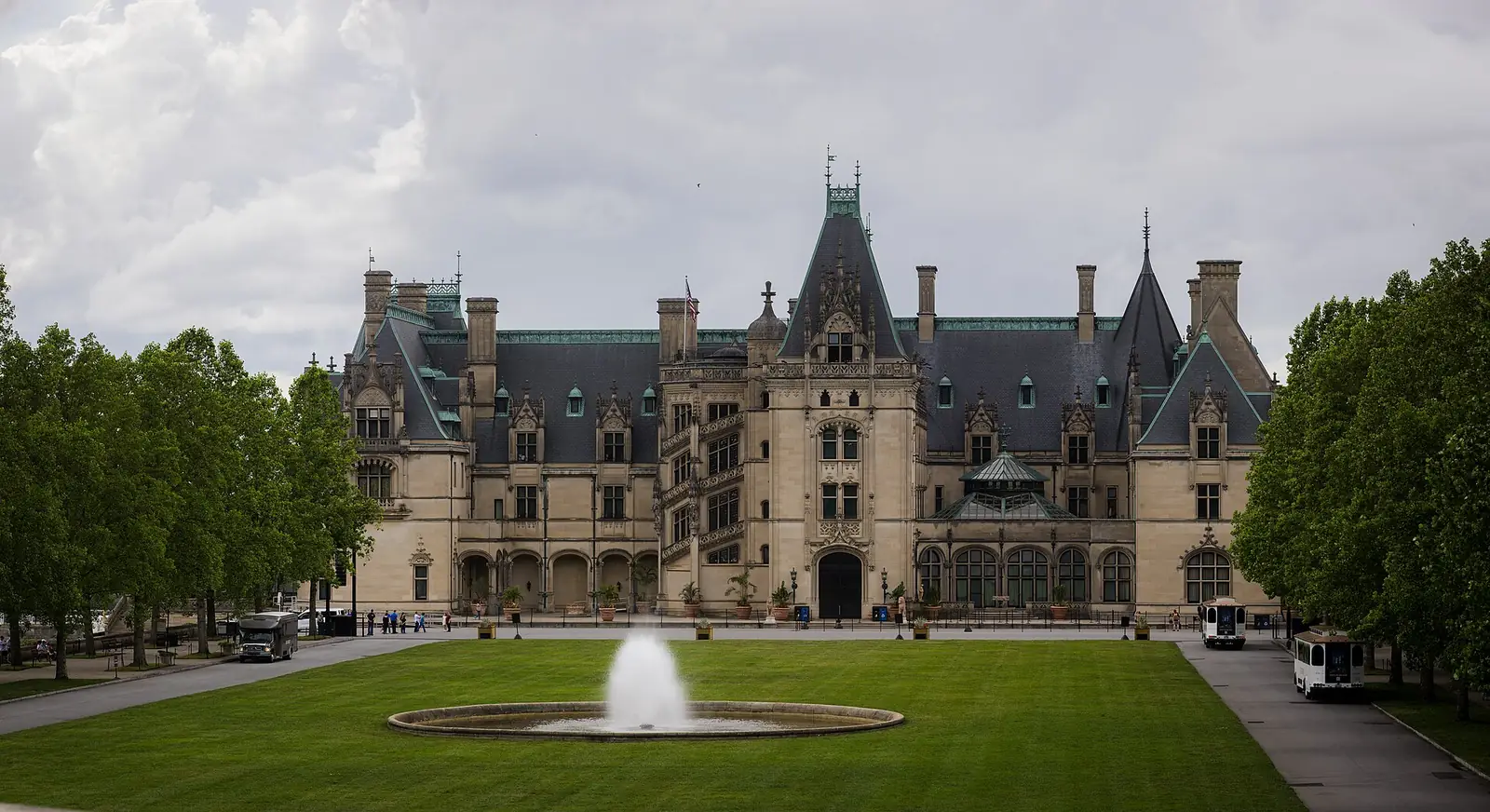
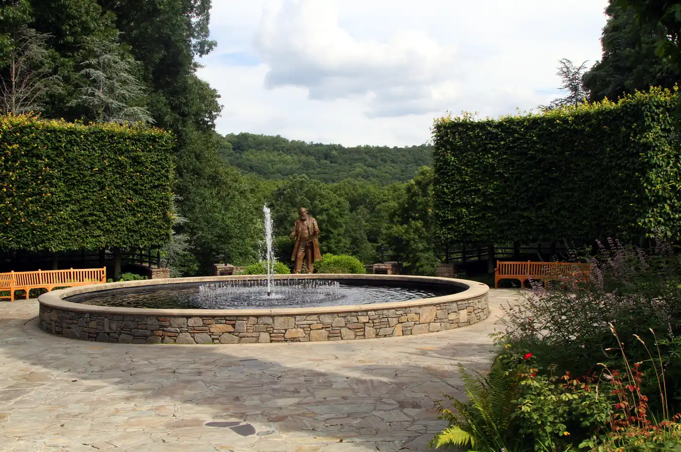
2. Biltmore Estate
 Save
SaveThe largest privately owned house in America, 250 rooms, finished in 1895 by George Vanderbilt, parked on 8,000 acres of Frederick Law Olmsted landscape. Photo-wise: the front facade catches morning light around 9-10am from the east-southeast and the symmetrical hero shot wants to be from the center of the front lawn at 24-35mm. Get there at gate opening (9am) to beat the tour buses. Interior photography is permitted without flash, without tripod — practical implication: bring a fast wide (16-35 f/2.8) and accept ISO 3200.
The conservatory and walled garden behind the house are arguably better photo subjects than the house itself — fewer people, more compositional variety, and the light bounces beautifully off the glass interior. Skip the audio tour, take the gardens-and-grounds-only pass if you’re there to shoot ($89 in 2026).
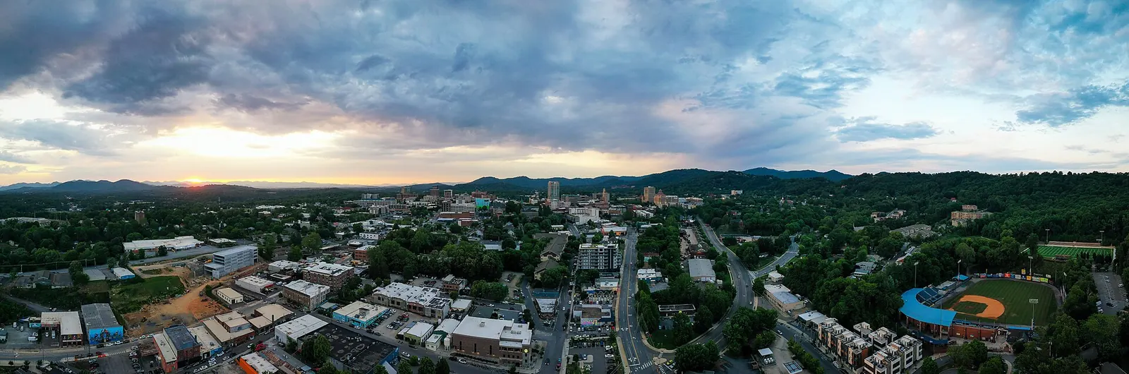
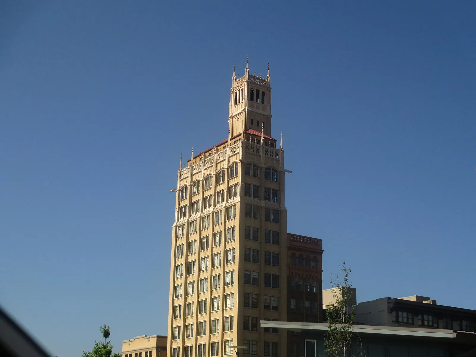
3. Downtown Historic District
 Save
SaveAsheville’s downtown is a compact dense Art Deco core that punches well above its size. The Jackson Building (1924), the Public Service Building, the City Hall (an Art Deco masterpiece in pink Georgia marble), the S&W Cafeteria building. Walk Pack Square at blue hour with a 24-105 and you have an hour of frames before the light goes. The street-level grit/charm — galleries, buskers, the constant smell of barbecue — also rewards a 35mm at f/2 for documentary work.
Best blue-hour vantage: the rooftop bar at the AC Hotel on Broadway. Public access, no reservation needed if you go for a drink, and it gets you above the building line for the mountain-frame-around-downtown shot that’s hard to nail from street level.
4. Craggy Gardens
Mile 364 of the parkway, accessed via a paved trail from the parking lot. The summit is a 360-degree alpine bald with stunted rhododendron and a vantage that on a clear day sees ridgelines stretching to Mount Mitchell. June is peak rhododendron bloom — book this trip around it if you can. The trail to the summit takes 20 minutes; bring a headlamp if you’re doing sunrise because the parking lot is dark at 5am and the trail has loose footing.
5. Looking Glass Falls
Twenty-five miles south of Asheville on US-276 in Pisgah National Forest. A 60-foot waterfall with a wide flat base, accessible by a 100-foot walk from the parking lot. Mid-morning shade puts the falls in even light without harsh contrast — perfect for long-exposure water blur at f/16, 1-2 seconds, with a 6-stop ND filter. The polarizer is mandatory here to cut glare off the wet rock face.
6. Black Balsam Knob
Off Black Balsam Road, mile 420 of the parkway. A grassy bald with 360-degree views and one of the few spots in the Blue Ridge where you can pitch a tent and shoot sunrise without driving anywhere. Hike in 0.6 miles from the trailhead. This is the milky-way location for a moonless August or September night — the sky here is Bortle 3 and Asheville’s light dome sits low on the southern horizon.
7. River Arts District (RAD)
South of downtown along the French Broad River. 200+ working artist studios in former industrial buildings, plus murals on nearly every exterior wall. This is your color-and-texture session. Shoot at 35mm or 50mm prime, look for graphic edges, layer the murals against fire escapes and brick. Wear shoes you can walk in. The RAD is also where the river photographs best from — the south end has a kayak put-in with a low-angle view back toward downtown.
8. Folk Art Center and Mountains-to-Sea Trail
Mile 382 of the parkway. The Folk Art Center building itself is a quiet exterior frame, but the real reason to stop here is the trailhead for the Mountains-to-Sea Trail. A 15-minute walk gets you to a quiet overlook with no crowds, and the trail wanders through what’s effectively old-growth understory — perfect for intimate landscape work at 50-85mm.
9. Mount Mitchell State Park
An hour north of Asheville, mile 355 of the parkway, then 4.7 miles up NC-128. At 6,684 feet it’s the highest point east of the Mississippi. The observation deck at the summit is your hero shot — but the better photograph is from the parking lot looking south at sunset, where you get the layered-ridge silhouette without the deck infrastructure in frame.
10. North Carolina Arboretum
Just south of the city off the parkway. 434 acres, the bonsai garden is the photo asset — meticulously maintained miniatures in graphic settings that work at any season. Macro lens optional; 90mm or 100mm macro turns the bonsai into portfolio frames. Open 8am to 9pm in summer, 8am to 7pm in winter. $16 parking.
When to Visit Asheville for Photography
October is the famous month — peak fall color on the parkway, fog mornings every other day, comfortable temps. Book accommodations six months out because every wedding photographer and Instagram tourist in the southeast comes here in October. April-June is the underrated window — rhododendron and mountain laurel bloom, longer light, half the crowds. December-February for moody minimalist landscape work and the chance of snow on the high parkway sections.
Avoid late July through early September: humidity is brutal, the haze cuts your distance views to a kilometer, and thunderstorms cap your evenings.
What to Pack for Asheville Photography
Asheville’s specific demands: cold-morning gear for parkway sunrise (4,000-6,000 feet is genuinely cold at 5am), wide-angle for vista work, telephoto for ridge isolation, polarizer non-negotiable for the falls and rivers, ND filter for water blur.
- Full-frame mirrorless body with weather sealing. The Sony A7 IV or Canon R6 Mark II at B&H handle the dynamic range on parkway overlooks at sunrise and ISO 3200 inside Biltmore.
- 16-35mm f/4 or f/2.8 wide zoom for parkway vistas. 16-35 f/4 zooms at B&H.
- 70-200mm f/4 or f/2.8 for ridge isolation and layered atmospheric compositions. Indispensable here.
- Carbon-fiber travel tripod. Peak Design Travel Tripod at B&H or the Manfrotto Befree carbon on Amazon.
- Circular polarizer. Breakthrough X4 CPL on Amazon.
- 6-stop ND filter for the waterfalls. 6-stop ND on Amazon.
- Fleece + windbreaker for parkway dawn. Even in May it’s 40°F at 5,000 feet at 5am.
If you’d rather not chase the logistics of parkway timing and Biltmore tickets, the local Asheville photography tours on Viator handle vehicle, timing, and overlook routing. The sunrise parkway tours in particular are worth the price the first time.
Three-Day Itinerary
Day 1 — Parkway North. 5am drive to Craggy Pinnacle for sunrise. 9am breakfast back in town. 11am Folk Art Center + Mountains-to-Sea walk. Lunch. 4pm drive Mount Mitchell. Sunset from the summit parking lot.
Day 2 — Biltmore + RAD. 9am Biltmore gates. Shoot exterior + gardens until lunch. 1pm RAD wander. Sunset Pack Square + AC Hotel rooftop for blue hour downtown.
Day 3 — Parkway South. 5am drive to Black Balsam Knob for sunrise. 9am drive Looking Glass Falls. 11am Pisgah area lunch. Afternoon Graveyard Fields or Pounding Mill. Sunset from Mount Pisgah.
Three days is enough. Five days is comfortable if you want fog-morning contingency and time at the Arboretum.
Settings Notes for Asheville Conditions
Parkway sunrise: f/11 to f/13, 1/8 to 1/30 handheld on a 24-70 with IBIS, or 1-4 second exposures on tripod. Bracket three frames at -1/0/+1 EV if you’re shooting into the sun. Biltmore interiors: ISO 3200 on a fast wide, 1/60 minimum to avoid motion blur from your own movement. The waterfalls: f/16, 6-stop ND, 1-2 seconds for silky water but still defined edges.
ISO management matters at Biltmore because tripods aren’t allowed inside — a body that holds clean shadows at ISO 3200 is the difference between a usable file and a noisy one. Lightroom’s masking and dehaze sliders earn their keep on the parkway atmospheric haze; don’t be afraid of +20 dehaze on the ridge-layer files.
Asheville rewards photographers who get up early and don’t skip the parkway because it looks like a drive. Sunrise and blue hour are the assignment — midday is for editing, eating, and scouting the next morning’s overlook.
Last updated June 2026.
 Save
Save Save
Save Save
Save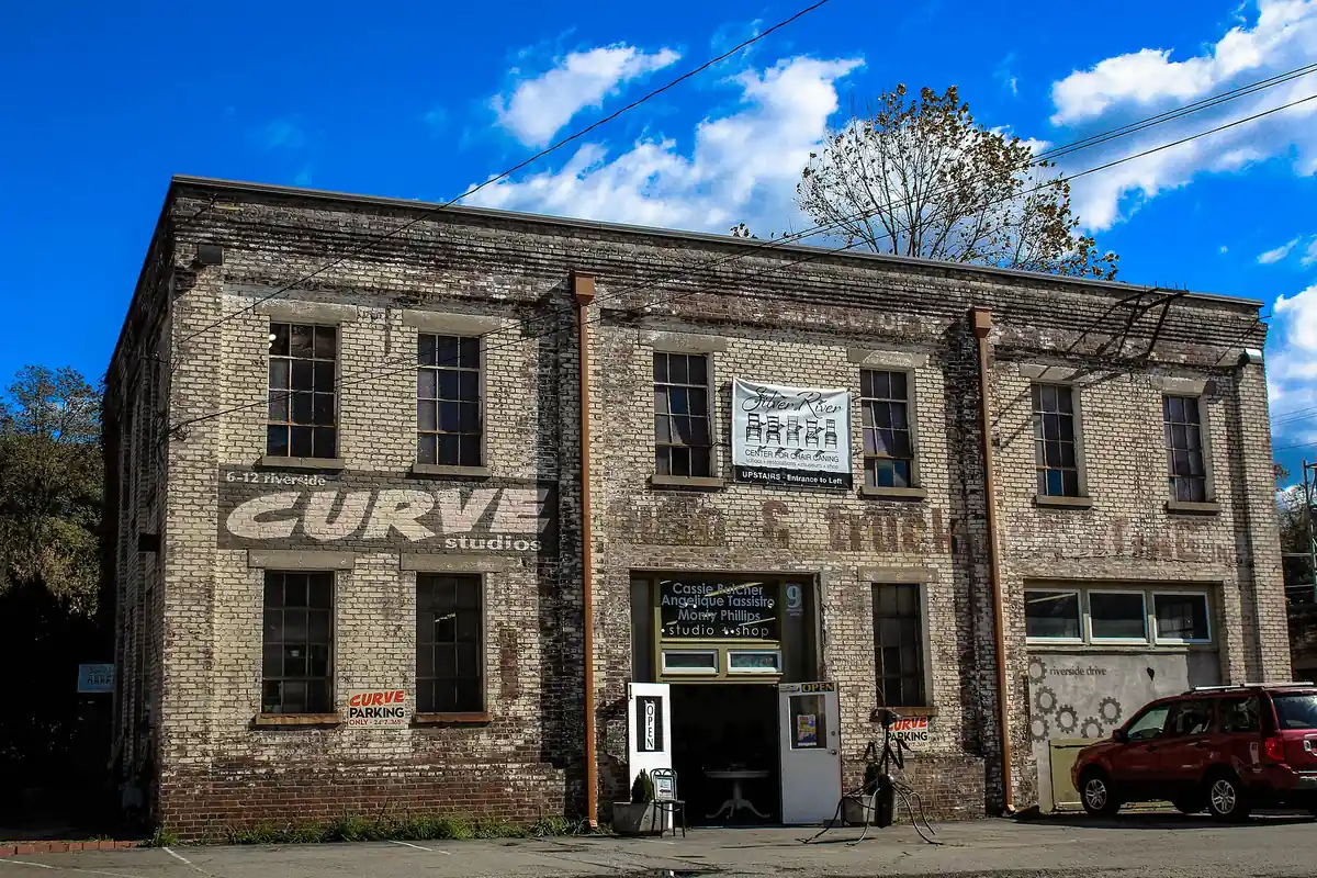 Save
Save Save
Save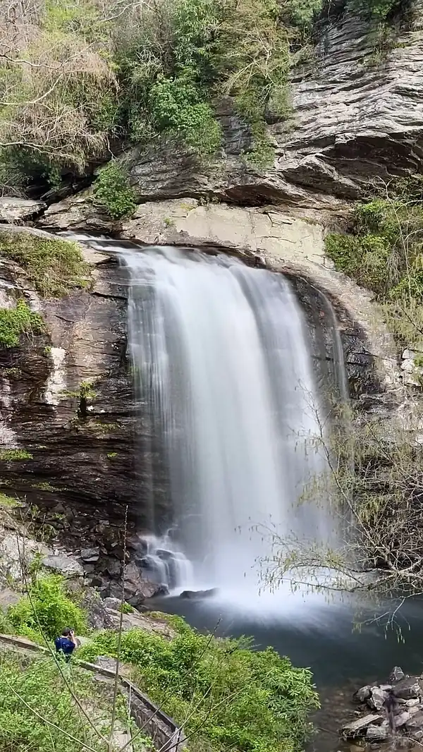 Save
Save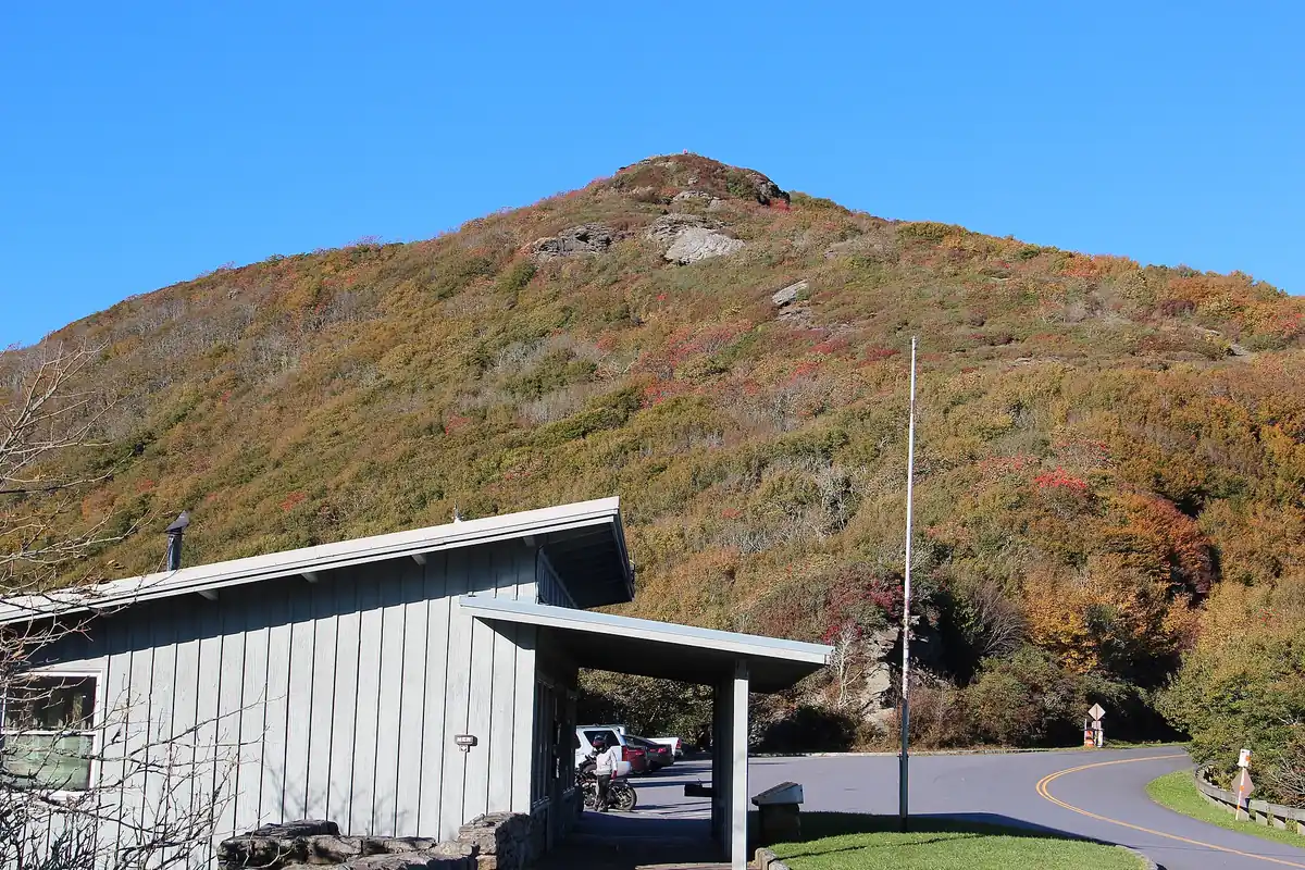 Save
Save