Best Photography Spots in Cappadocia: 11 Locations With GPS
edinchavez01-20). Buying through these links costs you nothing extra and helps fund our free guides.
Cappadocia, Turkey is one of the most photogenic cities in the world. If you have a camera and the patience to show up before dawn, Cappadocia will give you images that last a career — but only if you know where and when to point it.
This is the definitive field guide to the 11 best photography spots in Cappadocia, with GPS coordinates you can drop straight into Google Maps, exact camera settings tuned to Cappadocia’s unique light, precise timing for every location, and the access notes nobody else bothers to document. It mirrors the intel inside our Cappadocia Ultimate Photographer’s Guide ($47 PDF) — a downloadable field guide with full-page hero images, GPS maps, seasonal tables, a city safety briefing, and a complete photographer’s packing list. Get the guide →
Planning multi-city travel? See also: U.S. cities photography hub and the National Parks Photography Guides.
11 GPS-mapped locations · Exact camera settings · Multi-season shooting calendar · Free annual updates
Download the PDF guide →
Get the Cappadocia Ultimate Photographer’s Guide
Every location below — pre-mapped with GPS, golden-hour timing, gear recommendations, cultural rules, and a 14-day itinerary. Downloaded by 200+ working photographers.
Quick jump to the 11 spots
- Göreme Sunset Point (Lover’s Hill / Aşıklar Tepesi)
- Göreme Open Air Museum
- Love Valley (Bağlıdere Valley)
- Pigeon Valley & Uçhisar Castle
- Red Valley & Rose Valley Sunset Hike (Kızılçukur / Güllüdere)
- Çavuşin Old Village & Castle
- Avanos Pottery Town & Kızılırmak River
- Pasabag Monks Valley (Fairy Chimneys)
- Devrent Valley (Imagination Valley / Pink Valley)
- Derinkuyu Underground City
- Ihlara Valley Canyon Hike
A look inside the Cappadocia Photographer’s Guide
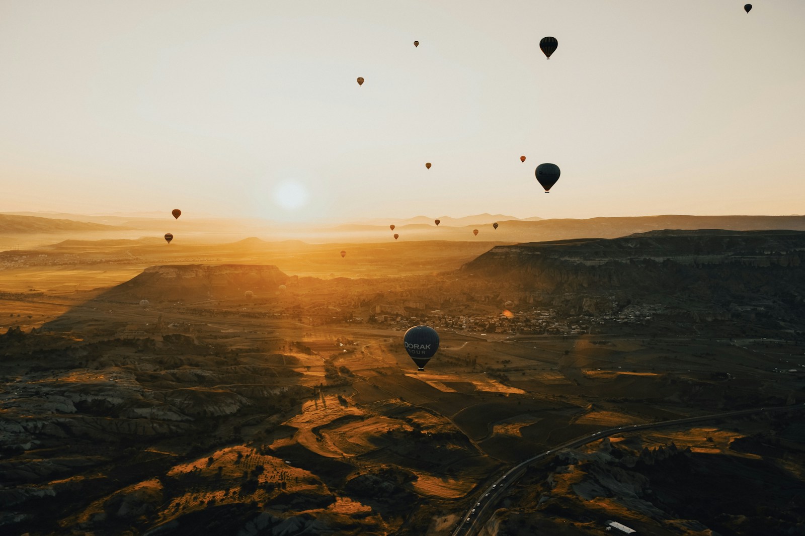
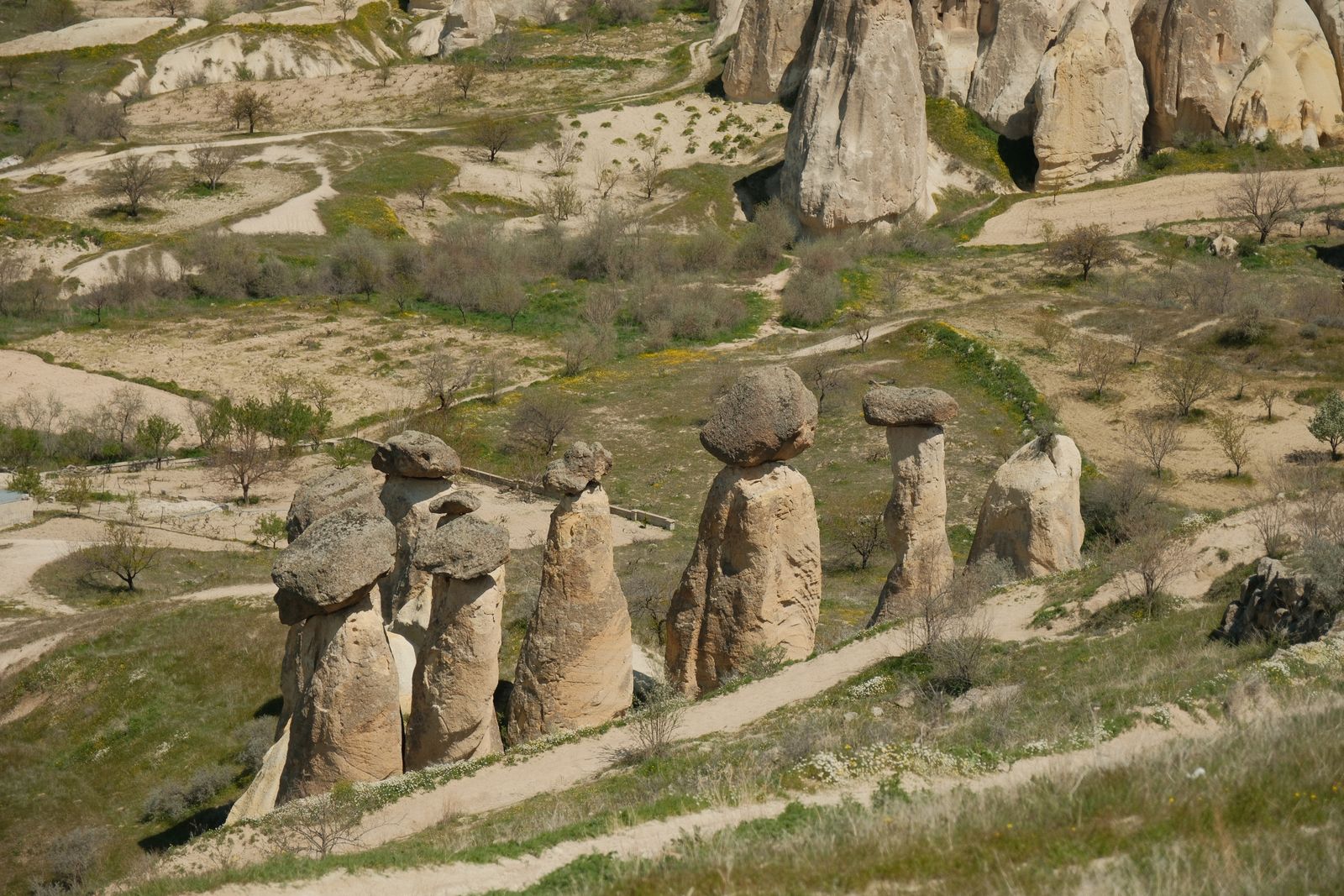
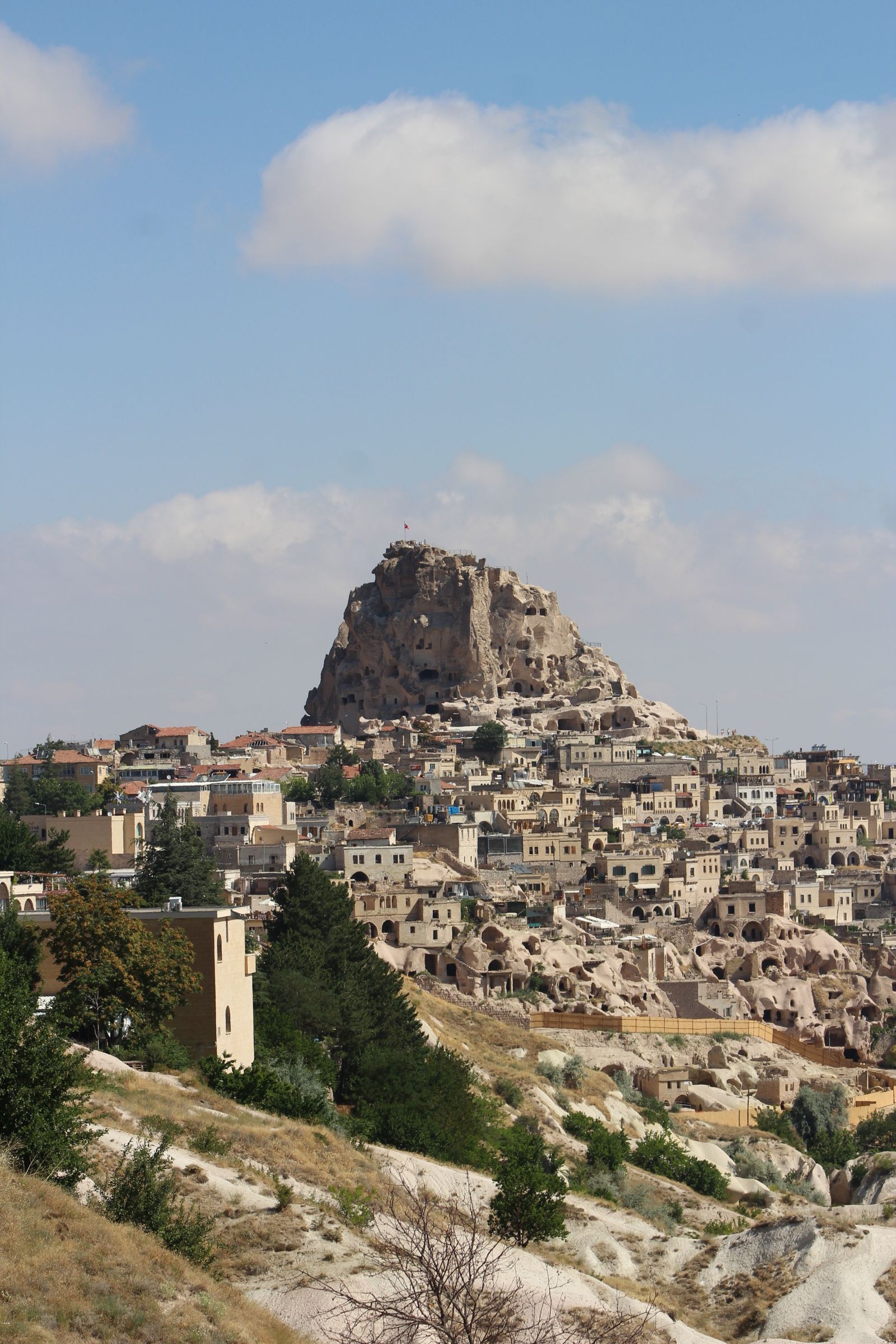
Here are three of the actual shots you’ll find inside the PDF — cinematic full-page references for the exact spots, lenses, and lighting conditions documented in the guide. The full guide includes 11 locations, each with a hero image, GPS map, settings table, and a five-shot list.
Save
Before you shoot Cappadocia: the essentials
- Free public access: Pigeon Valley trail (free), Love Valley floor hike (free), Rose Valley trail (free), Red Valley hike (free), Devrent Valley roadside stop (free), Cavusin old village (free), Avanos town and Kizilirmak riverbank (free), Mustafapasa village streets (free), Ihlara Valley entrance fee ~150 TRY/adult; Göreme Open Air Museum ~500 TRY/adult (Dark Church extra); Uçhisar Castle ~150 TRY/adult; Pasabag ~100 TRY/adult; Kaymakli Underground City ~250 TRY/adult; Derinkuyu Underground City ~250 TRY/adult. Hot air balloon rides 60–90 min, approx. €150–€300/person depending on operator and group size.
- Commercial permits: Personal/tourist photography in all public spaces and valleys is unrestricted. Drone regulations (DGCA Turkey): drones ≥500 g must be registered with the DGCA; recreational drones under 25 kg do not require a pilot license but must be registered. Maximum altitude 120 m (400 ft). Drones are PROHIBITED from flying during active hot air balloon hours (approximately 05:00–08:30 AM local time) across all Göreme, Çavuşin, and Ortahisar flight corridors — violation fines up to €2,000. No-fly zones include areas directly above Göreme Open Air Museum, underground city entrances, military zones, and within 5 km of airports. Additional permit from local governor’s office required near protected historical sites. Interior photography of frescoes is prohibited in most Göreme Open Air Museum cave churches (no flash strictly enforced); tripods permitted outdoors but not inside churches.
- Best photography seasons: April–June (spring wildflowers on valley floors, clear skies, balloon flights near-daily) and September–October (golden autumn light, rich warm tones on fairy chimneys, lower humidity, fewer crowds than August peak)
- Blue hour notes: Göreme sits at 38.64°N — sun arc is higher than northern Europe but blue hour still lasts a generous 18–25 minutes after sunset. In summer, sunset is approximately 20:30 local time (UTC+3); in winter around 17:00. The warm amber tones of tuff rock react dramatically to the deep blue sky of the post-sunset window. Uçhisar Castle and Pigeon Valley rim are exceptional blue-hour targets when village lights begin to appear in cave windows.
- Drone policy: Drone laws vary widely by country and city — many capital and tourist zones are no-fly. Verify the local civil aviation authority’s current rules before launching.
- Local resource: Official visitor information
The full-resolution version of every map below — plus seasonal calendars, gear notes per location, sun-angle diagrams, and a complete photographer’s packing checklist — is inside the Cappadocia Photographer’s Guide PDF ($47).
1. Göreme Sunset Point (Lover’s Hill / Aşıklar Tepesi)
This is the most iconic ground-level hot air balloon viewpoint in Cappadocia and arguably the world. On any given clear morning from April to October, between 50 and 200+ colorful balloons simultaneously inflate and rise over the valley visible from this hilltop. The foreground of classic phallic fairy chimney columns (Görkündere spires) with balloons floating above creates the single most reproduced Cappadocia image. The Turkish flag on the summit acts as a natural landmark orienting the composition. At sunrise, balloons begin lifting at the same moment that golden light breaks over the eastern ridge — a 30–45-minute spectacle that unfolds from this vantage like a living painting.
- GPS: 38.6415, 34.832
- Elevation: 3,937 ft
- Best time of day: Sunrise (45 minutes before first light) for hot air balloon launch photography — hundreds of balloons inflate and ascend over the fairy chimneys with warm pink and gold light; also excellent at sunset for golden glow on the tuff formations
- Sun direction: The viewpoint faces northwest over Göreme town and the Görkündere Valley. At sunrise (azimuth ~70° in summer, ~115° in winter), the sun rises behind the camera to the east-southeast, frontlighting the fairy chimneys and the ascending balloons with warm orange-pink light — optimal for balloon photography. The sun sets to the west-northwest in summer (~300°), painting the rock formations in amber and setting the sky ablaze behind the Güvercinlik (Pigeon) Valley ridge. At Göreme’s latitude 38.64°N, the low summer sun angle (max ~75° elevation) creates long shadows that define the contours of the volcanic tuff columns throughout the day.
- Access: From Göreme town center, walk approximately 2 km uphill (25–30 min) or rent a bicycle/scooter. Well-marked path with signposts. Also accessible by taxi from Göreme (5 min, ~50–100 TRY). Small entrance fee ~3 TRY collected at peak times. Open all day; no formal hours. Parking available near the viewpoint for self-drivers.
- Difficulty: easy
- Recommended settings: Balloon Sunrise Wide: f/8, 1/500 sec, ISO 400, 16–24mm — capture mass balloon fields against gradient dawn sky · Balloon Telephoto Compression: f/6.3, 1/800 sec, ISO 200, 200–400mm — compress multiple balloons into stacked layers above fairy chimneys · Sunset Golden Hour: f/8, 1/250 sec, ISO 100, 24–35mm · Blue Hour Town Lights: f/11, 15 sec, ISO 100, 24mm, tripod — Göreme cave-house windows glowing amber below
Shots to chase:
- Pre-dawn silhouette of balloon burner glow: arrive before 5 AM to find balloon crew inflating capsules in the field immediately adjacent to the viewpoint — shoot at 70–135mm for intense orange flame burst against dark sky
- Wide-angle mass balloon scene at 16–24mm with Görkündere fairy chimneys in sharp foreground and 50+ balloons scattered across the pink-to-blue dawn gradient
- Telephoto compression (300–400mm) stacking 5–10 balloons in layers above a single prominent fairy chimney spire
- Long exposure light-trail shot: use a 30-second exposure at f/11 ISO 100 to capture the faint glow trail of a balloon’s flame burner moving across the still-dark pre-dawn sky
- Sunset portrait with Turkish flag silhouetted and backlit fairy chimneys in warm amber — the flag itself makes a natural compositional anchor
Pro tip: Arrive at least 45 minutes before sunrise — the viewpoint fills rapidly and the best tripod positions (center ridge, unobstructed) disappear within 15 minutes of arrival. Balloon flights are weather-dependent and can be cancelled with no notice; plan 3+ days in Cappadocia to guarantee at least one balloon morning. The adjacent lower ridgeline (set back 50 m from the main flag point) is significantly less crowded and offers an equally good, slightly different angle — locals know this spot. Bring a zoom lens for balloon compression and a wide-angle for context — swapping between them during the 45-minute balloon window is standard practice.
Common mistake to avoid: Using only a smartphone or wide-angle lens and ending up with tiny unidentifiable balloons against a large sky — a 200–400mm telephoto is essential for balloon detail shots. Arriving exactly at sunrise and finding the viewpoint already packed. Leaving after the first balloons land (around 7–7:30 AM) and missing the peak saturation moment when the valley is completely filled with balloons just after 6 AM.
2. Göreme Open Air Museum
A UNESCO World Heritage Site since 1985, the Göreme Open Air Museum contains more than 30 rock-cut Byzantine churches and monasteries carved into volcanic tuff cones between the 10th and 13th centuries. The Tokali Church (Buckle Church), Elmali Church (Apple Church), and Dark Church contain some of the finest Byzantine frescoes surviving anywhere in the world. For photographers, the exterior offers spectacular compositions of carved fairy chimney facades with arched doorways, blind niches, and Orthodox crosses against the sky — scenes that look like nothing else on earth.
- GPS: 38.6432, 34.8607
- Elevation: 3,740 ft
- Best time of day: Early morning at opening (8:30–10 AM) for low raking light across the cave-church rock faces with minimal crowds; late afternoon (3–5 PM) for warm side-lighting on the tuff cones
- Sun direction: The museum complex faces generally westward, with the main path running south-to-north. Morning sun from the east lights the vertical rock faces of the church façades from the side, creating dramatic shadow relief on the carved niches and window frames. By midday the sun is overhead, washing out texture. Late afternoon (3–5 PM) brings warm western light that saturates the honey-gold tuff rock. The complex sits at ~38.64°N — mid-morning and mid-afternoon provide the ideal 45° side lighting angle for architectural photography.
- Access: Located 1.5 km northeast of Göreme town center; easy 20-minute walk on a marked path or 5-minute taxi. Admission ~500 TRY/adult; Dark Church (Karanlık Kilise) an additional charge, about 150 TRY — worth it for interior fresco photography context. Open daily 8:30 AM–7 PM (April–October), 8:30 AM–5 PM (November–March). Tripods permitted in outdoor areas; no flash and no tripods inside cave churches. Advance online ticket purchase recommended in high season (July–August).
- Difficulty: easy
- Recommended settings: Exterior Rock Church Facades: f/11, 1/500 sec, ISO 100, 24–35mm — use morning sidelight for maximum texture · Fresco Interior Available Light: f/2.8, 1/60 sec, ISO 3200, 24mm, no flash, no tripod · Dark Church Interior: f/2.8, 1/30 sec, ISO 6400, 16mm — brace against wall or doorframe · Wide Complex Overview: f/11, 1/400 sec, ISO 100, 16mm — elevated position from path above the main complex
Shots to chase:
- Low-angle shot looking up into the carved archway of the Dark Church entrance with the Byzantine cross relief silhouetted against bright sky beyond — f/8, 1/250 sec
- Wide-angle perspective of the main museum cluster from the raised path on the north side, showing 6–8 cave church cones simultaneously with balloons visible in the morning sky above
- Telephoto isolation (135mm) of a single fresco-painted niche through an arched window, using available window light for natural illumination
- Texture study of the volcanic tuff surface at f/16, 1/250 sec with morning sidelight — the erosion patterns in the rock are as compelling as the architecture
- Compositional pairing of two carved cave church doorways side by side, using a 35mm lens and slight elevation to frame both symmetrically
Pro tip: Photography inside the cave churches is officially restricted (attendants enforce the no-flash rule vigorously), but exterior photography around every doorway, façade, and courtyard is unrestricted. El Nazar Church, a detour about 600 m before the main museum entrance, is rarely visited and contains well-preserved frescoes with no attendant — arrive in morning for best light and solitude. The path above and behind the main complex offers a bird’s-eye composition rarely seen in published Cappadocia images. Buy tickets online in advance to skip the queue that forms by 10 AM.
Common mistake to avoid: Using flash inside cave churches, which both violates rules and damages centuries-old pigments — high ISO + wide aperture is the only acceptable approach. Visiting at midday in summer when direct overhead sun flattens all rock texture and heat is intense. Spending all time inside and missing the exterior architectural compositions that are often more photogenic than the restricted interiors.
3. Love Valley (Bağlıdere Valley)
Love Valley contains the most dramatically shaped and densest concentration of classic Cappadocian fairy chimney columns — their tall, narrow cylindrical form topped with mushroom caps creates a surreal forest of natural sculptures unlike any other landscape on earth. When photographed from the valley floor looking upward, columns fill the frame in all directions while hot air balloons drift silently above — the combination is one of the most arresting photographic compositions in world travel photography. The valley is also a beloved balloon watching ground, with some launch sites operating from the Göreme valley just below the ridgeline.
- GPS: 38.6548, 34.8204
- Elevation: 3,937 ft
- Best time of day: Sunrise — from inside the valley floor, hot air balloons float directly overhead from approximately 5:30–7:30 AM; golden hour light warms the tall cylindrical rock columns from the east; late afternoon golden hour also produces rich warm tones
- Sun direction: Love Valley runs roughly east-northeast to west-southwest, oriented so the valley floor faces upward to an open sky corridor. At sunrise, the sun rises behind the eastern ridge and its first rays illuminate the tops of the famous phallic tuff columns while the valley floor is still in shadow — creating a dramatic rim-lit effect. By mid-morning the sun enters the valley at a low angle from the east, sidelighting the columns and creating pronounced shadows that define their cylindrical shape. The columns reach 10–15 meters height; with a 35–50mm lens from valley floor level, the columns fill the frame with sky and balloons above.
- Access: From Göreme: drive or taxi northwest on road toward Uçhisar (D300) and follow signs for Bağlıdere/Love Valley — approximately 4–5 km, 10 minutes by car. Upper viewpoint (parking area) accessible by car; valley floor accessible by hiking trail from Göreme (3 km, 45–60 min walk) or from the road. No entrance fee. The upper rim viewpoint is crowded with tour buses by 7 AM — hike into the valley floor for solitude. A small café at the valley entrance opens in morning.
- Difficulty: easy-moderate
- Recommended settings: Valley Floor Wide Balloons: f/8, 1/500 sec, ISO 200, 16mm — columns in foreground, balloons above · Golden Hour Column Texture: f/11, 1/250 sec, ISO 100, 35–50mm — low sun sidelighting cylindrical forms · Telephoto Balloon Framing: f/6.3, 1/640 sec, ISO 200, 200mm — balloon framed between two column tops · Blue Hour Starfield: f/2.8, 25 sec, ISO 3200, 16mm, tripod — Milky Way above fairy chimneys (new-moon nights May–September)
Shots to chase:
- Ultra-wide (16mm) from valley floor looking straight up through a cluster of columns at a balloon passing overhead — keep horizon line out of frame for a disorienting, otherworldly feel
- Telephoto (200mm) from the upper rim looking down into the valley in early morning mist, with balloons drifting just above the column tops and haze softening distant fairy chimneys
- Silhouette composition at sunset: position a single column in the foreground against the vivid orange-to-purple gradient sky with the last balloon of the day still aloft
- Astrophotography: Love Valley floor with minimal light pollution — 25-second exposures at f/2.8 ISO 3200 capture the Milky Way core arching over the column silhouettes (best May–August around new moon)
- Human scale reference: ask a companion to stand at the base of the tallest column (10–15 m) and shoot at 35mm to convey the extraordinary height of these formations
Pro tip: The upper viewpoint (parking lot) is accessible by car and is where the tourist buses stop — for genuinely intimate balloon-and-column compositions, hike 20–30 minutes into the valley floor where tour groups rarely penetrate. The valley is 3 km from Göreme town center on foot — leave 45 minutes before sunrise to reach the floor by first light. Do not fly drones here during balloon hours (5–8:30 AM). The small café at the valley entrance opens around 5:30 AM for coffee before the balloon show.
Common mistake to avoid: Staying at the crowded upper viewpoint and missing the far superior valley-floor compositions. Visiting at midday when the columnar shadows flatten completely and the valley is packed with ATV tours raising dust clouds. Expecting the valley to be deserted — it sees significant foot traffic by 8 AM on clear days; midweek visits are substantially quieter.
Want this in your pocket on the street?
The full-resolution version of every spot above — with full-page hero photography, GPS maps with gold location pins, sun direction diagrams, multi-season tables, and a complete safety + packing checklist — is inside the Cappadocia Ultimate Photographer’s Guide PDF ($47). Print it, save it offline, take it on the walk. Get the guide →
4. Pigeon Valley & Uçhisar Castle
Uçhisar Castle is the highest point in the entire Cappadocia region and its monumental rock façade — riddled with hundreds of hand-carved pigeon house niches forming a geometric lattice pattern — is unlike any man-made or natural structure elsewhere. The castle rises dramatically from the valley floor and can be seen from nearly every vantage point in Cappadocia, making it a natural photographic anchor. From the castle summit, the 360° panorama encompasses Göreme, Love Valley, Pigeon Valley, and the distant Erciyes volcano (3,917 m). Pigeon Valley trail below offers intimate close-up compositions of the carved cliff walls with the castle hovering above.
- GPS: 38.6346, 34.8049
- Elevation: 4,530 ft
- Best time of day: Sunset — Uçhisar Castle turns deep amber-orange in the last 30 minutes of sunlight; Pigeon Valley floor provides a foreground of carved cliff pigeon holes below the castle silhouette; also excellent in late afternoon when the castle is side-lit from the west
- Sun direction: Uçhisar Castle stands at the western end of Pigeon Valley on a massive tuff monolith reaching ~1,386 m. From the Göreme-side entrance (east end) of the valley, the camera faces generally west-southwest toward the castle. Afternoon sun (west, 250–280° azimuth) backlights the castle from behind for dramatic silhouettes or illuminates its eastern face at a favorable angle. At sunset, the sun swings northwest (~290–300° in summer) and the castle monolith is lit in rich warm tones from the side. From within the valley, low cliff walls studded with hand-carved pigeon holes create intricate foreground texture against the looming castle.
- Access: Pigeon Valley trail: starts from Göreme side (Uzun Dere Cd., 5 min walk from Göreme center) or from Uçhisar side (1 km from Uçhisar town center at Pigeon Valley Gifts shop). Full trail 4 km, approximately 1.5 hours easy-moderate. Trail is signed throughout. Uçhisar Castle: admission ~150 TRY/adult; open 8 AM–7 PM (summer), 8 AM–5 PM (winter). The castle interior contains an extensive network of carved rooms and tunnels. No tripod fee; tripods permitted outside. Bus from Göreme to Uçhisar runs every 30 minutes, 3 TRY.
- Difficulty: easy-moderate
- Recommended settings: Castle Sunset Golden Hour: f/8, 1/500 sec, ISO 100, 50–85mm — side-lit warm tones on tuff monolith · Valley Floor Pigeon Holes: f/11, 1/250 sec, ISO 100, 35mm — texture detail of carved niches · Castle Summit Panorama: f/11, 1/500 sec, ISO 100, 16mm — 360° landscape sweep · Blue Hour Castle Lights: f/8, 8 sec, ISO 400, 50mm, tripod — village lights activating below castle
Shots to chase:
- From the valley floor, shoot the castle looming above using the carved pigeon holes as an intricate foreground frame — 35mm, f/11, sunrise light
- From the castle summit, 16mm panorama showing the entire Pigeon Valley below, Göreme in the mid-distance, and the Erciyes volcano on the horizon
- Telephoto (200mm) from the eastern valley rim at sunset compressing the castle monolith against a vivid sky with a hot air balloon floating to its left
- Blue-hour image from Göreme side of valley with castle as distant silhouette, cave-house windows glowing warm amber in the foreground cliffs
- Close-up texture study (85mm, f/11) of the carved pigeon-house grid pattern on a sunlit cliff face — the geometric regularity is visually arresting
Pro tip: The castle summit is the best wide-angle panorama point in all of Cappadocia — get there 30 minutes before sunset for the optimal light angle and to find a position before crowds gather at the narrow summit platform. From the valley trail, the best pigeon-hole textures are on the north-facing cliff sections approximately halfway along the trail — morning light falls on these faces. The Uçhisar–Göreme sunset overlook (GPS ~38.6419, 34.8194) is a quieter alternative viewpoint to the main castle crowds, with dramatic angles of the castle lit at sunset.
Common mistake to avoid: Visiting the castle only from the outside and missing the summit panorama. Walking only the road between Göreme and Uçhisar rather than the valley trail, which has dramatically better photographic content. Arriving at the castle summit exactly at sunset — the light is actually better 20–30 minutes before the sun reaches the horizon, when the castle glows rather than going dark.
5. Red Valley & Rose Valley Sunset Hike (Kızılçukur / Güllüdere)
Save
Red Valley’s iron-rich volcanic tuff undergoes a remarkable color transformation at sunset — what is pale ochre at noon becomes a vivid crimson-orange that deepens through scarlet to blood-red in the final minutes before dusk. This is the most extreme natural color event in the entire Cappadocia region and one of the most spectacular sunset locations in Turkey. The valley is flanked by tall tuff ridges and dotted with Byzantine cave churches (including the Crusader Church in Rose Valley and the Columned Church). The Kızılçukur section doubles as the primary launch zone for one major balloon company — arriving here at sunrise gives ground-level balloon inflation and launch photography within meters of the capsules.
- GPS: 38.6533, 34.8634
- Elevation: 4,100 ft
- Best time of day: Sunset — the sandstone and iron-oxide rock turns progressively deeper crimson from 30 minutes before sunset until 15 minutes after; also outstanding for sunrise balloon photography (Kızılçukur balloon launch zone at 38.6580, 34.8488 is the single best balloon-foreground location in Cappadocia)
- Sun direction: Red Valley sunset viewpoint faces west-northwest (azimuth ~285°). The sun sets almost directly in line with the valley’s main axis in summer (azimuth ~295–305°), flooding the iron-oxide tuff with increasingly red light as the angle lowers. The rock’s natural warm color amplifies the red channel dramatically — even modest post-processing reveals a color saturation that looks almost unreal. At Rose Valley, the pinkish hue of the volcanic rock reflects blue-sky light in a complementary way at midday but glows warmest in the last 20 minutes before sunset. The Kızılçukur balloon launch zone (Rose Valley) faces east, making it ideal for balloon-rise photography at sunrise.
- Access: Red Valley sunset viewpoint: 15-minute drive from Göreme (head south on D765 past Open Air Museum, turn left before the Ramada Hotel following signs for Kızılçukur). Paid car park and small entry fee ~2 TRY at guard post. Several cafés at the viewpoint (Crazy Ali Panorama Café is the well-known one). Rose Valley Trailhead: accessible from Göreme via Kaya Camping Ground (just past Open Air Museum). Combined Red+Rose Valley loop hike: 6–8 km, 2–3 hours, moderate difficulty. Meskendir Trailhead to Rose Valley to Red Valley is the recommended full loop.
- Difficulty: moderate
- Recommended settings: Sunset Valley Red Tones: f/11, 1/250 sec, ISO 100, 24mm — expose for highlights; protect the crimson saturation · Sunset Person Silhouette: f/8, 1/500 sec, ISO 100, 35mm — meter for the sky, let the person fall to silhouette · Balloon Launch Ground Level: f/8, 1/800 sec, ISO 400, 24mm — capture the burner flame and balloon fabric simultaneously · Blue Hour Valley Floor: f/8, 4 sec, ISO 400, 24mm, tripod — valley floor in deep shadow, sky still retaining color
Shots to chase:
- Stand on the main viewpoint ridge and shoot 24mm toward the setting sun as the rock walls turn from orange to scarlet — bracket by ±1 stop to capture the range of the color transformation
- Flag viewpoint shot: 15-minute uphill trail behind the main cafés leads to a hilltop flag mast — dramatically elevated composition with nobody around and the entire valley below glowing red
- Balloon launch close-up from Kızılçukur: arrive before 5 AM to position 10–20 m from a balloon being inflated; shoot the burner flame at 1/800 sec with the valley behind
- Rose Valley Crusader Church: inside the cave church interior, the window arch frames Red Valley below like a painting — 24mm at f/8 including the frescoed walls in the foreground
- Astrophotography from valley floor: no light pollution, fairy chimneys silhouetted, Milky Way arching overhead — 25-sec exposures at f/2.8 ISO 3200
Pro tip: The best-kept secret at Red Valley is the flag-hilltop viewpoint 15 minutes behind the main café crowd — 200 tourists at the lower viewpoint versus 2–3 people at the top. Arrive at the main viewpoint 60 minutes before sunset to claim a position on the narrow ridge before tour buses arrive. The Red Valley and Rose Valley can be combined in one 3-hour hike — start at the Rose Valley trailhead (near Kaya Camping), hike through Rose Valley to the Red Valley viewpoint, then return by road or taxi at dusk. Ask local hotel staff for the current GPS waypoints for the balloon launch zones — these shift seasonally.
Common mistake to avoid: Arriving at exactly sunset time and finding no positions on the crowded main ridge. Underestimating the return journey after dark — bring a headlamp if planning to hike rather than take a taxi back. Shooting at f/2.8 for sunset landscapes, which sacrifices depth-of-field sharpness in the valley ridgelines — use f/8 or f/11 for landscape sharpness.
6. Çavuşin Old Village & Castle
Çavuşin contains one of the most dramatically photogenic abandoned cliff villages in the entire Cappadocia region — its multi-story carved cave houses have been uninhabited since a 1964 landslide forced evacuation, and the untouched decay of the buildings creates an authentic, time-frozen quality absent from more tourist-polished sites. The Church of St. John the Baptist (5th century AD) at the summit is the second-oldest Christian church in Cappadocia and its cliff-top position provides sweeping views over Red Valley and toward Uçhisar Castle. For photographers, the interplay of natural tuff geology and human cave architecture creates layered compositions impossible to replicate elsewhere.
- GPS: 38.6681, 34.8628
- Elevation: 3,740 ft
- Best time of day: Early morning golden hour (7–9 AM) when low eastern sun illuminates the abandoned cave-house cliff face in warm gold; also late afternoon for dramatic shadow patterns across the carved façades
- Sun direction: Çavuşin old village cliff faces east to southeast — the abandoned houses are cut into a tuff massif that catches direct morning sun from azimuth ~70–110° E. At sunrise and early morning, the entire vertical cliff of carved windows, arched doorways, and natural rock formations is lit evenly with warm directional light that throws deep shadows into the carved recesses, revealing the three-dimensional character of the architecture. The Church of St. John the Baptist, positioned at the top of the cliff, is backlit in the afternoon and frontlit in the morning. By midday, overhead sun creates flat, uninspiring light on the vertical cliff face.
- Access: Çavuşin is 4 km north of Göreme on the Göreme–Avanos road (D400) — 10-minute drive or 20-minute bicycle ride. Free parking in the village center. The old village and castle cliff are freely accessible; no entrance fee. A signposted path leads up to the Church of St. John the Baptist (5th century). Take care on the path — some sections are steep and uneven. The village has small cafés and souvenir shops in the lower section.
- Difficulty: moderate
- Recommended settings: Morning Cliff Facade: f/11, 1/400 sec, ISO 100, 24–35mm — full cliff in frame with carved windows as subject · Church Interior Available Light: f/2.8, 1/60 sec, ISO 3200, 24mm · Telephoto Window Detail: f/8, 1/400 sec, ISO 200, 135mm — individual arched windows in the cliff face · Valley Overview From Church: f/11, 1/500 sec, ISO 100, 16mm — sweeping view from church summit toward Red Valley
Shots to chase:
- Full cliff face at 24mm from the village square below — capture the entire height of the abandoned cave-house complex from base to church summit in a single frame with a person for scale
- Telephoto (135mm) isolating a single arched doorway with crumbling lintel and receding dark interior — the contrast between sunlit exterior stone and dark interior creates dramatic chiaroscuro
- From the Church of St. John summit: 16mm wide-angle looking south toward Göreme and Uçhisar Castle, with the Devrent Valley fairychimney landscape visible in the mid-distance
- Abstract texture study of the eroding tuff walls at f/16, 1/250 sec with extreme sidelight — the rough volcanic pockmarks and smooth carved edges create competing textures
- Evening composition from the road below with the Cavusin cliff glowing amber against a blue sky, warm café lights in the foreground
Pro tip: Çavuşin receives a fraction of the tourist traffic of Göreme or Pasabag — most mornings before 9 AM you will have the old village virtually to yourself. The path to St. John’s Church is steep in the final section; wear sturdy shoes and be careful on loose tuff. The Church of St. John contains well-preserved 10th-century frescoes in its Nikephoros II nave — low ISO + wide aperture hand-held photography is possible. Combine with Pasabag (Monks Valley) 3 km north for a half-day photography circuit.
Common mistake to avoid: Driving past Çavuşin without stopping because it lacks a major tourist infrastructure — the abandoned village is significantly more atmospheric than many heavily visited sites. Visiting at midday when the cliff face is in full overhead light and texture disappears. Walking only the lower village area and missing the spectacular view from the Church of St. John at the cliff top.
7. Avanos Pottery Town & Kızılırmak River
Avanos has been Turkey’s premier pottery center for over 4,000 years (since the Hittite period), its tradition sustained by the distinctive red clay deposited by the Kızılırmak (Red River) on its banks. This is not a staged tourist attraction but a living craft tradition where multi-generational family workshops still use foot-driven wheels and traditional kiln techniques. For photographers, the combination of color-saturated glazed ceramics, master potters in action, and the atmospheric Kızılırmak riverfront creates a uniquely rich urban photography subject distinct from Cappadocia’s landscape-dominated other locations.
- GPS: 38.7168, 34.8488
- Elevation: 3,300 ft
- Best time of day: Morning (9 AM–noon) for active pottery workshops when wheel-spinning demonstrations are underway; late afternoon for the Kızılırmak riverbank when warm light catches the suspension bridge and water reflections; Friday market day for color and street photography
- Sun direction: Avanos sits on the south bank of the Kızılırmak River (Turkey’s longest river at 1,355 km), which flows east-to-west through the town. The riverside promenade and suspension bridge face north across the river. Late afternoon sun from the west lights the bridge and riverfront buildings from the side in warm golden tones. The town’s old quarter, with its cobbled streets and stone houses, catches morning light from the east on the north-facing street facades. Workshop interiors are lit by skylight and artificial light — high ISO is required.
- Access: Avanos is 8 km north of Göreme — 15-minute drive or accessible by local dolmuş (minibus, ~10 TRY) running regularly between Göreme and Avanos. Pottery workshops (Chez Galip, Sultan Ceramics) are in the town center; most are open 9 AM–6 PM, free to enter and observe. Güray Museum (underground ceramics museum) ~100 TRY. Suspension bridge and riverbank are public spaces, free, open 24 hours. Friday market on south bank near Taş Köprü bridge.
- Difficulty: easy
- Recommended settings: Pottery Workshop Available Light: f/2.8, 1/125 sec, ISO 1600, 50mm — capture wheel-spinning in motion · Market Street Photography: f/8, 1/500 sec, ISO 400, 35mm — zone focus for decisive moments · Riverbank Afternoon Light: f/8, 1/400 sec, ISO 100, 24mm · Bridge Blue Hour Reflection: f/11, 8 sec, ISO 100, 24mm, tripod — bridge and river reflections
Shots to chase:
- Close-up of master potter’s clay-covered hands at the wheel (f/2.8, 1/250 sec, 85mm) with the spinning clay blurred in the foreground and the potter’s focused expression sharp behind
- Color wall shot in a ceramics shop: floor-to-ceiling plates and vases in every glaze color — use 16mm from the doorway for a symmetrical composition
- Kızılırmak suspension bridge at blue hour with water reflection and warm town lights from the old quarter reflected in the river — 30-second exposure at f/11
- Street photography in the old quarter: narrow cobbled lanes, stone architecture, and pottery shops with hanging ceramic decorations — 35mm, f/8, available light
- Aerial view (drone, away from balloon hours) of the red river curving through Avanos with the distinctive clay-colored water contrasting against the green riverbank
Pro tip: Chez Galip pottery workshop is the most famous in Avanos and its owner has collected hair samples from thousands of visiting women for 30+ years (now a quirky museum exhibit) — the workshop is extraordinarily photogenic and the owner welcomes photographers. Most pottery workshops allow free observation and photography; buying a small piece is a courteous gesture. The Friday market on the Taş Köprü riverbank is the best street photography opportunity in Cappadocia. The Güray Museum, partially underground in carved tunnels, offers atmospheric ceramics + cave photography opportunities.
Common mistake to avoid: Visiting only for 30 minutes and treating Avanos as a quick stop — the pottery workshops are best experienced at a leisurely pace when you can watch the full production process. Missing the riverfront entirely and staying only in the market district. Going to multiple shops and purchasing ceramics without packaging protection — the items are fragile; ask shops to wrap them for transport.
Want this in your pocket on the street?
The full-resolution version of every spot above — with full-page hero photography, GPS maps with gold location pins, sun direction diagrams, multi-season tables, and a complete safety + packing checklist — is inside the Cappadocia Ultimate Photographer’s Guide PDF ($47). Print it, save it offline, take it on the walk. Get the guide →
8. Pasabag Monks Valley (Fairy Chimneys)
Pasabag contains the densest concentration of the most distinctively shaped Cappadocian fairy chimneys — the multi-headed mushroom-cap formations with wide resistant basalt caps balanced atop eroded tuff stems. The triple-headed chimney (three caps on one stem) in the center of the site is unique in all of Cappadocia and among the most photographed natural formations in Turkey. Several chimneys contain carved monk cells — the hermitage of Simeon monks — with an interior chapel dedicated to St. Simeon, giving the photographic subject a dimension of human history and spiritual weight.
- GPS: 38.6808, 34.8488
- Elevation: 3,610 ft
- Best time of day: First two hours after sunrise (6–8 AM) for sidelight that sculpts the mushroom cap textures and long shadows between columns; last hour before sunset for warm backlighting; at opening time for crowd-free compositions
- Sun direction: Pasabag Valley faces generally westward with tuff columns rising from a relatively flat basin. Morning sun from the east (azimuth ~65–90°) enters from behind the visitor and creates strong forward-directional sidelight that accentuates the rough pockmarked texture of the tuff surfaces and throws long shadows between the columns. This is the optimal light direction for revealing the three-dimensional character of the mushroom-cap formations. By late morning the sun is overhead and texture is lost. Late afternoon west-southwest sun (azimuth ~240–270°) backlights the columns creating silhouettes or golden-edged rim lighting on the rough caps.
- Access: Located 5 km north of Göreme on the Göreme–Avanos road (D400). Well-signed turnoff; entrance fee ~100 TRY/adult. Open 8 AM–7 PM (summer), 8 AM–5 PM (winter). Organized as a flat open-air museum area with clear paths; relatively small site (30–45 min tour). Zelve Open Air Museum is 1.5 km away — highly recommended combined visit. Devrent Valley is 2 km further along the same road. Parking available on site.
- Difficulty: easy
- Recommended settings: Morning Sidelight Texture: f/11, 1/400 sec, ISO 100, 24–50mm — full column from base to cap with maximum depth-of-field · Portrait Telephoto Background: f/2.8, 1/800 sec, ISO 100, 135mm — subject sharp, fairy chimney background softly blurred · Shadow Play Abstract: f/16, 1/500 sec, ISO 100, 50mm — shadow cast by chimney on the ground as compositional element · Dark Monk Cell Interior: f/2.8, 1/60 sec, ISO 3200, 16mm — interior with carved arches framing bright landscape outside
Shots to chase:
- Low-angle shot from the base of the triple-headed chimney looking straight up at all three caps against the sky — 16mm, f/11, ISO 100 to keep all caps in focus
- Monk cell interior: stand inside the carved cave and shoot through the arched doorway using the dark interior stonework as a frame for the sunlit fairy chimneys outside
- Portrait with telephoto background: subject at f/2.8 sharp with the signature mushroom-cap chimneys softly blurred in the warm morning light (85–135mm)
- Abstract shadow study: shoot the shadow cast by a chimney cap on the flat ground at midday — the sharp silhouette reveals the cap’s eccentric outline as a graphic element
- Zelve-to-Pasabag walking section (1.5 km): the roadside between the two sites passes through extraordinary unmanicured fairy chimney terrain — stop frequently for off-path compositions
Pro tip: The biggest compositional mistake at Pasabag is shooting from the same central viewpoint as everyone else — moving 5 meters in any direction reveals entirely different and often superior framing. The upper ridge (accessible by a short climb) provides an elevated overview of the entire basin. Visiting at opening time (8 AM) gives 20–30 minutes before tour buses arrive, during which the site is essentially deserted and morning light is at its best. The exterior areas around the back perimeter of the site are rarely visited and offer some of the most interesting multi-chimney groupings.
Common mistake to avoid: Shooting exclusively the famous triple chimney from the standard tourist angle — the rear and side views of this formation are often more graphically interesting. Leaving before exploring the monk cell interiors, which offer dramatic natural-frame compositions. Visiting in peak midday hours when both crowds and lighting are at their worst.
9. Devrent Valley (Imagination Valley / Pink Valley)
Save
Unlike all other Cappadocian valleys, Devrent was never inhabited — no caves, no pigeon holes, no churches, no human modifications whatsoever. This complete absence of human alteration makes Devrent uniquely pure as a geological subject. The completely wind- and rain-eroded fairy chimneys here have developed into forms uncannily resembling animals: the famous camel (highly visible from the road), a seal, a Napoleon hat, a Mary-and-Child column — shapes that appear unmistakable once pointed out. The valley has a distinctly lunar quality that attracted a film crew for a Star Wars landscape sequence.
- GPS: 38.6794, 34.8447
- Elevation: 3,740 ft
- Best time of day: Morning (8–10 AM) when low eastern sidelight maximizes shadow definition on the irregular rock formations and brings out the camel formation’s distinctive profile; early morning also avoids tour bus crowds that dominate from 10 AM
- Sun direction: Devrent Valley opens to a wide east-facing basin. Morning sun enters the valley directly from the east (azimuth ~75–100°) and illuminates the main animal-shaped formations from the front-left at a low angle, creating the relief shadow necessary to make the camel silhouette readable in photographs. As the sun rises higher, the rocks enter into flat overhead illumination and the animal profiles lose their three-dimensional definition. The valley has a pink-to-white tuff coloring that responds particularly well to sunrise and golden-hour light, adopting warm amber tones not present in midday light.
- Access: Devrent Valley is on the main Ürgüp–Avanos road, approximately 2 km from Zelve Open Air Museum and 7 km northeast of Göreme. Free entry; no ticket required. Small roadside parking area at the valley overlook. A 30-minute walking trail crosses the valley floor. Most visitors make a 10–30 minute roadside stop; a 1-hour hike through the valley provides far better photographic angles. Best combined with Zelve and Pasabag on a single morning circuit.
- Difficulty: easy
- Recommended settings: Morning Camel Formation: f/11, 1/400 sec, ISO 100, 35–50mm — include sky for silhouette contrast · Walking Trail Wide: f/11, 1/500 sec, ISO 100, 16mm — capture multiple unusual formations in one frame · Close Detail Erosion Texture: f/16, 1/250 sec, ISO 100, 85mm — macro-style erosion patterns · Sunset Pink Valley: f/8, 1/250 sec, ISO 100, 24mm — pink tuff glowing warm orange
Shots to chase:
- Classic camel formation silhouette: position so the camel shape is recognizable against the sky with early morning light and shoot at 50mm f/11 — the side-profile is more readable than a frontal view
- Walk into the valley and shoot from below looking up at an unusual formation, using the sky as a neutral backdrop — 16mm, f/11
- The further car park beyond the roadside stop gives an elevated overview of the entire Devrent basin showing the scale of the valley and multiple formations simultaneously — 24mm, f/11
- Abstract: extreme close-up (85–135mm) of the rough tuff surface textures — the erosion patterns are sculptural in themselves
- Include a person or vehicle for scale next to the camel formation — the formations are surprisingly large and this is a common scale perception error
Pro tip: The main roadside stop gets heavily congested with tour buses by 10 AM — a second, quieter car park 200 m further along the road gives a superior elevated overview of the valley and sees far fewer visitors. Walking the 30-minute trail into the valley floor reveals formations invisible from the roadside. A recommended circuit: arrive at Pasabag at opening (8 AM), walk to Zelve, then drive to Devrent by 10 AM before buses arrive. The valley has no toilets and no facilities — plan accordingly.
Common mistake to avoid: Spending only 5–10 minutes at the main roadside stop and dismissing it as a minor attraction — the valley floor walk reveals entirely different and superior photographic subjects. Not identifying the animal formations before visiting — reading about the camel, seal, and other shapes beforehand dramatically improves the photographic opportunities. Visiting in midday heat when the white tuff bleaches out in the flat overhead light.
10. Derinkuyu Underground City
Derinkuyu is the deepest publicly accessible underground city in Cappadocia — carved into the volcanic tuff by the Phrygians c. 800 BC and later expanded by Byzantine Christians who sheltered here from Arab raids. The city extends 85 meters deep with 18 estimated floors containing chapels, stables, wineries, kitchens, schools, and living quarters for an estimated 20,000 people plus their animals. For photographers, the scale, the complexity of the carved tunnels, and the dramatic contrast between the dark volcanic stone and pinpoint LED lighting create genuinely otherworldly images unlike any above-ground location.
- GPS: 38.3727, 34.7349
- Elevation: 3,937 ft
- Best time of day: Midday to early afternoon (10 AM–2 PM) for underground photography, as the subterranean environment has no natural light dependency; weekday mornings for lowest crowd density; combine with Kaymakli in a single south Cappadocia day trip
- Sun direction: As an underground site, Derinkuyu has no natural light — all illumination is provided by installed LED lighting along the tunnel corridors. The photographic challenge is managing high-contrast artificial light in extremely confined spaces with low ceilings. The only natural light occurs at the entrance and at the ventilation shaft area (approximately 52 m deep) where a vertical shaft connects to the surface. The ventilation shaft creates a dramatic ‘cylinder of light’ composition unique in underground photography.
- Access: Located 40 km south of Göreme in Derinkuyu town — 45-minute drive. No direct public transport from Göreme; best accessed by rental car, taxi, or organized tour (Green Tour of Cappadocia typically includes Derinkuyu). Admission ~250 TRY/adult. Open daily 8 AM–7 PM (April–October), 8 AM–5 PM (October–March). The accessible portion covers 8 floors to ~60 m depth (10% of the total estimated 18-floor complex). Guided tours strongly recommended for orientation. Bring a thin layer for the constant 7–8°C (45°F) underground temperature.
- Difficulty: moderate
- Recommended settings: Tunnel Corridor High Iso: f/2.8, 1/60 sec, ISO 3200, 16–24mm — brace against wall for stability · Ventilation Shaft Cylinder Light: f/8, 1/30 sec, ISO 800, 24mm — vertical shaft from below, available shaft light · Low Ceilings Wide Perspective: f/2.8, 1/60 sec, ISO 6400, 10–16mm — extreme wide to show confinement scale · Carved Room Detail: f/4, 1/60 sec, ISO 1600, 35mm — carved niches and wine-press hollows
Shots to chase:
- Ventilation shaft shot: position directly beneath the central 52-meter shaft and shoot straight up — a perfect cylinder of rock rises to a small circle of daylight at the top (35mm, f/8, ISO 800, 1/30 sec)
- Tunnel recession: find a long straight corridor section and use a 16mm lens wide open at f/2.8 to capture the receding arched ceiling with LED strips leading into darkness
- Low-angle shot through a connecting tunnel showing a cramped passage with a person crawling through — captures the genuine scale of the 50 cm high access tunnels
- Room carved into multiple levels: shoot from below looking up at carved balconies and niches in the communal living quarters — the vertical dimensionality is surprising
- Rolling millstone door: the massive stone disk doors used to seal tunnel sections — shoot at f/8 with the circular door filling the frame against the dark tunnel behind
Pro tip: The site becomes extremely crowded and overheated in the single-file tunnel sections during peak hours (10 AM–3 PM in summer) — arrive at opening time (8 AM) for the most comfortable photography conditions. A small monopod is more practical than a full tripod in the narrow tunnels. High-ISO noise in tunnel photos is typically acceptable given the extreme available-light conditions — RAW files allow significant noise reduction in post. Kaymakli Underground City (20 km north of Derinkuyu) can be combined in a single day trip — they differ in character: Derinkuyu is deeper and more vertically dramatic; Kaymakli is wider and more labyrinthine.
Common mistake to avoid: Bringing a full-size tripod that cannot be used in the confined tunnels. Shooting at low ISO and getting motion-blurred images instead of embracing high ISO for sharp results. Visiting in full summer midday and competing with every tour bus in Cappadocia in single-file passageways — this is the one location that genuinely rewards an 8 AM arrival.
11. Ihlara Valley Canyon Hike
Ihlara Valley is Cappadocia’s most dramatic natural landscape — a 100-meter-deep river gorge containing more than 50 rock-carved Byzantine churches with frescoes lining its 16-km length. The combination of lush green river vegetation, towering volcanic cliff walls, ancient painted cave churches built directly into the canyon sides, and the fast-flowing Melendiz River creates an environment completely different from the arid fairy chimney landscape of the Göreme area. The gorge has remained relatively uncrowded because of its distance from Göreme, giving photographers access to genuinely remote compositions. Selime Monastery at the valley’s northern end is a cathedral-scale structure carved into a giant volcanic cone — its scale rivals Petra.
- GPS: 38.2617, 34.0742
- Elevation: 3,280 ft
- Best time of day: Morning (8–11 AM) when low sun angles reach down into the 100-meter-deep canyon and illuminate the green river corridor against the volcanic cliff walls; spring (April–May) when the canyon floor is covered in wildflowers and the Melendiz River runs at full flow
- Sun direction: Ihlara Valley is a 16-km gorge carved by the Melendiz River through volcanic rock, running roughly north–south with the canyon axis trending NNW–SSE. The canyon walls are 100–150 meters high, which means direct sunlight reaches the valley floor only when the sun is high enough to clear the rim — approximately 2–3 hours after sunrise and 2–3 hours before sunset. At midday in summer, direct overhead sun illuminates the full canyon width. The most dramatic light condition is around 9–10 AM when shafts of sunlight cut diagonally across the canyon, creating alternating bands of light and shadow on the cliff faces and the river surface.
- Access: Ihlara Valley is 80 km south of Göreme — approximately 80 minutes by car. Best accessed by rental car; taxi is ~600–800 TRY round trip. Organized Green Tour includes Ihlara. Entrance fee ~150 TRY/adult. Access via the main Ihlara village entrance, down 400 steps to the canyon floor. The recommended hike is the 7–15 km loop (or one-way with taxi pickup at Selime Monastery exit). Open 8 AM–5 PM (winter), 8 AM–7 PM (summer). Selime Monastery at the northern exit is one of the largest rock-carved monasteries in Cappadocia.
- Difficulty: moderate
- Recommended settings: Canyon Floor River Landscape: f/11, 1/500 sec, ISO 100, 16–24mm — river in foreground, canyon walls rising · Cave Church Fresco Available Light: f/2.8, 1/60 sec, ISO 3200, 24mm — brace against wall · River Long Exposure: f/22, 1.5 sec, ISO 50, 24mm, tripod — silky river motion against sharp canyon walls · Selime Monastery Overview: f/11, 1/500 sec, ISO 100, 24mm — full monastery facade from the valley floor
Shots to chase:
- River long-exposure from the stepping stone bridges: 1–2 second exposure at f/16–f/22 smooths the water into silk while canyon walls and trees remain sharp (best in morning shade)
- Cave church fresco visible through arched window: position outside and shoot through the window aperture, framing a visible fresco inside with the lush gorge vegetation outside and below
- Canyon scale shot: 16mm wide from the valley floor looking straight up at the 100-meter canyon walls converging above, with a person standing in the river for scale
- Selime Monastery approach: the final 2 km of the hike culminates in a view of this cathedral-sized carving — 24mm from 100 m distance captures the full monolith
- Spring wildflower carpet: April–May, the valley floor is covered in wildflowers with the blue Melendiz River threading through — 16mm at f/11 for sweeping landscape
Pro tip: The full Ihlara–Selime hike (15 km) is long for a photography day — the recommended approach is the 7-km loop from Ihlara entrance, which includes the densest concentration of cave churches, or a one-way 15 km with taxi arranged at Selime. The 400-step staircase descent at the Ihlara entrance is the only steep section; the valley floor trail is flat and easy. Pack a lunch and water — facilities are limited inside the gorge. Belisırma village (midpoint) has riverside restaurants. April and May after snowmelt are the best months — the river runs fastest, vegetation is vivid green, and wildflowers are at peak.
Common mistake to avoid: Attempting the full 15-km round trip in one day and spending most time walking rather than photographing. Visiting in November–March when the valley floor is muddy, river flow is low, and many cave church interiors are closed. Overlooking the cave churches along the trail — they are numerous (50+) but some are only visible after leaving the main path for 50–100 m; ask a local guide for the best ones.
When to photograph Cappadocia: a year-round breakdown
Cappadocia is photogenic every month of the year — but the conditions differ radically by season. Here is what to expect:
April–June (spring wildflowers on valley floors, clear skies, balloon flights near-daily) and September–October (golden autumn light, rich warm tones on fairy chimneys, lower humidity, fewer crowds than August peak)
Photographer safety in Cappadocia: read this
City photography has its own risks: gear visibility, neighborhood timing, traffic, weather. Read the briefing before you go.
- Gear visibility: Use a discreet bag with no obvious camera branding. Keep a body strapped under a jacket on transit.
- Neighborhood timing: Pre-dawn and post-sunset shoots reward early scouting. Cross-reference each location with current local guidance and choose well-lit transit routes.
- Situational awareness: Headphones out. One eye in the viewfinder, one on the street.
- Traffic: Bridges, medians, and bike lanes are not setup zones. Shoot from sidewalks and pedestrian areas only.
- Weather: Summer storms move quickly; winter cold drains batteries. Layer up, keep gear dry, watch for ice on cobblestones at blue hour.
The complete safety briefing is inside the Cappadocia Photographer’s Guide PDF.
Take this guide into the city
This post is the complete field reference. The Cappadocia Ultimate Photographer’s Guide PDF is the field-deployable version: full-page resolution hero photography, GPS maps with gold pins for every location, multi-season shooting calendars, gear notes per location, sun-angle diagrams, the full city safety briefing, and a print-ready editorial layout in Framehaus black and gold. Save it offline. Print it. Take it on the walk.
Cappadocia Ultimate Photographer’s Guide
Downloadable PDF · 11 GPS-mapped locations · Multi-season calendar · City safety briefing · Packing checklist
Get the Cappadocia guide — $47
Get the Cappadocia Guide + Preset Pack
Photograph it. Edit it. Done.
All links go to Viator (a TripAdvisor company), the world’s largest marketplace for guided experiences. Tagged as affiliate per FTC.
Quick Amazon shortcuts to the gear most useful for this kind of shot. Use them if Prime shipping or Amazon credit makes more sense than B&H. As an Amazon Associate ShutYourAperture earns from qualifying purchases.
Take Cappadocia home in your pocket.
Every shot location, every angle, every time of day worth shooting. Printable PDF + GPS-tagged map.
Instant download. Works on phone, tablet, and printed.
Continue reading
- International Cities Photography Guides — every city, mapped
- U.S. Cities Photography Hub
- National Parks Photography Guides
- Travel photography destinations
- Travel photography pillar
- How to shoot golden hour like a pro
- Blue hour photography settings and locations
← Back to International Cities Photography Guides
Related guides nearby
Three more photography guides within striking distance — perfect for combining into one trip.
The complete Cappadocia guide is $47
All vantage points above + 5 bonus secret spots, printable map, gear pack list, and editing recipes. One-time payment, instant download, lifetime updates.
Common questions about the Cappadocia guide
Is the Cappadocia photography guide worth $47?
For most photographers, yes. The guide saves 8-12 hours of trip-planning research and prevents the most common mistake of Cappadocia photography: shooting at the wrong time of day. If a single better frame is worth $47 to you, the guide pays for itself on day one. Buyers get every GPS coordinate, every golden-hour window, every cultural rule, and a printable shot list.
Does the Cappadocia guide include GPS coordinates?
Yes — every vantage point in the guide has Google Maps-ready GPS coordinates so you can pin them before you fly. The guide also includes a printable map showing all locations clustered by walking distance, so you can build efficient half-day routes.
What's in the Cappadocia PDF that isn't in this article?
The article shows the highlights. The PDF includes: 5 additional secret spots not published online, a 14-day itinerary with daily routes, the full camera-settings cheat sheet for every scenario in Cappadocia, a printable gear packing list, post-processing recipes with screenshot examples, and a list of local guides we trust for portrait commissions.
Do I get the Lightroom presets too?
The $47 guide is the PDF only. The matching Cappadocia preset pack is a separate $19 download — most buyers grab both as a bundle and save the editing time. Both are instant download, both work on Lightroom Classic and Lightroom Mobile.
Will the guide work for a Cappadocia trip in 2026?
Yes. The guide is updated annually as fees, restrictions, and new vantage points change. All buyers get free lifetime updates. The 2026 edition includes the latest drone rules, museum photography policies, and seasonal light data for the year.