Best Photography Spots in Santorini: 11 Locations With GPS

Tours & experiences disclosure: This guide includes affiliate links to Viator, the world’s largest tour and experiences marketplace. If you book through these links, ShutYourAperture may earn a small commission at no extra cost to you.

Santorini photography guide hero imageSave

Amazon Associates disclosure: ShutYourAperture is a participant in the Amazon Services LLC Associates Program. As an Amazon Associate we earn from qualifying purchases. Some links below go to Amazon (Store ID edinchavez01-20). Buying through these links costs you nothing extra and helps fund our free guides.
Skip the planning. Get the Santorini PDF. All locations, GPS coordinates, golden-hour times, gear tips. Instant download.

Santorini, Greece is one of the most photogenic cities in the world. If you have a camera and the patience to show up before dawn, Santorini will give you images that last a career — but only if you know where and when to point it.

This is the definitive field guide to the 11 best photography spots in Santorini, with GPS coordinates you can drop straight into Google Maps, exact camera settings tuned to Santorini’s unique light, precise timing for every location, and the access notes nobody else bothers to document. It mirrors the intel inside our Santorini Ultimate Photographer’s Guide ($47 PDF) — a downloadable field guide with full-page hero images, GPS maps, seasonal tables, a city safety briefing, and a complete photographer’s packing list. Get the guide →

Planning multi-city travel? See also: U.S. cities photography hub and the National Parks Photography Guides.

Santorini Ultimate Photographer’s Guide — $47
11 GPS-mapped locations · Exact camera settings · Multi-season shooting calendar · Free annual updates

Download the PDF guide →

Quick jump to the 11 spots

  1. Oia Castle Ruins — Sunset Viewpoint
  2. Three Bells of Fira — Caldera Viewpoint
  3. Imerovigli — Skaros Rock
  4. Fira Town — Caldera Rim Walk
  5. Pyrgos Village — Kasteli Hilltop Panorama
  6. Akrotiri Lighthouse
  7. Red Beach — Kokkini Paralia
  8. Amoudi Bay
  9. Megalochori Village
  10. Profitis Ilias — Summit Panorama
  11. Nea Kameni — Volcano Crater Hike

A look inside the Santorini Photographer’s Guide

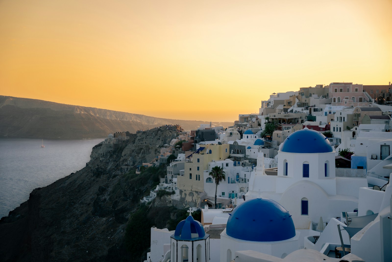
Here are three of the actual shots you’ll find inside the PDF — cinematic full-page references for the exact spots, lenses, and lighting conditions documented in the guide. The full guide includes 11 locations, each with a hero image, GPS map, settings table, and a five-shot list.

Oia Castle Ruins — Sunset Viewpoint — from the Santorini Photographer's GuideSave
Oia Castle Ruins — Sunset Viewpoint — sample reference photo from the Santorini Photographer’s Guide PDF

Before you shoot Santorini: the essentials

  • Free public access: All caldera-rim walking paths connecting Fira, Firostefani, Imerovigli, and Oia are free and open 24 hours. Oia Castle ruins are free. Three Bells of Fira viewpoint is free. Akrotiri Lighthouse exterior is free. Red Beach viewpoint is free (beach access officially discouraged due to rockfall). Amoudi Bay is free. Pyrgos village and Kasteli ruins are free. Megalochori village streets are free. Profitis Ilias summit road is free to drive or hike (monastery entry free Mon–Sat, closed Sundays for service but views are still accessible). Nea Kameni National Geological Park entrance fee is €5/adult; boat transport from Athinios Port additional cost (~€25–40/person via organized caldera tour).
  • Commercial permits: Personal and tourist photography in all public spaces is unrestricted. Drones require a permit from the Hellenic Civil Aviation Authority (HCAA) and are prohibited over Fira, Oia, and other populated areas without written authorization. Commercial photography assignments on public land require notification to the local municipality. Interiors of churches, monasteries, and the Akrotiri archaeological site prohibit flash photography and may restrict tripods; always ask staff before setting up.
  • Best photography seasons: April–June (wildflowers, clear atmospheric conditions, manageable crowds) and September–October (warm Aegean, golden autumn light, significantly fewer tourists than July–August peak)
  • Blue hour notes: Santorini sits at 36.4°N — the sun arc is higher and faster-moving than northern European destinations. Blue hour lasts 15–25 minutes after sunset. The caldera faces due west, so the entire rim from Oia south to Akrotiri receives symmetrical warm light as the sun drops into the Aegean. In summer, sunset ranges from 8:40–8:50 PM (June–July); in autumn, 7:00–7:30 PM (September). The whitewashed Cycladic architecture acts as a giant reflector, amplifying the warm-to-cool transition during blue hour in a way unique to the Greek islands.
  • Drone policy: Drone laws vary widely by country and city — many capital and tourist zones are no-fly. Verify the local civil aviation authority’s current rules before launching.
  • Local resource: Official visitor information

The full-resolution version of every map below — plus seasonal calendars, gear notes per location, sun-angle diagrams, and a complete photographer’s packing checklist — is inside the Santorini Photographer’s Guide PDF ($47).

1. Oia Castle Ruins — Sunset Viewpoint

Oia Castle is the single most reproduced Santorini image in photography. From the crumbling Venetian kastro walls, the view encompasses the full sweep of Amoudi Bay below, the volcanic caldera, the windmills, and the characteristic blue-domed churches of Oia silhouetted against the horizon. The geometry is almost impossible to compose badly — the foreground ruins frame the caldera, the middle-distance windmills provide a focal point, and the sun’s descent into the Aegean provides a spectacular light event every clear evening.

  • GPS: 36.4601, 25.3747
  • Elevation: 820 ft
  • Best time of day: last 45 minutes of golden hour through 20 minutes post-sunset blue hour — the sun drops directly into the Aegean over Amoudi Bay from this northwest-facing promontory, and the cave-house cliffs below glow in layered amber and pink
  • Sun direction: The castle sits at the northwestern tip of Oia. The sun sets to the northwest in summer (azimuth ~300–315°) and swings toward west-southwest (~245°) in winter, always dropping into open Aegean water from this vantage. The caldera and the whitewashed village of Oia extend to the south and east; the windmills to the northeast catch the last warm sidelight. Oia’s sun drops below the horizon without any obstruction — no headland, no hill — giving a clean ball-of-fire-into-sea event. The cliffs below the castle face west and southwest and light up in the last 20–30 minutes of sun as golden rays rake across the volcanic rock, deepening from ochre to deep burnt orange.
  • Access: Walk along the main pedestrian thoroughfare (Nomikou Street) in Oia toward the western end — the castle ruins are signposted. From the Oia bus terminus, allow 10–15 minutes on foot westward. Free public access 24 hours. No entry fee. Parking is extremely limited in Oia; visitors arriving by car should use the main Oia car park at the east entrance and walk (~20 min). Buses from Fira run frequently (KTEL line); journey ~25 minutes.
  • Difficulty: easy
  • Recommended settings: Golden Hour Caldera: f/8, 1/250 sec, ISO 100, 24–35mm  ·  Final Sunset Silhouette: f/16, 1/125 sec, ISO 100, 70mm (starburst of sun behind windmill)  ·  Blue Hour Long Exposure: f/11, 8 sec, ISO 100, 24mm, tripod  ·  Post Sunset Village Lights: f/8, 4 sec, ISO 200, 35mm, tripod

Shots to chase:

  • Classic wide-angle composition from the upper castle wall with the windmills in the right third and the sun descending into the Aegean over Amoudi Bay
  • Telephoto (100–200mm) isolating the windmill silhouette against the orange disk of the setting sun, compressing the distance and eliminating crowds from the frame
  • Low-angle shot from the castle wall using the rough volcanic stone as a textured foreground with the caldera arc extending behind
  • Blue-hour composition 15 minutes after sunset with the village cave-house lights switching on and the deep cobalt sky transitioning over the caldera
  • Starburst shot at f/16–f/22 with the sun partially hidden behind a windmill vane for a dramatic star effect at the moment of contact with the horizon

Pro tip: The morning before your sunset shoot, walk to the castle and identify which section of wall gives you the exact angle you want — many photographers miss the best positions by arriving late and taking whatever remains. The lower Oia steps (descending toward Amoudi Bay, accessible just south of the castle) give a nearly identical composition with far fewer people, particularly effective for a cleaner windmill-and-sea framing. Use a telephoto at sunset to compress the scene and fill the frame with the sun alongside architecture, eliminating the crowd-dense foreground.

Common mistake to avoid: Arriving 20–30 minutes before sunset and finding all wall positions taken, then being forced to photograph over standing crowds. Leaving immediately after the sun drops and missing the superior blue-hour window. Shooting wide-angle without a strong foreground element, producing a flat horizon-dominated image indistinguishable from hundreds of others. Setting up a tripod without securing it — Santorini’s caldera generates strong, gusting westerly winds that can topple unsecured equipment.

2. Three Bells of Fira — Caldera Viewpoint

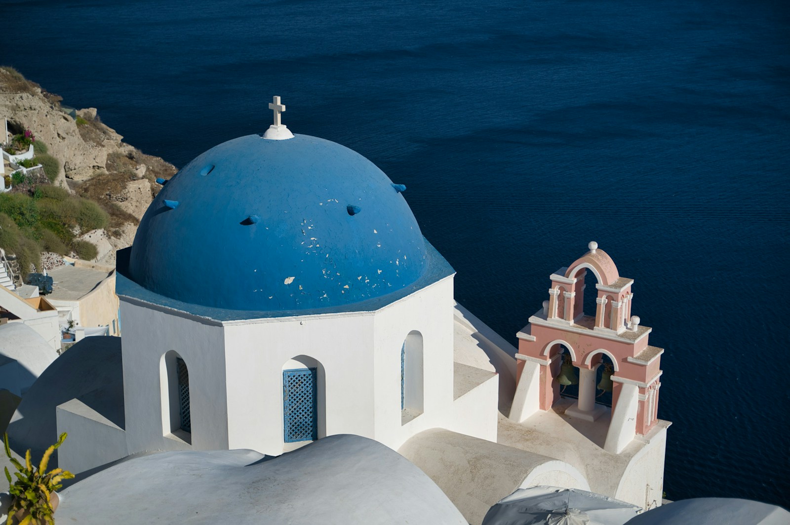
The Church of the Dormition of the Blessed Virgin Mary (locally the ‘Three Bells of Fira’) is one of the most reproduced images of the Greek islands. The composition of the white belfry’s three bells — stacked vertically — against the deep Aegean blue caldera, with the volcanic island of Nea Kameni visible in the middle distance and the island of Thirassia on the far horizon, is the quintessential Santorini postcard. Unlike Oia, the Three Bells viewpoint is accessible on foot from Fira without navigating the full village crowd circuit.

  • GPS: 36.4248, 25.4286
  • Elevation: 820 ft
  • Best time of day: morning (9:00–11:00 AM) for front-lit blue dome detail; sunset for the classic silhouette of the white belfry and dome against the burning caldera horizon
  • Sun direction: The Three Bells church faces west toward the caldera. From the road-level viewpoint above and behind the church (north side), the photographer looks west-southwest. Morning sun rises to the east and illuminates the front face of the dome and bells — ideal for color and detail. At sunset, the sun is behind and below the camera’s position, backlighting the dome and creating the iconic dark-silhouette-against-golden-sky postcard image. The classic Instagram composition is shot from this elevated road-side position looking downhill, with the blue dome in the lower frame and the caldera, Nea Kameni volcano, and Thirassia island filling the background.
  • Access: Located along the caldera walking path between Fira and Firostefani. From central Fira, walk north on Agiou Mina Street for approximately 10–15 minutes; the church appears on the right. The famous viewpoint is not the path-level facade — to get the postcard shot, follow signs up a short side path to the viewpoint behind and above the church, near the Santorini Palace Hotel parking area. Free, 24-hour access. Buses from Fira bus station to Oia pass the Firostefani area. If completing the Fira–Oia hike, you walk directly past the church.
  • Difficulty: easy
  • Recommended settings: Morning Dome Detail: f/8, 1/500 sec, ISO 100, 50mm  ·  Sunset Silhouette: f/11, 1/250 sec, ISO 100, 35mm  ·  Blue Hour Village Glow: f/8, 2 sec, ISO 400, 35mm, tripod  ·  Overcast Flat Light: f/8, 1/125 sec, ISO 200, 24mm

Shots to chase:

  • Classic wide-angle postcard shot from the roadside viewpoint behind the church: three stacked white bells in the lower third, blue dome slightly right of center, caldera and volcano filling the upper two-thirds
  • Vertical framing with the bell tower as a strong central vertical leading the eye from foreground to the caldera horizon
  • Telephoto compression (100–135mm) isolating the blue dome against the volcanic island of Nea Kameni in the background, eliminating the foreground clutter
  • Pre-dawn blue-hour long exposure with the dome lit by village ambient light against a deep indigo sky
  • Sun-star composition at f/16 with the setting sun peeking from behind the bell tower edge

Pro tip: The viewpoint that produces the famous image is not from the path level but from the higher road position behind and above the church — many visitors miss it entirely. Scout during the day: the path up to the viewpoint is near the Santorini Palace Hotel parking area and is clearly marked. Come in the morning for the best direct light on the dome’s blue paint; afternoon and sunset light produces a strong backlit silhouette which works beautifully but is compositionally different. In shoulder season, patience at the ledge bench below the viewpoint often rewards with a crowd-free gap for a clean shot.

Common mistake to avoid: Photographing only the path-level facade of the church, which shows an unremarkable cream-colored wall rather than the iconic blue dome and bells. Arriving at peak sunset without leaving enough time to find the elevated viewpoint. Shooting at midday when the overhead light flattens the dome’s curvature and the caldera loses depth. Confusing the Three Bells of Fira with the blue domes of Anastasi Church in Oia — they are different structures requiring different approaches.

3. Imerovigli — Skaros Rock

Skaros Rock is a unique compositional vantage in Santorini because it places the photographer inside the caldera, surrounded by water on three sides, with no buildings in the foreground. From the Theoskepasti Chapel at the base of the rock, the entire caldera arc — from the volcano in the south to Oia in the north — is visible in a single 180° sweep. The ruins of the Venetian Epano Kastro fortress on the rock’s crown add historical texture. This is the one viewpoint on Santorini that delivers a genuinely wild, architectural-free landscape composition.

  • GPS: 36.4379, 25.4245
  • Elevation: 820 ft
  • Best time of day: early morning at sunrise for low-crowd conditions and the sun rising behind the caldera from the east; late afternoon or early evening golden hour for the sun sweeping across the volcanic rock face in warm orange tones — sunset crowds here are far smaller than at Oia
  • Sun direction: Skaros Rock protrudes westward from Imerovigli into the caldera at approximately 250 m elevation. From the rock’s tip, the camera looks southwest, west, and northwest — capturing the caldera, the submerged volcanic crater, and on a clear day Thirassia island and the horizon. At sunrise, the sun rises behind the photographer (from the east over the Aegean), illuminating the rock’s reddish volcanic face and the caldera wall in warm front-light. At sunset, the sun descends to the northwest over open Aegean water, backlighting the scene from across the caldera — producing dramatic orange and red rim-lighting on the rock and the village above.
  • Access: Trail begins in Imerovigli village at the Agios Georgios Chapel (also signed from the Blue Note Restaurant). From the Grace Hotel pool terrace, descend the stone stairs — allow 45–60 minutes round trip to the chapel at the rock’s base. Alternatively, complete as a detour on the Fira–Oia hike (adds approximately 1 hour). Imerovigli is 5 minutes by car or ATV from Fira. Free, open all day. Wear sturdy footwear: the path involves approximately 280 steps down and back up, with some loose volcanic rock. The rock summit scramble is unofficial and considered risky due to unstable sections — not recommended.
  • Difficulty: moderate
  • Recommended settings: Sunrise Wide Caldera: f/11, 1/125 sec, ISO 100, 16–24mm  ·  Golden Hour Rock Texture: f/8, 1/250 sec, ISO 100, 35mm  ·  Telephoto Compression Oia: f/8, 1/500 sec, ISO 200, 200mm (Oia village in far distance with sun behind)  ·  Blue Hour Chapel: f/8, 4 sec, ISO 200, 24mm, tripod

Shots to chase:

  • From the Theoskepasti Chapel terrace at the base of the rock: wide-angle view with the tiny white chapel in the right foreground, caldera arc to the left, and open Aegean at center
  • Looking back up from the rock base toward Imerovigli: the village cave-houses stacked vertically up the caldera cliff with the sky behind
  • Telephoto (200mm) from the rock tip looking north toward Oia in the far distance with the afternoon light compressing the caldera into layers of water, cliff, and white village
  • Sunrise composition from the rock’s northern flank with the first light catching the red and black volcanic rock while the caldera remains in cool shadow
  • The Agios Georgios Chapel on the descent path at late afternoon: small white church with brilliant Aegean blue behind framed by the volcanic cliff walls

Pro tip: Go at sunrise rather than sunset to beat the growing number of photographers who have discovered Skaros as an Oia alternative. The trail from the Agios Georgios Chapel trailhead is well-signed; the path forks — left leads down the cliff side to Theoskepasti Chapel (the main scenic reward), right goes toward the rock summit scramble (not recommended without experience). The best photograph of Skaros itself is taken from the Imerovigli caldera path looking southwest — the entire rock formation is visible in profile against the caldera. Do not attempt at midday in summer: the exposed trail has no shade and temperatures can exceed 38°C on the volcanic rock surface.

Common mistake to avoid: Attempting the summit scramble without experience in loose-rock terrain — the Ministry of Culture warning sign at the base is real, and rockslides have occurred. Hiking at midday in peak summer when heat and sun exposure on the unshaded trail are extreme. Expecting to photograph the famous Santorini dome-and-sunset composition from here — Skaros Rock offers a raw, architectural-free caldera landscape, not the classic village-and-sunset image. Forgetting that all the elevation you lose on the descent must be regained on the return.

Want this in your pocket on the street?
The full-resolution version of every spot above — with full-page hero photography, GPS maps with gold location pins, sun direction diagrams, multi-season tables, and a complete safety + packing checklist — is inside the Santorini Ultimate Photographer’s Guide PDF ($47). Print it, save it offline, take it on the walk. Get the guide →

4. Fira Town — Caldera Rim Walk

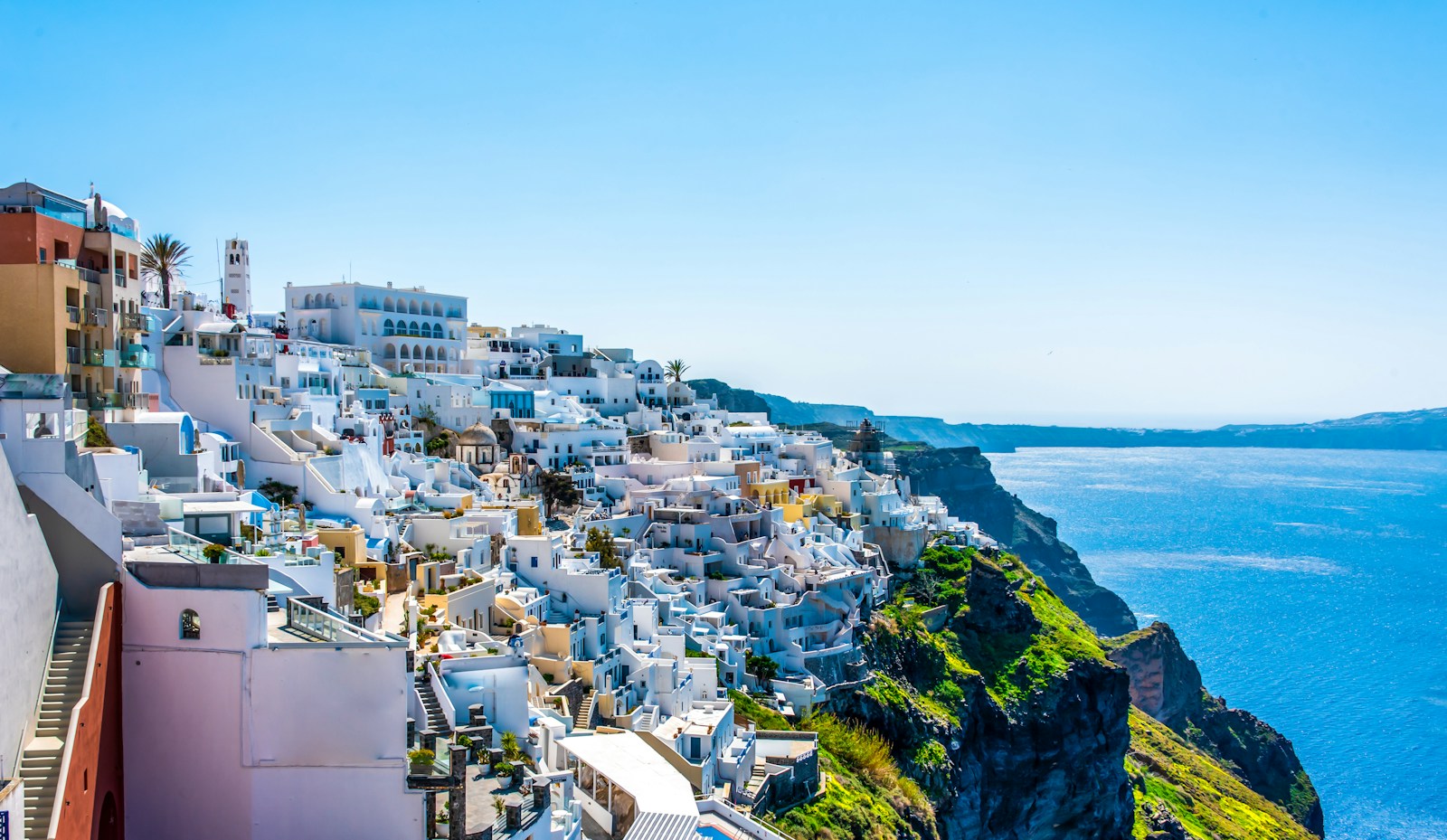
Fira’s caldera rim is one of the most densely photogenic stretches of cobblestone in the world — every 20 meters offers a new composition of white cubic architecture, cave-cut terraces, infinity pools, and the deep blue-black caldera. The rim walk is the starting point for the famous 10.5 km Fira-to-Oia hike. Unlike Oia, Fira has a lived-in capital energy — churches, local cafes, markets, and the Archaeological Museum of Thera — giving photographers architectural and street-photography subjects alongside landscape work. The cable car and the dramatic zigzag Karavolades path down to the old port are unique photogenic features found nowhere else on the island.

  • GPS: 36.42, 25.4317
  • Elevation: 820 ft
  • Best time of day: afternoon (1:00–5:00 PM) when the sun has moved off the eastern side and faces straight onto the caldera walls — the whitewashed buildings and caldera edge are in direct warm light; blue hour (20 minutes after sunset) for the village illumination against the cobalt caldera
  • Sun direction: Fira’s caldera edge faces west-southwest. Morning sun rises to the east and casts the caldera wall in deep shadow — avoid for caldera shots before noon. From approximately 1:00–2:00 PM, the sun crosses to the west side and begins directly illuminating the white facades and cave hotels that line the caldera edge. Golden hour light from the west sweeps across the whitewashed architecture and the volcanic cliff face below. Note: Fira is partially shaded by Skaros Rock in the final minutes of sunset, so the last golden-hour light at Fira is slightly shorter than at Imerovigli or Oia. Blue hour illumination from restaurant and hotel lighting along the caldera rim is spectacular.
  • Access: Fira is Santorini’s capital and main transport hub. Buses from Santorini Airport (JTR, 5 minutes) and Athinios Port (20 minutes). The caldera rim walk — Agiou Mina Street — is the main pedestrian path running north–south along the western edge of Fira from the cable car station to Firostefani. Completely free, open 24 hours. The old port (Fira Skala) is accessible via the cable car (€6 return) or the 588-step Karavolades path (free, donkeys also available). Cruise ship tenders dock at Fira’s old port.
  • Difficulty: easy
  • Recommended settings: Afternoon Facade Light: f/8, 1/500 sec, ISO 100, 35–50mm  ·  Blue Hour Village Panorama: f/11, 8 sec, ISO 100, 24mm, tripod  ·  Cable Car Architecture: f/8, 1/250 sec, ISO 100, 24mm  ·  Street Detail: f/4, 1/500 sec, ISO 200, 85mm

Shots to chase:

  • Long-exposure blue-hour panorama from the Agiou Mina Street path looking north toward Imerovigli, with cave-hotel terrace lights reflected on the caldera water far below
  • The Karavolades zigzag donkey path from above: wide-angle showing the 588 stone steps descending in switchbacks toward the old port and the caldera
  • Low-angle shot of a whitewashed alleyway in central Fira with blue shutters and bougainvillea leading toward a caldera-view gap between buildings
  • Cable car cabin in motion against the sheer caldera cliff — telephoto (100mm) from the Fira terrace above the cable car station
  • Sunset from the southern end of the caldera path near the Museum of Prehistoric Thera, looking toward the southern caldera where Fira’s gold-hour shadow falls later than at Oia

Pro tip: The caldera path in Fira is best photographed in the afternoon (1–5 PM) — morning light leaves the entire west-facing wall in deep shadow, producing flat, lifeless images of the architecture. Avoid the northern stretch of the path from noon to 2 PM when cruise-ship visitors crowd it densely. For street photography and architectural detail, the back streets of Fira east of the caldera rim are quieter and full of traditional blue-and-white subject matter. The old port area at blue hour — accessible via cable car — offers a completely different and underused perspective looking up at the cliff-face and the illuminated village above.

Common mistake to avoid: Visiting the caldera rim in the morning when the west-facing walls are in shadow and the light is poor for the architecture. Staying only on the main tourist strip and missing the quieter alleys behind, which offer more intimate and original compositions. Treating Fira only as a transit point rather than a photography destination in its own right. Underestimating how crowded the main path becomes between 10 AM–12 PM when cruise ships disgorge day-trippers.

5. Pyrgos Village — Kasteli Hilltop Panorama

Pyrgos Village — Kasteli Hilltop Panorama Santorini photography sampleSave
Pyrgos Village — Kasteli Hilltop Panorama — cinematic reference from the Santorini Photographer’s Guide PDF

Pyrgos is Santorini’s most intact medieval hilltop village and offers the only 360° view on the island from a settlement — visible from Oia in the north to the Akrotiri lighthouse in the south. The village is composed of the characteristic concentric ring layout of a Cycladic kastro, with mansions built as a defensive perimeter and narrow, fortified alleyways. Unlike the caldera towns, Pyrgos’s architecture includes earthier ochre, terracotta, and stone tones alongside white, giving warmer, more varied textures at golden hour. The absence of mass tourism infrastructure (no cable cars, no cruise-ship crowds) makes it ideal for unhurried architectural photography.

  • GPS: 36.3837, 25.4487
  • Elevation: 1,148 ft
  • Best time of day: last 90 minutes of golden hour through blue hour — Pyrgos is the highest village on Santorini, giving direct, unobstructed westward views from the Kasteli ruins; sunset crowd is minimal compared to Oia, and the 360° panorama at golden hour is one of the finest on the island
  • Sun direction: Pyrgos sits on the island’s central ridge at 350 m elevation, with the medieval castle ruins (Kasteli) at the summit. The view is genuinely 360°: west faces the caldera and sunset; east reveals the island’s agricultural lowlands and the Aegean beyond Kamari and Perissa beaches; north shows Fira and the caldera rim stretching toward Oia; south shows Cape Akrotiri and the lighthouse. At sunset, the sun descends into the Aegean to the west exactly as at Oia, but Pyrgos additionally captures the afterglow lighting up the eastern sea behind the photographer — a feature unique to this inland hilltop position.
  • Access: Pyrgos is located 8 km from Fira, approximately 15 minutes by car or ATV. Regular KTEL buses run from Fira to Pyrgos (route via Messaria). The village is walkable from the bus stop; the Kasteli castle ruins are at the topmost point of the village — follow narrow whitewashed alleys upward for 5–10 minutes. Free, open 24 hours. Parking on the village outskirts is limited but generally available. Multiple winery tasting rooms (Santo Wines, Estate Argyros, Hatzidakis) are nearby for combining photography with wine tours.
  • Difficulty: easy
  • Recommended settings: 360 Panorama Golden Hour: f/11, 1/250 sec, ISO 100, 16–24mm  ·  Village Alley Detail: f/5.6, 1/250 sec, ISO 200, 50mm  ·  Blue Hour Caldera From Kasteli: f/11, 6 sec, ISO 100, 24mm, tripod  ·  Church Bell Tower: f/8, 1/500 sec, ISO 100, 85mm

Shots to chase:

  • 360° panoramic series from the Kasteli summit at golden hour: caldera and windmills to the west, agricultural landscape and Kamari Bay to the east, Profitis Ilias peak to the southeast
  • Looking down into Pyrgos village from the Kasteli walls: concentric ring of whitewashed mansions spiraling down the hill in the warm golden-hour light
  • Narrow alleyway composition with stone steps and flowering bougainvillea leading toward a gap that frames the distant caldera
  • Blue-hour silhouette of the Kasteli ruins against the post-sunset western sky with the caldera visible below
  • Winery vineyard rows in the volcanic soil to the south of the village with Profitis Ilias in the background at midday for the contrast of lush green vines against black pumice earth

Pro tip: Arrive at Pyrgos 90 minutes before sunset to walk the village alleys in the warm sidelight before climbing to the Kasteli for the sunset event itself. The village is almost deserted compared to Oia or Fira at this time, making it possible to photograph the streets and churches without pedestrian interference. Several caldera-view restaurants and wine bars at the upper village (notably Kasteli Restaurant) offer terrace seats for sunset — these fill up in season, so book ahead. The village is at its photographic best in May and October when low-angle light rakes across the stone and white architecture throughout the afternoon.

Common mistake to avoid: Treating Pyrgos as only a sunset viewpoint and missing the extraordinary village-alley photography opportunities. Arriving without enough time to explore the medieval street layout before sunset. Driving to the very top of the village when parking is available lower down — the narrow stone streets are not navigable by car and the walk up is itself photogenic. Neglecting the view to the east: while the sunset is to the west, the eastern panorama of agricultural Santorini is equally striking and almost never photographed.

6. Akrotiri Lighthouse

Unlike all the caldera-rim villages, the Akrotiri Lighthouse delivers a minimalist seascape composition: white lighthouse tower, volcanic cliff edge, open Aegean horizon, and a sky that can shift from deep amber to purple-magenta at sunset. There are no whitewashed houses, no crowds, no cables or boats — just land, sea, and light. This makes it the go-to location for photographers who find the village viewpoints compositionally busy. The lighthouse structure itself (built 1892, still operational) is a beautiful, restrained Cycladic form that photographs well at any time of day.

  • GPS: 36.3577, 25.3597
  • Elevation: 230 ft
  • Best time of day: sunset — the lighthouse sits at the island’s southwestern tip with open Aegean on three sides, giving a direct sun-into-ocean event without any architectural obstruction; also excellent at sunrise for the lighthouse structure front-lit against the eastern sky
  • Sun direction: Akrotiri Lighthouse sits at the extreme southwest tip of Santorini, approximately 3 km from Akrotiri village, at the end of a narrow paved road. The structure faces south-southwest over open Aegean water toward the island of Christiani. At sunset, the sun descends to the northwest, directly toward and slightly left of the lighthouse when viewed from the road approach — the lighthouse sits in profile against the burning sky. The classic photograph is from the cliff staircase to the left (north side) of the lighthouse, where you stand on higher ground looking southwest and the lighthouse appears against the open sea horizon. Sunrise illuminates the east face of the lighthouse in warm front-light.
  • Access: Drive or ATV south from Akrotiri village (~10 minutes on paved road, ~3 km). Small parking area at road end. From parking, walk ~5 minutes to the lighthouse. To reach the elevated staircase viewpoint (classic composition), turn left from the main path and climb the stairs above the lighthouse — from here the lighthouse is below and in front of you against the sea. Free access, 24 hours. Minimal facilities; a seasonal snack kiosk operates near the parking area.
  • Difficulty: easy
  • Recommended settings: Sunset Lighthouse Silhouette: f/11, 1/125 sec, ISO 100, 35–50mm  ·  Golden Hour Wide Seascape: f/11, 1/250 sec, ISO 100, 16–24mm  ·  Blue Hour Ocean Reflection: f/11, 15 sec, ISO 100, 24mm, tripod  ·  Telephoto Sun Behind Tower: f/16, 1/250 sec, ISO 100, 100mm (starburst)

Shots to chase:

  • From the elevated staircase (turn left from the main path): lighthouse below against open sea at golden hour with the last light catching the white tower
  • Wide-angle seascape from the cliff edge with volcanic red rock in the foreground, lighthouse in the middle distance, and the open Aegean horizon beyond
  • Telephoto (100mm) with the setting sun positioned partially behind the lighthouse tower for a starburst effect at f/16–f/22
  • Long-exposure blue hour: smooth silky water below the cliffs, lighthouse glowing from its operational white light, deep blue twilight sky
  • Sunrise: lighthouse front-lit in warm gold against a pale dawn sky, calm sea reflecting the early light

Pro tip: The secret to avoiding the small but steady crowd is the elevated staircase viewpoint on the north side of the lighthouse — turn left and climb the stairs rather than following the main flat path. From the stairs, you look down at the lighthouse against the sea, achieving a cleaner composition without other visitors in the frame. The lighthouse is operational and flashes white every 10 seconds after dark — factor this into long-exposure planning for a light-trail effect. Very strong and unpredictable winds are common at this exposed tip; weight your tripod with a bag and keep a firm grip on equipment.

Common mistake to avoid: Taking the main flat path to the lighthouse front and finding a crowded standing-room-only situation — the staircase viewpoint to the left is less obvious but far superior. Arriving at the wrong time: morning light is flat and from behind; the lighthouse is best photographed in the late afternoon and sunset. Neglecting to stay for blue hour, when the lighthouse light activates against a darkening sky. Expecting caldera views from here — Akrotiri Lighthouse faces open Aegean water, not the caldera.

7. Red Beach — Kokkini Paralia

Red Beach is the most geologically dramatic landscape on Santorini. The 200-meter-tall volcanic cliff — composed of red, rust, ochre, and black basaltic rock — towers over a black-and-red pebble beach and clear turquoise water. The color contrast of the red cliffs against the deep blue Aegean is a completely different visual palette from the white-and-blue caldera villages, and represents one of the most unique beach compositions in the Mediterranean. The beach is also adjacent to the Bronze Age Akrotiri archaeological site, one of the best-preserved prehistoric cities in the world.

  • GPS: 36.3497, 25.4002
  • Elevation: 49 ft
  • Best time of day: late morning to midday when the sun is high enough to illuminate the red and black volcanic cliff faces in full; also early morning for softer light and minimal crowds — arrive before 9:00 AM before tour buses
  • Sun direction: Red Beach faces southwest. The beach and cliffs are flanked on the left (east) by the towering red volcanic bluff and on the right (west) by whitish rock. The sun must be high enough in the sky to illuminate the red cliff face before the colors appear saturated — arriving at first light in early morning produces muted colors because the east-facing cliff face is in its own shadow. By 10–11 AM, the sun clears the cliff top and the red color saturates dramatically. The beach faces southwest toward the Aegean; the most photogenic time for the red cliff color is from approximately 10 AM to 2 PM (sun overhead and slightly south). Late afternoon light rakes the cliff face from a lower angle, emphasizing its vertical striations.
  • Access: Located on Santorini’s southern coast, 12 km from Fira (~30 minutes by car) and 1.5 km from Akrotiri village. Drive to the Akrotiri archaeological site and use the parking above the beach, or use the separate Red Beach car park on the road from Akrotiri village. From the car park, a 5–10 minute rocky path leads down to the beach and viewpoint. Note: descent to the beach itself is officially discouraged due to ongoing rockfall risk from the unstable cliff face; the elevated viewpoint above the beach is safe and photographically excellent. Access also possible by boat from Perissa, Vlychada, or catamaran tours.
  • Difficulty: easy to moderate (rocky path to viewpoint; beach access involves loose volcanic rock)
  • Recommended settings: Cliff Color Saturation: f/8, 1/500 sec, ISO 100, 24mm, CPL filter to deepen blues and reds  ·  Beach And Water: f/11, 1/250 sec, ISO 100, 35mm  ·  Boat Approach Wide: f/8, 1/500 sec, ISO 100, 16mm  ·  Late Afternoon Cliff Texture: f/8, 1/250 sec, ISO 100, 85mm

Shots to chase:

  • Classic elevated viewpoint shot: red volcanic cliff filling the right two-thirds of the frame with deep turquoise water at the base and the sweeping arc of the beach below
  • Looking left along the cliff face: the vertical striations of red, ochre, and black volcanic layers revealed in raking afternoon light
  • From the viewpoint toward the beach: foreground volcanic boulders framing swimmers and sunbathers in the middle distance, cliff towering behind
  • From a catamaran at sea level looking up: the full height of the cliff is visible and the scale becomes overwhelming — extremely difficult to appreciate from land alone
  • Close-up detail of the volcanic rock texture at the viewpoint: abstract of reds, blacks, and ochres with no horizon reference

Pro tip: Use a circular polarizer filter to cut the sea glare and deepen the contrast between the red cliff and the turquoise water — this filter produces a dramatic result here that is immediately visible in the viewfinder. Arrive before 9 AM to beat tour groups, or visit after 4 PM when the afternoon light rakes the cliff face from a lower angle revealing its vertical geological structure. The viewpoint from the Akrotiri archaeological site parking area gives a slightly higher angle and is often less crowded than the main Red Beach path. Boat access (catamaran tour from Fira or Perissa) puts you at sea level looking up at the full cliff height — the most dramatic possible perspective.

Common mistake to avoid: Expecting a sandy beach — Red Beach has dark volcanic pebbles that are uncomfortable underfoot and get extremely hot in summer. Visiting only at high noon when the vertical sun flattens the cliff texture. Ignoring the rockfall risk signage and standing close to the base of the cliff. Forgetting a CPL filter and returning with washed-out, glare-heavy sea shots that fail to capture the color contrast.

Want this in your pocket on the street?
The full-resolution version of every spot above — with full-page hero photography, GPS maps with gold location pins, sun direction diagrams, multi-season tables, and a complete safety + packing checklist — is inside the Santorini Ultimate Photographer’s Guide PDF ($47). Print it, save it offline, take it on the walk. Get the guide →

8. Amoudi Bay

Amoudi Bay is the only location in Santorini where a photographer looks up at the island from the sea — a completely inverted perspective relative to all the caldera-rim viewpoints. The brightly colored wooden fishing boats in the bay’s harbor provide vivid foreground color against the dramatic geological scale of the 300-meter volcanic cliff face. At sunset, the reflection of the golden sky across the bay’s sheltered water, combined with the silhouette of Oia’s windmills above, creates one of the most complete and layered compositions on the island.

  • GPS: 36.4603, 25.3707
  • Elevation: 10 ft
  • Best time of day: golden hour and sunset — from the bay, the camera looks up at the Oia cliffs illuminated in warm amber from the west; also beautiful early morning when the fishing boats are active and the cliffs above Oia reflect the eastern light
  • Sun direction: Amoudi Bay is directly below Oia on the western (caldera) side, at sea level. The photographer at the bay looks northeast and east up at the sheer volcanic cliff face with Oia’s cave-houses perched above. At sunset, the sun descends to the northwest directly above and behind the camera position, illuminating the cliff face and Oia’s whitewashed buildings in warm light while the bay’s water reflects the golden sky. The caldera behind the photographer (to the west) turns deep cobalt and then violet. The classic Amoudi Bay composition is looking northeast from the fishing-boat pier: wooden boats in the foreground, volcanic cliff in the middle, Oia visible at the summit, and the burning sky above.
  • Access: Amoudi Bay is accessible via the 300-step path (Karavolades-style stone stairs) descending from below Oia Castle — the path entrance is just south of the castle viewpoint. Allow 15–20 minutes descent, 25–30 minutes back up. Alternatively, drive around the outside of the caldera to the bay (follow road signs from Oia toward ‘Ammoudi’). Small parking area at the bay that fills quickly in summer. Swimming is possible from the rocky shoreline below the tavernas. Boat tours and small excursions depart from the tiny pier.
  • Difficulty: moderate (300 steep stone steps; the return ascent is taxing in summer heat)
  • Recommended settings: Sunset Boat Reflection: f/8, 1/250 sec, ISO 100, 24–35mm  ·  Golden Hour Cliff Face: f/8, 1/500 sec, ISO 100, 35mm  ·  Blue Hour Lights Reflected: f/11, 4 sec, ISO 200, 35mm, tripod  ·  Wide Bay Panorama: f/11, 1/250 sec, ISO 100, 16mm

Shots to chase:

  • From the pier at golden hour looking northeast: brightly painted wooden fishing boats in the foreground, volcanic cliff with cave-house hotels stacked vertically, Oia windmills silhouetted at the top
  • Long-exposure reflection at blue hour with the bay surface acting as a mirror for the amber and violet sky above
  • Telephoto (100–200mm) from the bay looking straight up at Oia’s buildings on the cliff edge — extreme vertical compression revealing the impossible stacking of architecture on volcanic rock
  • Swimming vantage from the rock platform beside the tavernas: camera at water level looking up at the cliff wall with the sea in the immediate foreground
  • Pre-dawn fishing boat activity: the taverna lights are still on, the boats are being prepared, and the eastern sky is beginning to lighten behind the cliff

Pro tip: The descent via the 300-step path from below Oia Castle takes you past some of the best compositions — pause and shoot looking back up toward the castle as you descend. The return climb is demanding in summer heat; start early or wait until the cool of evening to ascend. The rocky jumping platform beside the tavernas is a popular local activity (dive from 8–12 m into deep water) and can provide a dynamic human-interest foreground element. Several caldera-view tavernas offer fresh seafood at tables right on the water — a base for photographing the bay at leisure over a meal.

Common mistake to avoid: Descending to the bay at midday and attempting the return climb in peak summer heat — the 300 steps back up are brutal above 30°C. Arriving without the return climb in mind and being trapped at the bay as sunset crowds above make the path congested. Shooting only from the pier and missing the view from the rocky shoreline north of the tavernas, which gives a different angle on both the cliff and the bay entrance. Underestimating the water-entry points for swimming — the shore is entirely rocky, with no sand.

9. Megalochori Village

Megalochori Village Santorini photography sampleSave
Megalochori Village — cinematic reference from the Santorini Photographer’s Guide PDF

Megalochori is one of the least-visited and most authentically preserved traditional villages on Santorini. Unlike the heavily touristed caldera towns, it retains a genuine lived-in character — locals at kafeneions, winery caves cut into the volcanic earth, laundry on lines, bougainvillea arching over whitewashed walls. The three-tier bell tower in the central square is architecturally unique on the island: it serves as a physical gateway arch above the main square entrance, and its shadow patterns at morning light are a well-known photography subject. The village was historically a center of Santorini’s wine production, and several underground cave-wine-press chambers (yposkafa) can be photographed with permission.

  • GPS: 36.3727, 25.4372
  • Elevation: 590 ft
  • Best time of day: morning (8:00–10:00 AM) for dramatic shadow play on the bell tower and empty streets; late afternoon (4:00 PM onward) when the village awakens and bougainvillea-draped whitewashed walls light up in warm sidelight; also at sunset for the quiet hilltop atmosphere
  • Sun direction: Megalochori is an inland hilltop village oriented around its central square and prominent bell tower. The bell tower faces east-northeast. Morning sun from the east illuminates the bell tower’s face and produces the famous shadow patterns on the white walls as the tower’s three tiers cast elongated geometric shadows onto the square and adjacent alleys. By afternoon, the sun shifts west and the bougainvillea-draped facades on the western side of the village light up in warm, saturated pink-magenta against white plaster. Unlike caldera towns, Megalochori does not have direct sunset views to the west, but the village itself glows beautifully in the last hour of sidelight.
  • Access: Megalochori is located in the southern-central part of Santorini, approximately 6 km from Fira and 7 km from Perissa beach. Accessible by car, ATV, or KTEL bus (Fira–Akrotiri line). The village center and bell tower are signposted from the main road. Free access, 24 hours. Multiple wineries and wine caves (yposkafa) are accessible within the village. Paid parking available near the village entrance.
  • Difficulty: easy
  • Recommended settings: Morning Shadow Play: f/8, 1/500 sec, ISO 100, 50mm  ·  Bougainvillea Wall Detail: f/4, 1/500 sec, ISO 100, 85mm  ·  Bell Tower Wide: f/8, 1/500 sec, ISO 100, 24mm  ·  Narrow Alley Sidelight: f/5.6, 1/250 sec, ISO 200, 50mm

Shots to chase:

  • Bell tower at sunrise: the tower’s three tiers casting elongated geometric shadows across the white plaster of the central square — pure chiaroscuro composition
  • The bell tower framing its arch: standing beneath the arch looking through toward the square, the tower forms a natural frame for village life
  • Narrow alley with bright pink bougainvillea arching overhead against a stark white wall, leading toward a domed church at the end
  • Close-up detail of bougainvillea petals against whitewashed plaster, bokeh background, strong Cycladic color palette of magenta-pink on pure white
  • A wine cave (yposkafa) interior: vaulted volcanic-rock ceiling, barrels, and natural light entering through the doorway — a uniquely Santorinian architectural type almost absent from photography

Pro tip: The bell tower shadow photography is best between 7:30–9:30 AM in summer and 8:30–10:30 AM in spring/autumn, before the sun rises too high to cast elongated shadows. Visit in the shoulder season (April–June, September–October) when the village remains almost entirely touristically undiscovered, and the atmosphere is genuinely that of a working Greek village. Ask at one of the wineries — most are family-run — for permission to photograph inside the wine caves; they are almost always willing and these spaces are architecturally extraordinary. Combine with a visit to Pyrgos village (3 km north) for a full day of traditional-village photography away from the caldera.

Common mistake to avoid: Visiting only at midday when flat overhead light flattens the bell tower’s texture and the alleys lose their shadow-contrast. Rushing through on the way to Red Beach and missing the back alleys, wine caves, and church interiors that are the real photographic reward. Expecting a caldera view — Megalochori faces slightly inland and east; it is a village-texture and architectural-photography destination, not a caldera-panorama location.

10. Profitis Ilias — Summit Panorama

Profitis Ilias is the highest point on Santorini and the only location from which the entire island can be seen at once — both the caldera (normally invisible from the east-side beaches) and the Aegean to the east are simultaneously visible. The Monastery of the Prophet Elias — founded 1711, with a remarkable ecclesiastical museum containing Byzantine icons and manuscripts — adds an architectural and cultural dimension to the photography beyond the landscape. On exceptionally clear days (typically October–May), the islands of Ios, Sikinos, Folegandros, and even Crete’s White Mountains are visible from the summit.

  • GPS: 36.3693, 25.4561
  • Elevation: 1,860 ft
  • Best time of day: early morning at or after sunrise for the clearest atmospheric visibility and an island-wide panorama before sea haze builds; also golden hour when the long low-angle light creates dramatic shadow relief across the island’s topography
  • Sun direction: Profitis Ilias is the highest peak on Santorini at 567 m (1,860 ft), located in the southeast of the island near Pyrgos. From the summit, the view is unobstructed in all 360 directions: to the west lies the entire caldera including Oia, Imerovigli, Fira, and the submerged volcanic crater; to the east are the agricultural plains of Exo Gonia, Kamari, and Perissa beaches and the open Aegean; to the south is Cape Akrotiri and the lighthouse; to the north, the full island arc toward the caldera narrows. Morning sun rises to the east-northeast and immediately backlights the caldera view to the west — the summit is front-lit in the afternoon and at sunset the caldera scene to the west is in direct golden-hour light.
  • Access: From Pyrgos village, a paved serpentine road leads up the mountain to the Profitis Ilias Monastery and the summit (~3–4 km, driveable or by ATV). Alternatively, a marked 2.5 km hiking trail departs from Pyrgos main square. Free access to summit and surroundings. The Profitis Ilias Monastery (established 1711) is open daily 9 AM to sunset, closed Sundays for services but the summit ground is still accessible. No vehicle charge. Cell towers and a military installation are present at the summit; the panoramic view is still unobstructed.
  • Difficulty: easy (by car/ATV) to moderate (hiking the 2.5 km trail from Pyrgos)
  • Recommended settings: Island Panorama Clear Day: f/11, 1/500 sec, ISO 100, 16–24mm  ·  Monastery Architecture: f/8, 1/500 sec, ISO 100, 35mm  ·  Telephoto Caldera Overview: f/8, 1/500 sec, ISO 200, 100–200mm  ·  Golden Hour Wide: f/11, 1/250 sec, ISO 100, 16mm

Shots to chase:

  • Full 360° composite panorama from the summit road: north to south the entire island arc from Oia caldera to Cape Akrotiri, with both the Aegean and the caldera water visible simultaneously
  • Telephoto (100–200mm) compression looking west across the caldera from 567 m elevation — the caldera wall appears as layered ribbons of white villages stacked above black cliffs
  • The monastery whitewashed bell tower framed against the island panorama below — unique combination of architecture and aerial landscape
  • Early morning mist photography: sea fog sometimes pools in the eastern lowlands of Santorini (October–April), and from the summit you look down onto a white-fog floor covering the lower island while the caldera remains clear above
  • Star photography at night: at 567 m with no nearby light pollution sources, Profitis Ilias offers the island’s best Milky Way conditions on clear nights

Pro tip: The road from Pyrgos is entirely paved and suitable for a small car; the ATV version of this road is a popular morning activity. Arrive at or just after sunrise for the clearest skies before afternoon sea haze develops; in summer, a warm-air haze layer often sits at 200–300 m and reduces visibility from the summit from about 10 AM onward. The monastery museum is worth photographing internally (ask permission, no flash) — the Byzantine icons, embroidered vestments, and carved wooden iconostasis are extraordinary. Night photography of the Milky Way from the summit requires scheduling around new moon phases and avoiding July–August when summer haze significantly reduces star visibility.

Common mistake to avoid: Visiting at midday when summer haze has thickened and visibility is at its daily minimum. Arriving expecting to see the caldera from the east side — the summit view to the west is dramatic but the caldera floor is 567 m below and the geometry is different from the close-range cliff-edge views in the villages. Rushing the summit visit in 15 minutes without exploring the monastery grounds and peripheral viewpoints that open up different compositions.

11. Nea Kameni — Volcano Crater Hike

Nea Kameni is the only place on Santorini where you stand on live volcanic rock inside an active caldera — it is a national geological park and one of the most geologically significant accessible sites in Europe. The landscape is entirely alien: black and brick-red basaltic lava flows, yellow sulfur-stained fumarole vents still emitting gas, and an ochre crater bowl sitting in the center of a submerged super-volcano. From the crater rim, the 360° view of the surrounding caldera wall — with the white villages of Fira, Oia, and Imerovigli stacked above the black cliffs — is the inverse of the usual tourist perspective and entirely unlike any photograph taken from the caldera rim itself.

  • GPS: 36.4042, 25.3953
  • Elevation: 426 ft
  • Best time of day: morning departure (boats typically leave from Athinios Port or Fira’s old port at 9:00–10:00 AM) — arrive on the island by mid-morning for best light on the volcanic rock; avoid midday heat which is extreme on the exposed black lava crater
  • Sun direction: Nea Kameni is the active volcanic island at the center of the Santorini caldera, formed by eruptions over the last 3,500 years with the most recent activity in 1950. The island sits at approximately 36.4°N, 25.4°E in the middle of the flooded caldera. From the crater rim, the camera looks outward in all directions toward the surrounding caldera walls — Fira and Imerovigli are visible to the east, Oia to the north, Thirassia to the northwest. The volcanic landscape itself — black and rust-red lava rock, sulfuric vents, ochre mineral staining — photographs best in slightly overcast or hazy light when the contrast is reduced; on brilliantly clear days, the black rock becomes very dark and requires careful exposure. The best compositional light is in the morning before the sun goes overhead.
  • Access: Nea Kameni is accessible only by boat. Organized day-trip boats depart multiple times daily from Athinios Port (main port below Fira) and from Fira’s old port (Fira Skala). Most caldera boat tours (catamaran, traditional wooden caique, speedboat) include a Nea Kameni stop. Entrance fee to the National Geological Park: €5/adult. Allow 45–60 minutes on the island for the volcano hike. The trail to the crater rim is well-marked and approximately 1 km one-way with ~130 m elevation gain on loose volcanic rock. No shade on trail. Boat transfer time from Fira old port: 30 minutes each way.
  • Difficulty: moderate (loose volcanic rock, exposed terrain, significant heat on the dark lava surface)
  • Recommended settings: Volcanic Texture Detail: f/8, 1/500 sec, ISO 100, 85mm  ·  Crater Wide: f/11, 1/500 sec, ISO 100, 16–24mm  ·  Caldera Panorama From Crater: f/11, 1/500 sec, ISO 100, 24mm  ·  Sulfur Vent Close: f/5.6, 1/250 sec, ISO 200, 50mm (close focus on mineral color)

Shots to chase:

  • Wide-angle from the crater rim looking outward: the ancient dark lava in the foreground with Fira and the white caldera-wall villages visible as a white ribbon along the far rim — the inside-the-caldera perspective
  • Close-up abstract of sulfuric mineral deposits at the fumaroles: vivid yellow, orange, and white mineral crystals on black volcanic rock — a macro composition unique to active volcanic geology
  • Telephoto (100–200mm) looking across the caldera at Fira from the crater rim — the same village visible from a completely different direction and altitude than any land-based viewpoint
  • The marked hiking trail on the crater’s flank: a line of hikers ascending black volcanic rubble against a blue-sky background conveys the extraordinary scale
  • Boat approach at sea level: the stark volcanic island emerging from the caldera water with the caldera cliff and Oia visible in the background — a ‘layers of geology’ composition

Pro tip: Wear closed-toe shoes with grip — the loose lava scree is unpredictable underfoot and open sandals result in volcanic grit injuries. Bring significantly more water than you expect to need; the black volcanic surface absorbs and radiates heat intensely, and temperatures on the crater trail can be 8–12°C higher than in the villages. The €5 geological park entrance fee is collected at the island landing stage. Do not remove volcanic rocks — this is a protected geological site and fines apply. The most interesting photographic subject on the island is the intersection of geology and tourism: the trail, the sulfur vents, and the ring of caldera villages visible above create a uniquely layered image that no viewpoint on the rim can replicate.

Common mistake to avoid: Visiting at midday in peak summer without adequate water — the exposed black lava creates a furnace-like microclimate and heat exhaustion risk is real. Treating the island as just a transit point to the nearby hot springs and spending only 15 minutes ashore — the volcano crater itself deserves the full 45–60 minutes. Expecting lush landscape photography — the island is entirely barren volcanic rock with minimal color variation, and its photography value is in texture, scale, and the caldera panorama rather than color photography. Do not collect volcanic rocks as souvenirs; rangers actively enforce this.

When to photograph Santorini: a year-round breakdown

Santorini is photogenic every month of the year — but the conditions differ radically by season. Here is what to expect:

April–June (wildflowers, clear atmospheric conditions, manageable crowds) and September–October (warm Aegean, golden autumn light, significantly fewer tourists than July–August peak)

Photographer safety in Santorini: read this

City photography has its own risks: gear visibility, neighborhood timing, traffic, weather. Read the briefing before you go.

  • Gear visibility: Use a discreet bag with no obvious camera branding. Keep a body strapped under a jacket on transit.
  • Neighborhood timing: Pre-dawn and post-sunset shoots reward early scouting. Cross-reference each location with current local guidance and choose well-lit transit routes.
  • Situational awareness: Headphones out. One eye in the viewfinder, one on the street.
  • Traffic: Bridges, medians, and bike lanes are not setup zones. Shoot from sidewalks and pedestrian areas only.
  • Weather: Summer storms move quickly; winter cold drains batteries. Layer up, keep gear dry, watch for ice on cobblestones at blue hour.

The complete safety briefing is inside the Santorini Photographer’s Guide PDF.

Take this guide into the city

This post is the complete field reference. The Santorini Ultimate Photographer’s Guide PDF is the field-deployable version: full-page resolution hero photography, GPS maps with gold pins for every location, multi-season shooting calendars, gear notes per location, sun-angle diagrams, the full city safety briefing, and a print-ready editorial layout in Framehaus black and gold. Save it offline. Print it. Take it on the walk.

Santorini Ultimate Photographer’s Guide
Downloadable PDF · 11 GPS-mapped locations · Multi-season calendar · City safety briefing · Packing checklist

Get the Santorini guide — $47

Combo Deal

Get the Santorini Guide + Preset Pack

Photograph it. Edit it. Done.

$66
$54
Save $12
PDF Guide Every spot, GPS, golden hour
Preset Pack 20 Lightroom presets
Book your tours & experiences in Santorini

All links go to Viator (a TripAdvisor company), the world’s largest marketplace for guided experiences. Tagged as affiliate per FTC.

Also on Amazon: gear that helps with this technique

Quick Amazon shortcuts to the gear most useful for this kind of shot. Use them if Prime shipping or Amazon credit makes more sense than B&H. As an Amazon Associate ShutYourAperture earns from qualifying purchases.

Take Santorini home in your pocket.

Every shot location, every angle, every time of day worth shooting. Printable PDF + GPS-tagged map.

Instant download. Works on phone, tablet, and printed.

Continue reading

← Back to International Cities Photography Guides

Related guides nearby

Three more photography guides within striking distance — perfect for combining into one trip.

  • Athens 229 km away · city · Unknown
  • Istanbul 599 km away · city · Turkey
  • Cappadocia 861 km away · city · Unknown

Browse all 78 guides → · Open the map