Best Photography Spots in Atlanta: 12 Locations With GPS
shutyouraperture-20). Buying through these links costs you nothing extra and helps fund our free guides.
Atlanta, Georgia is one of the most photogenic cities in the United States. If you have a camera and the patience to show up before dawn, Atlanta will give you images that last a career — but only if you know where and when to point it.
This is the definitive field guide to the 12 best photography spots in Atlanta, with GPS coordinates you can drop straight into Google Maps, exact camera settings tuned to Atlanta’s unique light, precise timing for every location, and the access notes nobody else bothers to document. It mirrors the intel inside our Atlanta Ultimate Photographer’s Guide ($47 PDF) — a downloadable field guide with full-page hero images, GPS maps, seasonal tables, a city safety briefing, and a complete photographer’s packing list. Get the guide →
Planning multi-city travel? See also: U.S. cities photography hub and the National Parks Photography Guides.
12 GPS-mapped locations · Exact camera settings · Multi-season shooting calendar · Free annual updates
Download the PDF guide →
Get the Atlanta Ultimate Photographer’s Guide
Every location below — pre-mapped with GPS, golden-hour timing, gear recommendations, cultural rules, and a 14-day itinerary. Downloaded by 200+ working photographers.
Quick jump to the 12 spots
- Jackson Street Bridge — Skyline Overlook
- The Roof at Ponce City Market — Skyline Park
- Piedmont Park — Skyline Picture Point & Lake Clara Meer
- Centennial Olympic Park — Fountain of Rings
- Krog Street Tunnel — Street Art Gallery
- Fox Theatre — Peachtree Street Marquee
- Georgia State Capitol — Gold Dome Exterior
- Atlanta BeltLine Eastside Trail — Freedom Parkway Mural Underpass
- Stone Mountain — Summit Walk-Up Trail
- Martin Luther King Jr. National Historical Park — Eternal Flame & Freedom Hall
- Oakland Cemetery — Victorian Garden Cemetery
- SkyView Atlanta — Observation Ferris Wheel
A look inside the Atlanta Photographer’s Guide
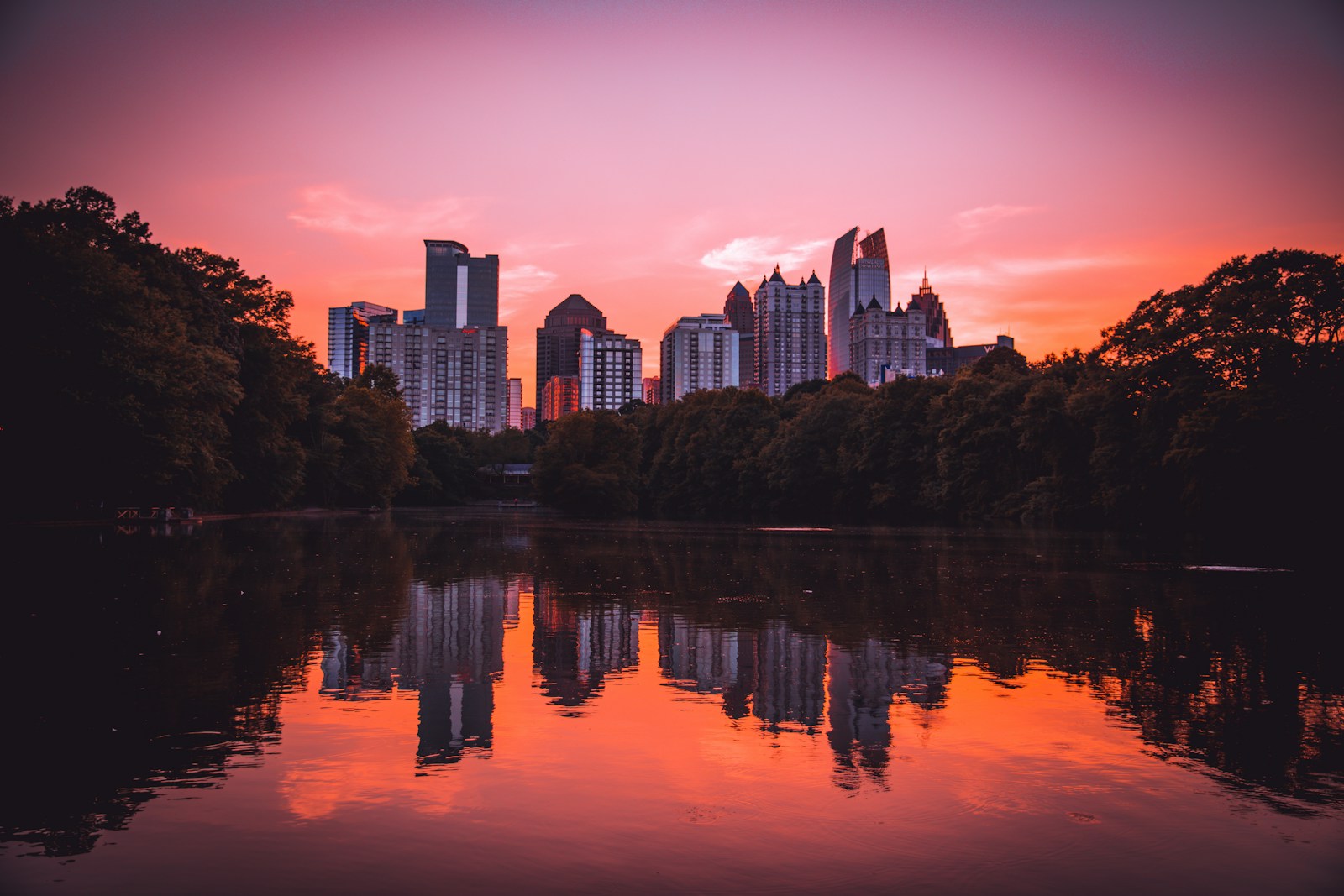
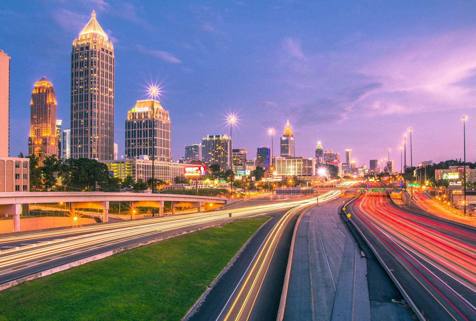
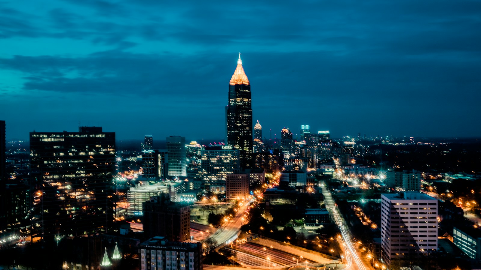
Here are three of the actual shots you’ll find inside the PDF — cinematic full-page references for the exact spots, lenses, and lighting conditions documented in the guide. The full guide includes 12 locations, each with a hero image, GPS map, settings table, and a five-shot list.
Save
Before you shoot Atlanta: the essentials
- Free public access: Jackson Street Bridge, Krog Street Tunnel, all Atlanta BeltLine Eastside Trail mural walls, Piedmont Park including Lake Clara Meer, Centennial Olympic Park grounds and Fountain of Rings viewing, Georgia State Capitol exterior, MLK National Historical Park exterior and grounds (all NPS areas free), and Oakland Cemetery grounds are free to photograph 24/7 or during open hours. The BeltLine Eastside Trail is publicly accessible dawn to midnight.
- Commercial permits: Commercial photography on Atlanta BeltLine property requires a permit if using 2+ cameras, stationary lighting, or boom mics; apply at least 10 business days in advance via beltline.org/press/filming-photography-request/. City of Atlanta parks including Piedmont Park require a Mayor’s Office of Film and Entertainment permit for commercial shoots; apply via atl311.com. Stone Mountain Park requires written approval and charges location fees for commercial photography; submit at least 10 days prior via stonemountainpark.com/press-room/filming/. Oakland Cemetery commercial photography and filming must be approved by the Cemetery Sexton in advance. NPS sites (MLK National Historical Park): under the EXPLORE Act (signed January 4, 2025), permits are NOT required for still photography involving 8 or fewer individuals using hand-carried equipment in public areas without exclusive site use. Fox Theatre exterior (public sidewalk on Peachtree Street): no permit required for non-commercial photography; interior requires house permission. The Roof at Ponce City Market: paid admission required ($20 adults); no separate photography permit for personal use.
- Best photography seasons: Fall (mid-October–November) for golden and crimson canopy framing the skyline from Piedmont Park and Stone Mountain, with low humidity and clear skies ideal for long-distance views; Spring (late March–April) for flowering dogwoods and azaleas at Oakland Cemetery and Piedmont Park, dramatic stormy-sky sunsets over the midtown skyline, and BeltLine crowds just thin enough for clean mural shots; Summer (June–August) for long golden hours — Atlanta’s 33.7° N latitude yields 9 PM civil twilight in June — and lush green canopy giving the ‘city in a forest’ look; Winter (December–February) for bare-tree skyline views from Piedmont Park lake, atmospheric morning fog in the valleys below Jackson Street Bridge, and the Fox Theatre marquee glowing against cold deep-blue holiday skies
- Blue hour notes: Atlanta’s blue hour is especially powerful from elevated vantage points that reveal the city’s forest-within-a-skyline identity. From Jackson Street Bridge 20–25 minutes after sunset, the I-75/85 Connector freeway streams with red and white light trails beneath a cobalt sky while the illuminated glass towers of Midtown and Downtown glow with warm LEDs — the window typically lasts 20–30 minutes. Centennial Olympic Park transforms at the 9 PM fountain show: the Fountain of Rings’ 251 jets illuminate in synchronized color while the SkyView wheel blazes with LED patterns against the transitioning sky. From Piedmont Park’s Skyline Picture Point at blue hour, the mid-rise Midtown skyline reflects in Lake Clara Meer with near-perfect mirror symmetry. Blue hour in Atlanta arrives approximately 20–35 minutes after sunset year-round, with summer’s extended twilight giving photographers an exceptionally long blue-hour window (often 30–35 minutes).
- Drone policy: Most major U.S. cities restrict drone flight in airspace and via local ordinances. Check FAA + city rules before launching.
- Local resource: Official visitor information
The full-resolution version of every map below — plus seasonal calendars, gear notes per location, sun-angle diagrams, and a complete photographer’s packing checklist — is inside the Atlanta Photographer’s Guide PDF ($47).
1. Jackson Street Bridge — Skyline Overlook
Jackson Street Bridge is Atlanta’s most iconic photography vantage point: a free, publicly accessible bridge where the I-75/85 Connector freeway’s eight lanes converge as leading lines directly into the heart of the skyline, compressing the Bank of America Plaza, Westin Peachtree Plaza, and the full Midtown-Downtown tower cluster into a single frame. Recognized globally as the opening-credits view of AMC’s The Walking Dead, the bridge delivers the city’s most dramatic intersection of urban infrastructure and glass-and-steel skyline — especially at blue hour when the freeway’s red and white light trails pulse beneath the illuminated towers.
- GPS: 33.7601, -84.3743
- Elevation: 1,070 ft
- Best time of day: Golden hour (1 hour before sunset) and blue hour (20–30 minutes post-sunset); sunrise for fog over the freeway canyon; night for light trails
- Sun direction: The bridge runs roughly east–west with the primary skyline shooting angle facing west-northwest (approx. 280–310°). At sunset (azimuth 240–290° depending on season), the sun descends behind and to the right of the skyline cluster from April through August, creating warm front-lighting on the glass towers — ideal in the hour before sunset. In late autumn and winter (October–February), the low sun sets more southwesterly (azimuth ~240°), side-lighting the Bank of America Plaza’s triangular crown and casting long golden rakes across tower facades. At sunrise, shooting toward the east is possible from the opposite (east) side of the bridge, but the canonical west-facing skyline shot is backlit at sunrise — best for silhouette-style compositions with glowing morning sky behind the towers. The freeway runs NNW-SSE, so both sides of the bridge frame the I-75/85 lanes converging symmetrically toward the horizon.
- Access: Jackson Street NE at the intersection with Freedom Parkway, Atlanta, GA 30312. The bridge is a public road with wide sidewalks on both sides — free 24/7 pedestrian access. Street parking available on Jackson Street NE and Cain Street NE; arrive 30–45 minutes early at peak sunset times as space fills quickly on weekends. No MARTA station walking distance; nearest is King Memorial (~0.8 mile south). No permit required for personal photography; commercial shoots require City of Atlanta Mayor’s Office of Film and Entertainment permit.
- Difficulty: Easy — flat sidewalk on both sides of the bridge; active road traffic immediately adjacent so stay on sidewalk and watch for vibrations from passing trucks that can blur tripod shots
- Recommended settings: Blue Hour Light Trails: aperture: f/11, shutter: 20s, iso: 100, lens: 16–35mm at 24mm, notes: Set up tripod on the west-facing sidewalk centered on the freeway converging lines. Use 20-second exposure during moderate-to-heavy traffic for full red/white trail streaks. Cable release or 2-second timer mandatory — heavy truck vibration will blur shorter exposures. Bracket ±1 EV to handle bright tower illumination vs. dark freeway canyon. · Golden Hour Skyline: aperture: f/8, shutter: 1/125s, iso: 200, lens: 24–70mm at 50mm, notes: Shoot 30–60 minutes before sunset for warm golden light on tower facades. Keep ISO low for shadow detail in the freeway cuts below. A 0.6 GND filter balances the bright sky against the darker freeway canyon. · Sunrise Fog: aperture: f/8, shutter: 1/30s, iso: 400, lens: 70–200mm at 135mm, notes: After cold nights or morning rain, fog pools in the I-75/85 cut below the bridge; telephoto compression makes towers appear to float above a white sea. Works best in October–March. A tripod is essential; arrive 30 minutes before sunrise for the blue-to-gold transition. · Night Long Exposure: aperture: f/16, shutter: 30s, iso: 100, lens: 16–24mm, notes: After 9–10 PM traffic thins; wait for a traffic-light cycle to green on the adjacent Freedom Parkway to send a full burst of headlights through the frame. At f/16 with 30 seconds, tower windows create clean starburst patterns.
Shots to chase:
- Classic Walking Dead frame: from the west-facing sidewalk centered above the freeway median, capture the Bank of America Plaza crown rising above the symmetrical stream of light trails at 20-second exposure — the definitive Atlanta image
- Fog-shrouded skyline: on cold autumn mornings when ground fog fills the I-75/85 canyon, telephoto-compress the towers appearing to float above a white mist layer — otherworldly and rarely photographed
- Silhouette skyline sunrise: from the east-facing side of the bridge at dawn, expose for the golden sky behind the backlit tower cluster creating bold graphic silhouettes framed by the freeway ramps
- Stormy sky drama: pre-frontal storm light in spring or summer creates violet-orange skies behind the towers; a 0.9 GND filter holds the turbulent sky while the illuminated towers pop below
- Symmetry and compression: use a 70–200mm at 200mm from the bridge center to compress the freeway lanes into a narrow converging strip with the Bank of America Plaza’s lit crown as a perfectly centered capstone
Pro tip: Arrive at least 30 minutes before sunset on weekdays and 45 minutes on weekends to claim the prime west-facing sidewalk position — the bridge draws a consistent crowd of photographers and the optimal center spot fills fast. Watch for the street light at the top of the adjacent road turning green to send a rush of headlights for light trails. Shoot on both sides of the bridge: the east-facing view toward the morning sun reveals the freeway on-ramps and a dramatically different, underused composition.
Common mistake to avoid: Shooting only at the expected ‘golden hour’ and leaving before blue hour, which is typically 30–40% more dramatic due to illuminated towers against the cobalt sky. Setting shutter speed too short (under 5 seconds) to capture full light trail arcs — 15–30 seconds is needed for the complete red/white streak pattern. Ignoring bridge vibration: large trucks cause measurable shake; pause shots while trucks cross and use Image Stabilization OFF on tripod.
2. The Roof at Ponce City Market — Skyline Park
The Roof at Ponce City Market is Atlanta’s highest publicly accessible commercial rooftop and one of only three viewpoints in the metro where Buckhead, Midtown, AND Downtown skylines are simultaneously visible in a single 180° panoramic arc — all from a lively amusement-park setting atop Atlanta’s largest adaptive reuse project, the 2.1-million-square-foot former Sears distribution complex. The juxtaposition of the neon-lit vintage carnival (Ferris wheel gondola, SkyLift ride, mini golf) against the illuminated glass skyline is found nowhere else in the American South.
- GPS: 33.7726, -84.3664
- Elevation: 1,150 ft
- Best time of day: Golden hour (2–3 hours before sunset through sunset); blue hour for illuminated skyline; late afternoon for all three skyline zones in one frame
- Sun direction: The rooftop faces west-southwest toward the Midtown and Downtown skylines. The sun sets nearly directly behind the skyline cluster from late March through late September, creating dramatic backlit silhouettes at sunset and warm golden side-lighting 1–2 hours before sunset. In summer, the setting sun (azimuth ~280–300°) falls between the Midtown cluster and the Buckhead towers to the north, creating a golden gap perfect for sun-flare compositions. In winter (azimuth ~240°), the low sun descends to the right (south) of the skyline, side-lighting 191 Peachtree and the Westin cylinder. At blue hour, the rooftop’s vintage-carnival atmosphere — neon signs, the SkyLift ride, mini golf — contrasts with the dark cobalt sky and illuminated towers in a uniquely Atlanta-in-the-round composition.
- Access: 675 Ponce De Leon Avenue NE, Atlanta, GA 30308 (Old Fourth Ward). Paid admission to Skyline Park: $20 adults, $12 children (ages 4–12), free under 3. Hours: Mon–Thu 3 PM–10 PM; Fri 3 PM–midnight; Sat 11 AM–midnight; Sun 11 AM–9 PM. Ticket booth in east courtyard near orange Roof sign. Paid parking in attached PCM garage ($2–$3/hour; first 30 min free). MARTA Bus 2 (Ponce de Leon) stops directly in front. The BeltLine Eastside Trail passes immediately alongside the building.
- Difficulty: Easy — elevator access to the rooftop; flat walking surface throughout; ADA accessible
- Recommended settings: Golden Hour Skyline Panorama: aperture: f/8, shutter: 1/200s, iso: 200, lens: 16–35mm at 16mm, notes: Shoot from the south-facing railing 60–30 minutes before sunset for warm light on all three skyline segments. Use a wide 16mm to capture the full 180° arc from Buckhead (left/north) through Midtown (center) to Downtown (right/south). A polarizer deepens the blue sky and cuts haze. · Blue Hour Neon City: aperture: f/8, shutter: 4s, iso: 400, lens: 24–70mm, notes: Set up 15–25 minutes after sunset. The rooftop’s neon and LED carnival lights activate, mixing with the cobalt sky and lit towers — use 4-second exposure on a tripod to balance both ambient elements. Frame the SkyLift ride or Ferris wheel gondola in the foreground against the skyline. · Environmental Portrait: aperture: f/2.8, shutter: 1/500s, iso: 800, lens: 35mm or 50mm, notes: Photograph visitors at the edge railing with the skyline as bokeh backdrop. Post-sunset with ISO 800 allows natural ambient mix without flash overpowering the skyline glow. · Night Beltline Overview: aperture: f/11, shutter: 15s, iso: 200, lens: 24–70mm at 35mm, notes: From the east-facing rail, look down onto the BeltLine trail below — at night the trail’s string lights and foot traffic create a winding line of movement through the lit Old Fourth Ward warehouse district.
Shots to chase:
- Triple skyline panorama: from the southwest corner of the roof, use a 16mm lens to capture Buckhead towers (left), Midtown cluster (center), and Downtown highrises (right) in one 180° horizontal sweep — the only freely accessible viewpoint in the city showing all three districts simultaneously
- Neon-carnival vs. skyline juxtaposition: place the rooftop’s SkyLift ride or mini-golf course in the foreground at blue hour with the illuminated Midtown skyline filling the background — a uniquely Atlanta image that fuses the city’s playful hospitality culture with its architectural ambition
- Beltline from above: lean over the east railing to photograph the linear BeltLine trail below, lit by trail lights and moving cyclists, with the converted PCM brick warehouse cascading to street level — an industrial-heritage-meets-green-corridor composition
- Rain-soaked rooftop reflection: after rain, the wet tiled surface of the roof reflects both the neon signs and the skyline in fragmented puddle mirrors — get low with a 24mm for an abstract foreground-to-skyline sweep
- Sunset silhouette on the SkyLift: time the slow-moving SkyLift gondola against the sunset as it swings riders into the air — shoot at 1/1000s to freeze the gondola with the orange sky behind
Pro tip: Arrive at opening time (3 PM weekdays, 11 AM weekends) to secure the southwest-facing railing spot before afternoon crowds arrive. The rooftop does not allow personal tripods after 5 PM due to crowd density — arrive before 4 PM or use a Joby GorillaPod on the railing. The laser light show activates after dark and creates interesting light-painting opportunities but also washes out long-exposure skyline shots; plan blue-hour shooting before the show begins. The north-facing rail shows the best Buckhead view; the south rail frames Downtown most cleanly.
Common mistake to avoid: Shooting only from the most crowded center section, missing the less-trafficked north rail where Buckhead towers rise unobstructed on the horizon. Forgetting that admission closes 30 minutes before listed closing time — plan to arrive well before that window. Using flash at night, which flattens the ambient city-glow that makes the scene magical.
3. Piedmont Park — Skyline Picture Point & Lake Clara Meer
Piedmont Park’s Skyline Picture Point and Lake Clara Meer offer Atlanta’s signature nature-meets-skyline composition: the Midtown tower cluster (including the 41-story Symphony Tower) rises above a foreground of weeping willows, dogwoods, and the still-water lake surface, creating an image that simultaneously communicates Atlanta as ‘the city in a forest’ and a serious American metropolis. As the city’s central park (211 acres, comparable to Central Park in urban function), it hosts the BeltLine’s northern anchor and remains the most versatile photography location in Atlanta for wedding, engagement, landscape, and architectural photography.
- GPS: 33.7851, -84.376
- Elevation: 1,030 ft
- Best time of day: Sunrise and early golden hour for still-water reflections; late afternoon golden hour for warm light on tower facades; blue hour for city-glow reflections in the lake
- Sun direction: The Skyline Picture Point faces southwest toward the Midtown skyline cluster (azimuth roughly 210–240°). At sunrise (from the east), the towers are backlit — ideal for silhouette and golden sky compositions from the east bank of Lake Clara Meer. As the sun moves to the southeast in late morning, the glass curtain walls of 1180 Peachtree (Symphony Tower) and surrounding Midtown highrises catch specular reflections, brightening dramatically. The best window for reflected-light on the towers combined with warm atmospheric haze is typically 7–9 AM in summer. The Clara Meer Dock faces west, making it an excellent sunset and blue-hour platform. In late May–early June, the sun sets almost due west, allowing a direct sunset-between-towers composition from the west edge of the meadow. Calm wind is essential for lake reflections; early mornings (before 8 AM) are reliably calmer.
- Access: 400 Park Drive NE, Atlanta, GA 30306 (Piedmont Park main entrance near Park Tavern). The park is publicly accessible daily 6 AM–11 PM at no charge. Multiple parking options: Piedmont Park SAGE deck (1320 Monroe Drive NE, paid); Park Tavern lot (1016 Monroe Drive NE, paid on weekends). MARTA N1/S1 rail to Arts Center Station, then 0.7-mile walk or BeltLine Eastside Trail access. Tripods permitted on all public park grounds; commercial photography requires a City of Atlanta Mayor’s Office of Film and Entertainment permit.
- Difficulty: Easy — flat paved paths throughout; ADA-accessible routes to lake and Skyline Picture Point
- Recommended settings: Sunrise Lake Reflection: aperture: f/11, shutter: 1/15s, iso: 200, lens: 24–70mm at 35mm, notes: From the Clara Meer Dock or east shoreline 20 minutes before sunrise, low angles (6 inches above the water surface) capture the fullest reflection of the tower silhouettes in still water. Tripod mandatory. Bracket 3 frames ±1 EV to blend sky and reflection in post. · Golden Hour Meadow: aperture: f/8, shutter: 1/250s, iso: 200, lens: 70–200mm at 135mm, notes: From the meadow near Park Tavern, telephoto-compress the skyline rising behind the tree canopy 30–60 minutes before sunset. Autumn is best when the canopy turns gold-orange, tripling the color complexity of the scene. · Blue Hour City Glow: aperture: f/8, shutter: 8s, iso: 400, lens: 24–70mm at 28mm, notes: From the Skyline Picture Point 15–25 minutes post-sunset, the Midtown towers illuminate individually in blues, whites, and warm yellows while the sky holds its final gradient. An 8-second exposure on a tripod captures both sky gradient and reflected glow on the lake. · Overcast Moody: aperture: f/5.6, shutter: 1/125s, iso: 400, lens: 16–35mm, notes: On overcast days, shoot in black-and-white or desaturate in post. The diffuse light eliminates harsh shadows on the park’s ancient oaks and reveals texture in the Spanish moss and stone staircases near the Picnic Shelters.
Shots to chase:
- Lake Clara Meer mirror: from the east bank or dock at pre-dawn calm, achieve a perfectly symmetrical reflection of the Midtown skyline in the lake — split the frame 50/50 at the waterline for maximum impact
- Autumn canopy frame: in mid-October, position yourself at the Active Oval or Oak Hill with the golden-red tree canopy framing all four sides while the tower cluster anchors the center — Atlanta’s quintessential ‘city in a forest’ image
- Clara Meer Gazebo detail: include the park’s white Victorian gazebo (mid-lake) as mid-ground anchor with the skyline behind and willow reflections below — a triptych of architectural eras in a single frame
- Stone staircase by the bandstand: shoot from the top of the ivy-covered stone stairs (pre-1906 infrastructure) looking through the arch of oak branches toward the skyline — a timeless composition mixing the pastoral and the modern
- BeltLine entry at Piedmont: from the BeltLine trail entrance at 10th Street and Monroe Drive, capture the moment the trail disappears into the park tunnel mural — an urban-to-green transition shot
Pro tip: The Skyline Picture Point (GPS 33.785, -84.376, directly in front of the Park Tavern meadow) is confirmed as the park’s best skyline-lake reflection spot by Piedmont Park’s own top-10 photo guide. Visit any weekday before 7:30 AM to have the meadow and dock almost entirely to yourself; weekend mornings after 8 AM fill with joggers and dog walkers. Spring brings the park’s most photographed moments: dogwoods bloom in late March and azaleas follow in April, creating pink-and-white canopies over the stone staircases that frame the skyline above.
Common mistake to avoid: Arriving too late in the morning when wind picks up and destroys lake reflections — the calm reflection window is typically 5:30–8:00 AM. Shooting exclusively from the Skyline Picture Point and missing the Clara Meer Dock (to the west), which provides a different angle where the lake foreground is wider and the sky fills more of the frame. Standing and shooting at eye level rather than getting as low as 12–18 inches above the water surface for maximum reflection inclusion.
4. Centennial Olympic Park — Fountain of Rings
Centennial Olympic Park is Atlanta’s most kinetically photogenic public space — a 21-acre legacy of the 1996 Summer Games where the world’s largest interactive fountain (251 jets in the Olympic Rings pattern) puts water, light, and color in motion four times daily. At the 9 PM show, the fountain’s LED illumination cycles through full-spectrum color to synchronized music while the SkyView Ferris wheel’s own LED display adds a second animated light source against the night sky — creating a uniquely Atlanta scene where Olympic heritage meets 21st-century light art in a single public frame.
- GPS: 33.7604, -84.3932
- Elevation: 1,010 ft
- Best time of day: Night (9 PM fountain show with colored LED illumination); blue hour for SkyView Ferris wheel and fountain combined; midday for interactive fountain splashing with people
- Sun direction: Centennial Olympic Park is oriented roughly north–south. The Fountain of Rings (Olympic Ring configuration) faces roughly west toward CNN Center and State Farm Arena. At golden hour, direct warm light from the west-southwest falls on the fountain’s water jets, creating rainbow prisms within the spray — best from the east side of the fountain looking west into the setting sun from mid-April through September. At blue hour (20–30 minutes post-sunset), the fountain’s integrated LEDs activate during the evening shows, cycling through colors synchronized to music. The surrounding Hermes Towers of Centennial Plaza illuminate at night, providing additional foreground architecture with the Downtown skyline backdrop to the south. The SkyView Atlanta Ferris wheel (to the northwest) becomes its own illuminated subject against the night sky.
- Access: 265 Park Avenue NW (Yelp/street address) / 285 Andrew Young International Blvd NW (official address), Atlanta, GA 30313. The park is free and publicly accessible daily 7 AM–10 PM (hours may vary by season and events). Free public access to all grounds and Fountain of Rings viewing. MARTA Dome/GWCC/State Farm Arena/CNN Center Station is adjacent (Red/Gold lines). Multiple paid parking decks on Marietta Street and Centennial Olympic Park Drive. No permit required for personal photography; commercial productions must contact the GWCCA.
- Difficulty: Easy — flat, paved park grounds; fully ADA accessible; highly family-friendly
- Recommended settings: Night Fountain Show: aperture: f/11, shutter: 15s, iso: 200, lens: 16–35mm at 20mm, notes: Set up on a tripod at the south or east edge of the fountain during the 9 PM show. A 15-second exposure blends the water into silky white plumes while the LED colors streak across the frame. Include the Hermes Towers and/or SkyView wheel in the background. · Blue Hour Wide: aperture: f/8, shutter: 6s, iso: 400, lens: 16–35mm at 16mm, notes: 20 minutes post-sunset, include the SkyView wheel (northwest), the fountain, and the CNN Center tower (south) in one ultra-wide frame. The cobalt sky acts as a unifying tonal background for the multiple colored light sources. · Midday Action Fountain: aperture: f/8, shutter: 1/2000s, iso: 200, lens: 70–200mm at 135mm, notes: During fountain shows (12:30, 3:30, 6:30 PM), telephoto-compress children running through the jets for high-speed frozen-water drops with colorful clothing. Best in strong summer sun for rainbow prisms in the spray. · Olympic Rings Overhead: aperture: f/11, shutter: 1/250s, iso: 100, lens: 16–24mm (or drone if permitted), notes: The Olympic Ring layout of the 251 jets is best seen from directly above. From nearby elevated parking deck levels or via drone (with proper FAA authorization and park permission), the full ring geometry becomes an icon-within-icon image.
Shots to chase:
- 9 PM fountain light show long exposure: from the south side of the fountain, use 15-second exposure to blend the silky water plumes with the fountain’s colored LED spectrum cycling through red-to-blue-to-green in a single frame
- Olympic rings symmetry at dusk: position directly in front of the fountain’s ring configuration at blue hour and use a wide lens to capture all five rings in perspective, framed by the 8 illuminated Hermes Towers receding to a vanishing point
- Children in the interactive fountain: during the day shows, freeze-frame with 1/2000s a child running through a jet burst — the rainbow refraction in the water spray and the joy of the moment make for universally resonant images
- SkyView wheel time-lapse composite: set up south of the wheel at blue hour and use multiple 30-second exposures to capture several rotations of the LED display — stack in post for a starburst/mandala pattern of light
- Park at dawn with no crowds: arrive at 7 AM to photograph the fountain plaza in mirror silence — no jets active but the ring formation on the ground and the surrounding tower skyline provide a graphically clean architectural study
Pro tip: The 9 PM fountain show is the most dramatic of the four daily shows (12:30, 3:30, 6:30, 9 PM) because it coincides with full darkness and the LED colors are fully saturated against the night sky — plan your visit around it. Stand on the south side of the fountain facing north for compositions that include the fountain in the foreground AND the SkyView wheel in the background simultaneously. Check the park’s events calendar: major events block photography access and change the park’s character entirely.
Common mistake to avoid: Shooting the fountain at the wrong time — the water is always running but the LED show only plays at the four scheduled times. Missing the 9 PM show, which is by far the most photogenic. Setting shutter speed too fast (above 1/250s) during shows and losing the silky water blur that makes long-exposure fountain shots distinctive.
Want this in your pocket on the street?
The full-resolution version of every spot above — with full-page hero photography, GPS maps with gold location pins, sun direction diagrams, multi-season tables, and a complete safety + packing checklist — is inside the Atlanta Ultimate Photographer’s Guide PDF ($47). Print it, save it offline, take it on the walk. Get the guide →
5. Krog Street Tunnel — Street Art Gallery
Save
Krog Street Tunnel is Atlanta’s most celebrated and continuously evolving outdoor gallery — every square inch of the 120-foot tunnel, from ground to the curved railroad arch ceiling, is covered in an ever-changing palimpsest of graffiti, street art, murals, and paste-up works that has been building since the 1960s. As the busiest pedestrian connection between Inman Park and Cabbagetown, the tunnel sits at the cultural heart of Atlanta’s arts community, making it simultaneously an art installation, an urban infrastructure artifact, and a social commons where new work appears literally overnight. No two visits yield the same images.
- GPS: 33.7524, -84.3634
- Elevation: 990 ft
- Best time of day: Early Sunday morning (minimal foot traffic and car interruptions); overcast days for even diffuse light; after rain for puddle reflections of the murals
- Sun direction: The Krog Street Tunnel runs northeast–southwest beneath the CSX railroad tracks, built in 1912. Natural daylight enters from both tunnel mouths (northeast and southwest openings), creating strong backlit silhouette conditions at both ends during morning and afternoon respectively. Midday direct sun illuminates approximately the first 15 feet inside each opening with harsh shafts; the interior center relies entirely on ambient bounce light from the painted walls. On overcast days, the indirect diffuse light from the sky portals provides even, color-accurate rendering of the murals throughout. The northeast end (Inman Park side) is best lit by morning light; the southwest end (Cabbagetown side) is best lit by afternoon light. The graffiti art wraps from ground to ceiling — low-angle compositions maximize the immersive surrounding-art feel.
- Access: 1 Krog Street NE, Atlanta, GA 30316 (at the intersection of Krog Street NE and Dekalb Avenue NE). The tunnel is a public road and pedestrian/bike thoroughfare — free 24/7 access. Wide sidewalks on both sides of the vehicle lane. Street parking on Krog Street NE and Dekalb Avenue NE (free street parking available). Adjacent to Krog Street Market and the Atlanta BeltLine Eastside Trail. No permit required for personal photography. Commercial photography requires Atlanta BeltLine permit if using the adjacent trail.
- Difficulty: Easy — flat walk-through; be aware of vehicle traffic through the one-lane tunnel section; low light in the interior requires a tripod or fast lens
- Recommended settings: Interior Long Exposure: aperture: f/5.6, shutter: 2s, iso: 800, lens: 16–35mm at 16mm, notes: From ground level (get the camera 6–12 inches off the ground) looking down the tunnel length, use 2-second exposure to capture both the art in full color and ghost any pedestrians walking through. A tripod is mandatory in the low-light interior. Shoot during a lull between vehicles for vibration-free captures. · Detail Mural: aperture: f/4, shutter: 1/60s, iso: 1600, lens: 35mm or 50mm, notes: For tight detail shots of individual pieces, use 35mm or 50mm wide open at f/4 to separate the subject layer from the layered background murals behind. ISO 1600 is usable in the interior with modern mirrorless sensors. · Puddle Reflection: aperture: f/8, shutter: 1/60s, iso: 1600, lens: 16–24mm, notes: After rain, puddles on the tunnel floor reflect the arch of colorful murals above — place the camera 2 inches from the puddle surface and shoot with the mural reflection filling the bottom half and the actual arched ceiling filling the top half. · Light Ray Portal: aperture: f/11, shutter: 1/250s, iso: 400, lens: 16–35mm, notes: At tunnel entry on overcast days, position a subject (or self-timer silhouette) in the tunnel mouth portal — the diffuse light creates a perfectly exposed rectangle of sky behind a silhouetted figure surrounded by vivid graffiti.
Shots to chase:
- Floor-level tunnel vista: lay the camera 4 inches off the ground looking down the full tunnel length — the converging walls, arching roof, and receding corridor of layered art create a powerful central-perspective composition
- Post-rain puddle mirror: after rainfall, the puddle reflections on the uneven floor surface create kaleidoscopic doubles of the art above, turning the ground into a second gallery
- Portal silhouette: position a subject framed in the bright tunnel-mouth opening with the dark art-covered interior as background — the halo of natural light around the figure against the explosion of color is iconic
- Detail of layered history: use a macro or 85mm lens to photograph the archaeological layers of paint visible at low angles — decades of work visible in the stratified edges of overlapping pieces
- Bike passing with motion blur: 1/15s exposure during moderate light captures a cyclist passing through as a kinetic blur against the static mural walls — the contrast between movement and stillness captures the tunnel’s living-gallery energy
Pro tip: Sunday mornings between 6 and 9 AM are consistently the best time: the recent overnight art additions are fresh, the light from the east portal is at its best angle, and vehicle traffic is minimal enough to allow long exposures without vibration. After a rainstorm is the single most productive visit — the puddle reflections and the way rain saturates the painted surface intensify the colors dramatically. Bring a wide-angle (16mm) and a macro or 85mm prime to cover both the full tunnel sweep and the intricate detail layers.
Common mistake to avoid: Shooting only at eye level and missing the entire lower and upper register of the tunnel art — the ceiling arch and floor-level work contain some of the most elaborate pieces. Visiting at peak daytime hours (noon–6 PM on weekends) when foot traffic makes clean long-exposure interior shots impossible. Using on-camera flash, which creates flat, washed-out results on the textured painted concrete — ambient light shooting with high ISO yields far more character.
6. Fox Theatre — Peachtree Street Marquee
The Fox Theatre (1929) is Atlanta’s most beloved architectural landmark and one of the finest surviving examples of Moorish-Egyptian movie palace design in America. Its 4,665-seat auditorium is enclosed in a fantastical facade of minarets, battlements, onion domes, and elaborate terra cotta ornament that reads as a purely cinematic object on the otherwise modernist Peachtree Street corridor. The large vertical marquee sign — blazing red against the night sky — has appeared in more Atlanta photography, film, and music imagery than any other single architectural element in the city, functioning as a universal shorthand for Atlanta’s character: theatrical, Southern, historically rooted, and proudly eccentric.
- GPS: 33.7725, -84.3856
- Elevation: 1,040 ft
- Best time of day: Blue hour (20–40 minutes after sunset) for marquee glow against deep cobalt sky; night for full neon impact; overcast dusk for diffuse even light on the moorish facade
- Sun direction: The Fox Theatre’s main Peachtree Street facade faces west-northwest (approximately 290°). At sunset from late March through September, the setting sun falls nearly directly on the front facade from the west, creating dramatic warm front-lighting on the 1929 Moorish-Egyptian terra cotta and brick facade details and the iconic large vertical marquee sign. The narrow Peachtree Street canyon (~80 ft wide) means the sun’s angle rapidly shifts from illumination to shadow as it drops below the western building line — the sweet spot for raking facade light is 45–90 minutes before sunset. At blue hour, the theater’s vertical marquee sign glows in brilliant red and white against the cobalt sky, and the ornate minaret towers and Moorish arch details illuminate from embedded theater lighting — creating one of Atlanta’s most distinctive architectural night-photography subjects. Winter evenings (November–January) are best for combining early darkness (blue hour at ~6:30 PM) with the marquee’s warm glow.
- Access: 660 Peachtree Street NE, Atlanta, GA 30308 (corner of Peachtree Street and Ponce de Leon Avenue, Midtown). The Peachtree Street sidewalk is publicly accessible 24/7 for exterior photography at no charge. MARTA N4/S4 rail: North Avenue Station (0.3 mile walk south on Peachtree Street). Street parking on Ponce de Leon and adjacent streets; paid garages on West Peachtree Street. No permit required for non-commercial exterior sidewalk photography. Show nights provide the most illuminated marquee displays; check foxtheatre.org for upcoming performances.
- Difficulty: Easy — flat city sidewalk; best shot from directly across Peachtree Street or from the intersection with Ponce de Leon Avenue
- Recommended settings: Blue Hour Marquee: aperture: f/8, shutter: 4s, iso: 200, lens: 24–70mm at 35mm, notes: From the west sidewalk of Peachtree Street directly across from the theater, use 4-second exposure 20 minutes after sunset. Include car light trails on Peachtree Street as leading lines toward the marquee. A tripod is mandatory. The blue sky window lasts 15–25 minutes — bracket multiple exposures. · Golden Hour Facade Detail: aperture: f/11, shutter: 1/250s, iso: 100, lens: 70–200mm at 135mm, notes: 45 minutes before sunset, use a telephoto to isolate the Moorish minaret towers, the ornate terra cotta band detailing, and the carved Arabic-style friezes — this angle reveals the architectural complexity that wide shots obscure. · Night Full Facade: aperture: f/11, shutter: 8s, iso: 200, lens: 16–35mm at 20mm, notes: Full facade wide shot at night from across Peachtree Street captures the vertical marquee, the full minaret skyline, and the illuminated archway entrance. Include Peachtree Street with trailing car lights for urban energy. · Marquee Close Up: aperture: f/5.6, shutter: 1/60s, iso: 800, lens: 70–200mm at 200mm, notes: Isolate the Fox’s large illuminated vertical sign and the show title lettering on the marquee panels against the sky — a tight graphic image that works well as a standalone frame. Shoot at blue hour for the best sky-to-neon color contrast.
Shots to chase:
- Blue hour marquee vs. cobalt sky: from the west sidewalk across Peachtree Street, capture the blazing red marquee sign against the 20-minutes-post-sunset cobalt sky with 4-second car light trails leading the eye directly to the theater entrance
- Moorish facade detail study: use a 200mm telephoto at golden hour to isolate individual architectural elements — the terra cotta minaret finials, the geometric Arabic-pattern friezes, and the arched entrance portal — building a series of detail shots that reveal the building’s theatrical complexity
- Reflection in neighboring glass tower: from the north end of the Fox’s frontage, the theater’s illuminated facade reflects in the glass curtain wall of the adjacent modern office building, creating a temporal juxtaposition of 1929 and 2024 Atlanta
- Pre-show crowd and marquee: 30 minutes before a performance, the entrance plaza fills with theatregoers in formal dress beneath the blazing marquee — a wide environmental portrait of Atlanta cultural life
- Winter night with fog: on cold, foggy winter evenings, the marquee and facade lighting creates a halo of colored light in the atmospheric moisture — a cinematic frame that feels like a 1940s movie premiere scene
Pro tip: Check the Fox Theatre performance calendar (foxtheatre.org) before visiting — on show nights the marquee displays the current production title in large letters and the entrance is bathed in additional event lighting that transforms the facade beyond its standard nighttime appearance. The absolute best position is from the west sidewalk of Peachtree Street, approximately 80 feet south of the Ponce de Leon intersection, which provides a slight upward angle on the marquee and captures the full facade in one frame without including neighboring buildings. Wet Peachtree Street after rain creates reflections of the illuminated marquee on the pavement — shooting from low angle during the reflection window is worth waiting for.
Common mistake to avoid: Standing too close (directly on the theater’s east sidewalk) and losing the full facade width in the frame — cross Peachtree Street for the proper working distance. Shooting only the marquee and missing the extraordinary Moorish minaret skyline visible above it. Underexposing for the bright marquee signs and losing the surrounding facade detail — expose for the mid-tone facade and let the marquee blow out slightly for a natural night-photography result.
7. Georgia State Capitol — Gold Dome Exterior
The Georgia State Capitol (1889, designed by Willoughby Edbrooke) is Atlanta’s most historically charged architectural landmark: a National Historic Landmark whose copper dome was gilded in 1958 with gold from Dahlonega, Georgia — honoring the site of America’s first major gold rush. The neoclassical Corinthian-column facade and gilded dome rising above downtown Atlanta’s modern skyline creates a uniquely American tension between civic idealism and commercial ambition, making it the city’s most powerful single-building architectural photograph. The grounds include statues of Dr. Martin Luther King Jr. and Jimmy Carter alongside Confederate-era monuments, giving photographers a complex sociopolitical landscape to navigate visually.
- GPS: 33.7488, -84.3882
- Elevation: 1,005 ft
- Best time of day: Sunrise and early morning golden hour for warm light on the gilded dome; midday for bright Corinthian column contrast against a blue sky; blue hour for dome illumination against a cobalt sky
- Sun direction: The Georgia State Capitol faces north on Washington Street SW. The building’s main north facade and gilded dome face approximately 0–10° north. At sunrise (azimuth ~70–100° in spring/fall), light comes from the east-southeast, raking across the dome’s gilded surface and creating specular highlights on the Georgia-gold dome plates — the dome glows most intensely in the first 30 minutes after sunrise in spring and fall. By mid-morning the south-facing rear elevation receives direct light, while the north facade falls into soft shadow — actually ideal for even, low-contrast architectural photography. At sunset (azimuth ~260–280°), warm light from the west rakes the north facade and dome obliquely, creating long golden-hour shadows that emphasize the column relief and pediment sculpture. Blue hour (20 minutes post-sunset) illuminates the building’s floodlights against a cobalt sky for clean architectural night photography from the north facing the Capitol grounds.
- Access: 206 Washington Street SW, Atlanta, GA 30334. The Capitol grounds are publicly accessible. The building’s exterior and grounds (including the Liberty Plaza area and statue of Dr. MLK Jr.) are open to the public. The Capitol building interior is open Mon–Fri 8 AM–5:30 PM for free self-guided tours. Photography sessions inside the South Wing are restricted to specific times (Mon 7–8 AM and Wed 4–5 PM outside of General Assembly sessions) per Georgia Building Authority rules. Nearest MARTA station: Georgia State Station (0.3 mile north). Parking: state parking decks on MLK Drive. No permit required for exterior grounds photography.
- Difficulty: Easy — flat grounds with paved walkways; all exterior angles are publicly accessible
- Recommended settings: Sunrise Golden Dome: aperture: f/11, shutter: 1/60s, iso: 200, lens: 24–70mm at 50mm, notes: From Capitol Avenue SE (east side) at sunrise, the first rays rake across the dome’s gilded surface, igniting it golden. Use f/11 for sharp dome detail and a polarizer to deepen the blue sky contrast. Shoot vertically to include the full dome apex and the green Capitol grounds in the foreground. · Blue Hour Facade: aperture: f/8, shutter: 8s, iso: 400, lens: 24–70mm at 35mm, notes: From the north (Washington Street) at blue hour, the floodlit white marble facade and gilded dome glow against the cobalt sky. An 8-second exposure on a tripod captures the building’s institutional gravitas. Include the MLK statue in the foreground for narrative depth. · Wide Grounds Context: aperture: f/11, shutter: 1/250s, iso: 100, lens: 16–24mm, notes: From the sweeping north steps of the Capitol, a 16mm lens includes the Capitol’s full facade with its 4 Corinthian columns, the memorial fountain, and the statuary — contextual documentation shot best in mid-morning overcast light. · Dome Telephoto Isolation: aperture: f/8, shutter: 1/500s, iso: 200, lens: 70–200mm at 200mm, notes: From 500+ feet away on Capitol Avenue, use 200mm to compress the gilded dome against the background city skyline — the golden dome hovering above Atlanta’s glass towers with the American and Georgia flags is a powerful editorial image.
Shots to chase:
- Golden dome sunrise: from Capitol Avenue at first light in April or October, capture the dome’s Georgia-gold plating blazing in the pure first rays of sunrise against a coral sky — 15-minute window before the angle flattens
- Dome-above-skyline compression: from the MLK National Historical Park area 0.8 miles east, use a 200mm telephoto to compress the gilded dome with the Downtown glass towers clustered behind it — history and modernity in one frame
- MLK statue and Capitol: from the north grounds, frame the bronze statue of Dr. Martin Luther King Jr. (installed 1998) with the Capitol dome visible over his shoulder — a powerful visual pairing of America’s civil rights legacy and its political institutions
- Interior rotunda (with permit): during the permitted Mon/Wed window (7–8 AM Mon or 4–5 PM Wed, outside Assembly sessions), photograph the four-story atrium rotunda with its cast-iron spiral staircases and classical murals — rare access to one of Georgia’s finest Gilded Age interiors
- Wide grounds with flag: on windy days, the American and Georgia state flags fly prominently above the dome — use a 24mm wide-angle from the north plaza to capture the full Capitol complex with billowing flags completing the patriotic civic composition
Pro tip: The absolute best light on the gilded dome occurs in the 15-minute window immediately after sunrise during the equinox months (late March, late September) when the sun azimuth aligns closely with the east-facing dome curve — the entire golden surface ignites simultaneously rather than the partial illumination seen at other times. Shoot from Capitol Avenue SE for the east-facing dome view at sunrise, and from Washington Street NW for the north-facing facade view at blue hour. The grounds’ perimeter statues (including Jimmy Carter and Herman Talmadge) provide foreground anchors for wider architectural compositions.
Common mistake to avoid: Shooting only from directly in front (north) and missing the Capitol’s east elevation where the dome’s golden curve catches morning light most dramatically. Arriving in midday summer sun when harsh overhead lighting flattens the building’s relief details — the dome reads as a pale yellow blot rather than the gleaming gold of a proper golden-hour shot. Missing the window for interior rotunda photography by not checking the Georgia Building Authority’s restricted session schedule in advance.
8. Atlanta BeltLine Eastside Trail — Freedom Parkway Mural Underpass
The Atlanta BeltLine Eastside Trail’s Freedom Parkway underpass is the city’s most concentrated outdoor mural gallery — a constantly rotating canvas where Atlanta-based and internationally recognized street artists create work under the bridge, replacing previous pieces sometimes overnight. Adjacent to the Historic Fourth Ward Skatepark (funded in part by Tony Hawk), the site captures the full energy of Atlanta’s progressive creative culture: activist murals, photorealistic portraiture, abstract typography, and tribute pieces appear in rapid succession. As the southeastern US’s largest outdoor art museum corridor (22 miles in total), the BeltLine makes this underpass its most photogenic single node.
- GPS: 33.7553, -84.3726
- Elevation: 1,000 ft
- Best time of day: Overcast or shaded light (10 AM–4 PM under the bridge) for even mural color rendering; golden hour for warm side-light on the trail and murals in the open sections; early morning on weekdays for minimal crowd
- Sun direction: The BeltLine Eastside Trail runs north–south through the Old Fourth Ward neighborhood. The John Lewis Freedom Parkway bridge (the primary mural underpass) runs east–west over the trail, creating a fully shaded photography environment beneath the bridge regardless of time of day — consistent soft light from the north and south portals illuminates the mural walls evenly. In the open trail sections, morning sun (from the east) creates sidelight on east-facing mural walls while afternoon sun (from the west) illuminates west-facing walls. The Historic Fourth Ward Skatepark immediately adjacent (north side of Freedom Parkway bridge) catches warm afternoon light from 3–6 PM, making it an ideal combo with the underpass murals for a single session. The trail is open 6 AM–midnight.
- Access: Access the John Lewis Freedom Parkway bridge mural section from Historic Fourth Ward Park, 680 Dallas Street NE, Atlanta, GA 30312 (skatepark/trailhead); the BeltLine trail is paved and free. Street parking on Angier Avenue NE, Morgan Street NE, and along Dallas Street NE. Nearest MARTA: Old Fourth Ward area served by bus routes 2 and 99; nearest rail station is King Memorial (~0.9 mile). The BeltLine itself is free 24/7; commercial photography requires an advance permit from Atlanta BeltLine Inc. (beltline.org/press/filming-photography-request/) at least 10 business days in advance.
- Difficulty: Easy — flat paved trail; the underpass area has gravel/debris in some sections; be aware of cyclists and skateboarders moving at speed through the underpass
- Recommended settings: Mural Color Study: aperture: f/5.6, shutter: 1/60s, iso: 800, lens: 35mm or 50mm, notes: Under the bridge in the shade, use 35mm at f/5.6 to balance depth of field for a full mural panel against the out-of-focus depth of the tunnel. ISO 800 handles the soft ambient light without noise issues on modern mirrorless sensors. · Wide Trail With Murals: aperture: f/8, shutter: 1/125s, iso: 400, lens: 16–24mm, notes: Capture the full trail passing through the underpass as a corridor, with murals on both sides converging to a vanishing point. Morning and afternoon portals provide backlit silhouette framing of cyclists or walkers passing through. · Golden Hour Open Trail: aperture: f/5.6, shutter: 1/250s, iso: 200, lens: 24–70mm at 50mm, notes: In the open trail sections between 4–6 PM, late afternoon sun rakes the west-facing mural walls at a low angle, creating dramatic shadow-and-highlight texture on the spray-painted surfaces. Environmental portraits of cyclists and walkers against lit murals work well here. · Skatepark Portrait: aperture: f/4, shutter: 1/1000s, iso: 400, lens: 70–200mm at 135mm, notes: From outside the skatepark bowl, telephoto-compress skaters mid-trick against the mural-covered retaining walls behind the park. 1/1000s freezes most skate tricks; shoot from the park’s edge rather than inside the bowl for safety.
Shots to chase:
- Tunnel portal with cyclist silhouette: from inside the underpass looking toward the bright south portal, use the backlit figure of an approaching cyclist as a silhouette against the explosion of mural color lining the walls
- Full mural panorama study: photograph each major mural panel as a triptych (left-third, center, right-third at 35mm) and stitch in post for a museum-style documentation of Atlanta’s most prominent street art works
- Skatepark with mural context: from the trail above the O4W Skatepark, use a wide lens to capture a skater in the bowl with the Freedom Parkway mural wall as the entire background — the juxtaposition of athletic motion and street art is quintessentially Atlanta
- Tiny Door discovery: search for the world’s first Tiny Door (installed 2014 at the Freedom Parkway underpass per Tiny Doors ATL) — a whimsical 3-inch architectural installation set into the mural wall, requiring a macro lens and tells a charming story about Atlanta’s art community
- Night trail atmosphere: the BeltLine’s overhead trail lights create a warm orange/amber corridor through the underpass at night — long exposures capture the light and the mural color in a moody, cinema-ready frame
Pro tip: The murals at the Freedom Parkway underpass change frequently — new pieces appear sometimes within 24 hours of a previous work being completed. Follow Atlanta-based street art accounts on social media to learn about fresh installations before visiting. The best crowd-free window is weekday mornings between 7–9 AM. For the widest variety of mural styles, walk the full 1.3-mile section from Ponce City Market south to Krog Street Market — the trail passes approximately a dozen distinct mural zones with different artists and themes.
Common mistake to avoid: Visiting only the Freedom Parkway underpass and missing the Wylie Street mural section (just south of Krog Street Tunnel) and the North Highland Avenue underpass murals — each has distinct large-format works. Photographing exclusively from eye level rather than getting low to capture the ground-level paint details and overhead arch compositions. Missing the skatepark entirely, which is one of the strongest sports-plus-street-art photography environments in the American Southeast.
Want this in your pocket on the street?
The full-resolution version of every spot above — with full-page hero photography, GPS maps with gold location pins, sun direction diagrams, multi-season tables, and a complete safety + packing checklist — is inside the Atlanta Ultimate Photographer’s Guide PDF ($47). Print it, save it offline, take it on the walk. Get the guide →
9. Stone Mountain — Summit Walk-Up Trail
Save
Stone Mountain is one of the world’s largest exposed granite monadnocks — a 5-mile circumference dome of bare Precambrian quartz monzonite rising 825 feet above the surrounding Georgia piedmont. Its summit provides the only truly unobstructed 360° panoramic view of the greater Atlanta metropolitan area, visible from up to 60 miles on clear days. As the most elevated accessible vantage point in metro Atlanta (1,683 ft ASL vs. the city’s 1,050 ft average), it dramatically compresses the entire Atlanta skyline and the Kennesaw Mountain ridgeline in a single wide-angle frame — a composition inaccessible from any rooftop or bridge within the city itself.
- GPS: 33.8111, -84.1617
- Elevation: 1,683 ft
- Best time of day: Sunrise for the full Atlanta skyline panorama 16 miles to the west; sunset for the Orange-and-rose sky over the metro; clear winter days for maximum long-range visibility (up to 60 miles)
- Sun direction: Stone Mountain’s summit provides a true 360° panorama. The western view faces the Atlanta skyline approximately 16 miles away (azimuth ~260–270°). At sunrise (azimuth ~70–110° by season), the low sun comes from behind the photographer (east) and front-lights the Atlanta skyline in the distance while illuminating the summit’s bare granite surface in warm gold. This is the optimal window for skyline photography — the towers catch the first light while the observer’s granite platform glows amber. At sunset (azimuth ~260–300°), the sun descends directly into and behind the Atlanta skyline cluster — creating dramatic backlit silhouette and sun-flare conditions. In autumn and winter when the air is clear, the sunset window illuminates the entire skyline in warm rust-orange before it dips below the horizon. The summit is also exceptional for storm photography: approaching thunderheads build from the southwest over the skyline and can be captured as full panoramic anvil clouds from the exposed summit dome.
- Access: Stone Mountain Park, 1000 Robert E. Lee Blvd, Stone Mountain, GA 30083 (15 miles east of downtown Atlanta via US-78 East, Exit 8). Walk-Up Trail trailhead GPS: 33.811059, -84.161678 (near Confederate Hall). Daily parking pass required: $20/car, $40/year. The Walk-Up Trail is 1.3 miles (2.1 miles round-trip) with ~700 ft elevation gain; no dogs allowed. Park opens at 5 AM daily. Summit Skyride cable car also available for those not hiking ($16 per person, seasonal). Commercial photography requires written approval from Stone Mountain Park (stonemountainpark.com/press-room/filming/) at least 10 days prior.
- Difficulty: Moderate — 1.3-mile uphill hike on smooth granite and gravel paths with significant elevation gain; suitable for most fitness levels but requires proper footwear; no shade above the halfway point
- Recommended settings: Sunrise Skyline Panorama: aperture: f/11, shutter: 1/30s, iso: 200, lens: 24–70mm at 35mm, notes: From the summit’s west face, 15 minutes before sunrise, set up facing west toward the Atlanta skyline. The pre-dawn sky above the distant towers glows purple-to-gold before the sun rises from behind you. Use a tripod; the summit rock provides a perfectly flat stable surface. Bracket ±1.5 EV for the bright sky vs. dark distant city. · Sunset Backlit Skyline: aperture: f/16, shutter: 1/500s, iso: 100, lens: 70–200mm at 200mm, notes: In the last 30 minutes before sunset, the Atlanta skyline towers appear as dark silhouettes in a blazing orange-red sky. A telephoto at 200mm compresses the towers into a dramatic urban bar graphic against the sunset colors. Use a circular polarizer to deepen the sky saturation. · Wide 360 Panorama: aperture: f/11, shutter: 1/250s, iso: 200, lens: 16–24mm, notes: Shoot a 5-frame horizontal stitch panorama at 16mm from the summit center, rotating 72° per frame. Process in Lightroom panorama merge. The result shows the full dome, Stone Mountain Lake below, the Atlanta skyline to the west, and the North Georgia mountains to the north — a 360° survey of the Georgia landscape. · Storm Cloud Drama: aperture: f/8, shutter: 1/1000s, iso: 400, lens: 16–35mm, notes: Before summer afternoon thunderstorms, the approaching anvil cloud formations are visible 40–50 miles out from the summit. Use 1/1000s to freeze the cloud structure, with the smooth granite foreground leading to the dramatic sky. Use extreme caution — leave immediately if lightning threatens; the exposed summit is extremely dangerous in storms.
Shots to chase:
- Skyline across the Georgia piedmont: from the summit’s west face at sunrise, capture the Atlanta tower cluster rising 16 miles away above the tree canopy sea of the Piedmont — the entirety of metro Atlanta compressed to a 3-inch band of glass and steel on the horizon
- Granite foreground with skyline: lie prone on the smooth granite dome and use a 16mm extreme low-angle to include the undulating bare rock surface sweeping toward the distant Atlanta skyline — earth, stone, city in a single hyper-wide frame
- Stone Mountain Lake reflection (west face viewpoint): from the summit’s southwest edge, Stone Mountain Lake is visible below — use a 200mm to bring the lake surface and the granite reflection pool into the same frame as the skyline beyond
- Autumn trees from above: in mid-October, look east down the mountain’s forested flanks — a sea of amber, gold, and crimson tree canopy extends to the flat Georgia horizon with the bare summit granite as a stone island above the color
- Pre-dawn hiker headlamps: arrive 60 minutes before sunrise and photograph fellow hikers ascending the trail in darkness with their headlamps — the converging lines of moving light on the bare rock slope make a striking abstract
Pro tip: The park’s 5 AM gate opening allows pre-dawn summit hikes that land you at the top 30–40 minutes before sunrise — the most magical and least crowded photography window. In November and December, the exceptionally clear post-cold-front days can yield 50–60 mile visibility, making the Atlanta skyline appear as a razor-sharp miniature on the western horizon. Do not attempt the summit in approaching thunderstorms — the bare exposed dome is one of Georgia’s most lightning-prone locations; check weather forecasts before your visit.
Common mistake to avoid: Arriving too late on sunny weekend mornings — the summit fills with hikers by 9 AM and the wide-open granite provides zero natural shade or windbreak from competing foot traffic. Shooting only the western Atlanta view and missing the equally dramatic eastern and northern views toward the North Georgia mountains and Stone Mountain Lake. Not accounting for the haze that builds through the afternoon on warm days, which obscures the 16-mile Atlanta skyline — morning is significantly clearer for long-range views.
10. Martin Luther King Jr. National Historical Park — Eternal Flame & Freedom Hall
The MLK National Historical Park is America’s most significant civil rights landscape — encompassing the birth home, church, and memorial of Dr. Martin Luther King Jr. in the heart of Sweet Auburn, Atlanta’s historic African American commercial and cultural corridor. The Eternal Flame burning continuously beside King’s white marble crypt, the International World Peace Rose Garden encircling the reflecting pool, and the 1922 Ebenezer Baptist Church’s red-brick exterior provide photographers with layered symbolic subject matter that captures the universal arc of Atlanta’s — and America’s — most transformative social movement.
- GPS: 33.7555, -84.3735
- Elevation: 1,000 ft
- Best time of day: Early morning (before 10 AM) for soft light and minimal crowds; overcast light for even tonal rendering on brick facades; golden hour for warm light on the church exterior and rose garden
- Sun direction: The MLK National Historical Park’s primary photography subjects — the Eternal Flame memorial plaza (where King’s tomb is located), Freedom Hall (The King Center), and the historic Ebenezer Baptist Church — are clustered on Auburn Avenue NE. Auburn Avenue runs east–west, with the King Center and tomb complex on the south side facing north. The Eternal Flame pool and Dr. King’s tomb face north-northwest; morning sun (from the east, azimuth ~70–100°) creates side-lighting on the King Center’s brick face and soft directional light across the reflecting pool at the tomb. The Ebenezer Baptist Church (1922 church) faces south, catching the warmest afternoon light from approximately 1–4 PM. In the International World Peace Rose Garden (surrounding the tomb area), late afternoon golden hour in late spring illuminates the roses in peak bloom (typically April–May). Overcast light is ideal for the brick architecture of the entire historic district, eliminating the harsh shadows that deep-blue-sky days create in the narrow streetscapes.
- Access: 450 Auburn Avenue NE, Atlanta, GA 30312 (NPS Visitor Center entrance). The park is open and free to all; parking lot entrance at 423 John Wesley Dobbs Avenue NE (GPS 33°45’32.43″N, 84°22’24.00″W; free). NPS Visitor Center hours: Mon–Sat 9 AM–5 PM; closed Thanksgiving, Christmas, and New Year’s. Historic Ebenezer Baptist Church interior tours and Birth Home tours require timed tickets (free; first-come, first-served at the Visitor Center). The Atlanta Streetcar stops directly at the King Historic District. Under the EXPLORE Act (signed January 4, 2025), personal still photography in public NPS areas by 8 or fewer individuals using hand-carried equipment requires no permit. Commercial photography requires an NPS Special Use Permit.
- Difficulty: Easy — flat, paved 35-acre park; all major photography subjects are within a 0.4-mile walking radius
- Recommended settings: Eternal Flame Reflection: aperture: f/8, shutter: 1/125s, iso: 200, lens: 24–70mm at 35mm, notes: From the east end of the reflecting pool, include the Eternal Flame (burning at the west end), the white marble tomb, and the reflection of both in the shallow pool. Early morning before 9 AM provides calm water for the clearest reflection. Expose for the midtone reflection and let the sky be slightly overexposed. · Church Exterior Detail: aperture: f/11, shutter: 1/250s, iso: 100, lens: 24–70mm at 50mm, notes: The 1922 Ebenezer Baptist Church exterior in afternoon light shows rich red brick and gothic-revival window detailing. Shoot from the sidewalk at slight elevation on the opposite side of Auburn Avenue for a level perspective. A polarizer eliminates sky glare on the stained glass windows. · Rose Garden Golden Hour: aperture: f/4, shutter: 1/500s, iso: 200, lens: 70–200mm at 135mm, notes: In late April–May rose bloom, use a telephoto wide open at f/4 to isolate individual roses with the white marble tomb visible as a soft element in the background bokeh. Golden hour light in late afternoon saturates the rose petal colors maximally. · Civil Rights Walk Of Fame: aperture: f/8, shutter: 1/250s, iso: 200, lens: 16–35mm at 16mm, notes: The Gandhi Promenade and International Civil Rights Walk of Fame granite pavers lead to the Visitor Center in a processional composition — use a 16mm from ground level with the etched pavers as foreground leading lines toward the institutional building and Ebenezer Church steeple above.
Shots to chase:
- Eternal Flame and tomb reflection: from the east end of the shallow pool at dawn, capture the Eternal Flame’s gentle glow reflected in the still water alongside King’s white marble crypt — a meditation on legacy and perpetual light
- Ebenezer Baptist Church facade: from Auburn Avenue at late afternoon golden hour, photograph the 1922 red-brick church’s Gothic windows and steeple in warm sidelight — the church where King was baptized, ordained, and eulogized represents his entire life arc in a single frame
- Civil Rights Walk of Fame paver portrait: position a single figure standing on the Walk of Fame pavers in the promenade, head bowed — from a low angle the etched names recede to infinity beneath their feet
- Birth Home on Auburn Avenue: the modest Victorian-era childhood home of Dr. King (501 Auburn Avenue) photographed at early morning in the context of the street — a small, unassuming wood-frame house whose ordinary scale makes its historical weight profound
- International World Peace Rose Garden blooms: during the April–May bloom, the thousands of rose varieties surrounding the tomb site create a sea of color that contrasts powerfully with the white marble of the memorial — isolate bloom clusters with the eternal flame visible in the soft background
Pro tip: Arrive before the Visitor Center opens (before 9 AM) for the most atmospheric and crowd-free photography of the tomb and eternal flame plaza — the low-angle morning light creates the most powerful reflections in the pool, and the site feels genuinely contemplative without daytime visitor crowds. For the best church exterior light, return at around 2–3 PM for direct afternoon sun on the Ebenezer facade. The Behold monument and Gandhi Promenade are open and unguarded 24/7 — the Eternal Flame creates a uniquely powerful night photography subject with its warm orange glow against the dark reflecting pool.
Common mistake to avoid: Arriving at peak midday (11 AM–2 PM) when visitor tour groups fill the tomb plaza and block clean compositions. Photographing only the tomb and missing the historic Auburn Avenue streetscape context — the block between Jackson Street and Boulevard contains some of Atlanta’s most historically significant commercial architecture. Using flash inside the church during tours, which is prohibited and disrespectful to the active worship community.
11. Oakland Cemetery — Victorian Garden Cemetery
Oakland Cemetery (1850) is Atlanta’s oldest and most visually extraordinary public green space — 48 acres of Victorian garden cemetery containing 70,000 burials within a museum-quality landscape of obelisks, Gothic revival mausoleums, bronze portrait statuary, and cast-iron Victorian fencing. The resting place of Margaret Mitchell, Bobby Jones, and over 6,900 Confederate soldiers, it is simultaneously Atlanta’s most historically dense site and its most photogenic: the interplay of weathered marble monuments, spreading magnolias, and a surprise skyline view from the northeast quadrant creates photographic opportunities unavailable anywhere else in the city.
- GPS: 33.7489, -84.3728
- Elevation: 1,005 ft
- Best time of day: Early morning (7–10 AM) for mist between the monuments and soft raking light on marble statuary; spring (late March–April) for dogwoods and Cherokee roses in bloom; autumn (October) for fall color and the annual Capturing the Spirit Halloween tour
- Sun direction: Oakland Cemetery’s main entrance faces west on Oakland Avenue SE. The internal roads run east–west and north–south in a grid, with the bell tower and Victorian chapel on elevated ground near the center. Morning sun (from the east) creates beautiful directional light from behind the photographer standing at the main entrance looking east, raking across the carved marble headstones and statuary from 8–10 AM. Afternoon sun (from the west) backlights Gothic obelisks and raised tombs dramatically when shooting east from the center of the cemetery — ideal for silhouette compositions. The Victorian magnolia, dogwood, and oak canopy creates heavily dappled light in summer; shoot on overcast days for even tonal rendering of weathered marble. The cemetery’s highest ground (Confederate Veterans section, northeast quadrant) provides a slight elevation view toward the Atlanta skyline, which appears as a backdrop above the Victorian monuments — best in late afternoon golden hour.
- Access: 248 Oakland Avenue SE, Atlanta, GA 30312. Cemetery grounds open daily from approximately 7 AM (gate opening) to dusk. Visitor Center hours: 10 AM–5 PM daily (closed Independence Day, Labor Day, Thanksgiving, Christmas Eve, Christmas Day, New Year’s Day). Admission is FREE. Guided tours available (ticketed separately). Paid parking lot at 342 Martin Luther King Jr. Drive SE (ParkMobile app). MARTA: King Memorial Station (0.4-mile walk west on Decatur Street to Grant Street). Commercial photography and filming requires advance approval from the Cemetery Sexton (City of Atlanta Parks Department) — contact 404-549-8932.
- Difficulty: Easy to moderate — mostly flat paved roads with some unpaved paths and gentle hills; some areas are uneven cobblestone; comfortable shoes required
- Recommended settings: Morning Mist Monuments: aperture: f/8, shutter: 1/30s, iso: 400, lens: 24–70mm at 50mm, notes: On cool autumn mornings when mist forms between the monuments at ground level, position yourself on an internal road looking east with the rising sun creating backlit rays through the monument silhouettes. A tripod is necessary at 1/30s. Mist typically clears by 9 AM. · Marble Statuary Detail: aperture: f/5.6, shutter: 1/125s, iso: 200, lens: 70–200mm at 135mm, notes: Use telephoto to isolate individual sculptural elements — weeping angel figures, portrait medallions in bronze, moss-covered carved marble — with a shallow depth of field that separates the subject from the layered monument background. Overcast days provide the most even revealing light for carved surface detail. · Skyline Over Monuments: aperture: f/11, shutter: 1/250s, iso: 200, lens: 24–70mm at 35mm, notes: From the northeast quadrant’s elevated ground, frame Victorian obelisks and monuments in the foreground with the Atlanta Downtown/Midtown skyline visible 1.5 miles to the northwest above the magnolia canopy. Best in late afternoon for warm light on both the monuments and the tower facades. · Spring Bloom: aperture: f/4, shutter: 1/500s, iso: 200, lens: 35mm or 50mm, notes: In late March–April, the cemetery’s native dogwood and Cherokee rose blooms frame Victorian funerary monuments in white petals. Shoot at f/4 with the blooms as soft foreground bokeh and a monument as the sharp mid-ground subject. Golden hour in late afternoon gives the white petals a warm pink cast.
Shots to chase:
- Gothic obelisk silhouette at sunset: from the Confederate Veterans section, position a large carved obelisk against the setting western sky — the stark geometric silhouette of the monument against a warm orange sunset creates a powerful image of permanence vs. the ephemeral
- Skyline above the Victorian monuments: from the cemetery’s northeast high ground, include the leading foreground of Victorian-era carved marble monuments with the contemporary Atlanta skyline floating above the magnolia canopy in the distance — time collapsed
- Spring dogwood frame: in late March, photograph a weeping angel or Celtic cross monument through an archway of blooming white dogwood branches — the Victorian granite and the pure white blooms create a painterly composition
- Autumn light and magnolia: in October, the cemetery’s ancient magnolia trees drop their leaves, opening the canopy to allow shafts of golden raking light across the rows of headstones — shoot at 35mm with the light shafts visible in the frame
- Rain-soaked marble reflection: after rainfall, many flat-topped granite monuments and mausoleum steps develop shallow reflective water layers — get low with a 24mm and capture a monument reflection in a puddle on the cemetery road surface
Pro tip: Visit in October for the annual ‘Capturing the Spirit of Oakland Halloween Tour’ — a candlelit evening event where the entire cemetery is illuminated with hundreds of luminaries and costumed historical character interpreters, creating extraordinary portrait and atmospheric photography opportunities unlike anything available at the site during normal hours. The first hour after the gates open (approximately 7 AM) provides the most atmospheric light and is the most crowd-free time of any day. The cemetery’s historic Bell Tower (center of the site, near the Visitor Center) provides a navigational landmark and foreground element for wide compositions.
Common mistake to avoid: Visiting at midday in summer when the overhead sun creates harsh flat-light conditions that eliminate the shadow detail crucial for making weathered marble monuments three-dimensional. Staying only near the main entrance and missing the elevated Confederate Veterans section (northeast quadrant) and the Jewish Baronial section (east side), which contain some of the most elaborately carved and historically significant monuments. Not checking for special events (the Halloween Candlelight Tour and Sunday in the Park require ticketed admission) that transform the space photographically.
12. SkyView Atlanta — Observation Ferris Wheel
SkyView Atlanta is a 20-story (200-foot) illuminated observation wheel rising above Centennial Olympic Park — a hybrid of ride and observation platform that provides the closest thing to an aerial viewpoint of Atlanta’s dense downtown at eye-level with the mid-rise skyline. As a lit sculpture visible from across downtown at night, the wheel doubles as one of Atlanta’s most distinctive nighttime photography subjects: its LED display system produces a continuously shifting pattern of color visible from Centennial Olympic Park, the CNN Center, and surrounding streets, making it a kinetic light installation as much as a ride. The gondolas’ glass walls allow clean aerial photography of Centennial Olympic Park, the Fountain of Rings, the Georgia Aquarium, and the surrounding downtown skyline from 200 feet above street level.
- GPS: 33.76, -84.3944
- Elevation: 1,210 ft
- Best time of day: Night (after dark) for illuminated wheel display against the city skyline; blue hour for wheel silhouette against the gradient sky; golden hour for aerial views through gondola glass
- Sun direction: SkyView Atlanta is located at 168 Luckie Street NW, adjacent to Centennial Olympic Park’s northwest corner. The wheel’s gondolas face all directions as they rotate, providing a full 360° view during the ~10-minute ride. The primary skyline views from the gondolas are toward the east and southeast, where the Downtown Atlanta towers (State Farm Arena, Truist Park area to the north, CNN Center to the south) are most visible. At sunset, the gondola on the western arc of the wheel looks directly into the setting sun over downtown — best for silhouette compositions. The eastern arc at golden hour catches warm back-lighting on the Midtown skyline tower facades visible to the northeast. The SkyView wheel is most dramatically photographed from outside at night: the wheel’s LED display cycles through color patterns that are best captured from the Centennial Olympic Park grounds to the east (approximately 300 ft away) where the full wheel diameter (200 ft) is visible against the lit downtown skyline backdrop.
- Access: 168 Luckie Street NW, Atlanta, GA 30303. Hours: Sun–Thu 10 AM–10 PM; Fri–Sat 10 AM–11 PM. Admission: approximately $15–$20 per person (standard gondola, 3–4 rotations, ~10 minutes); VIP gondola available (tinted glass, glass floor, extended ride) at premium pricing. Check skyviewatlanta.com for current pricing. Paid parking in nearby Centennial Olympic Park lots and garage decks. MARTA Dome/GWCC/State Farm Arena/CNN Center Station (Red/Gold Lines) is 0.3 mile walk south. No additional photography permit required for personal use; tripods inside the gondola are not permitted due to space constraints.
- Difficulty: Easy — flat ground access; wheel is fully enclosed in climate-controlled gondolas (42 total, capacity 6 per gondola); ADA accessible; minimal physical demand
- Recommended settings: Exterior Night Led: aperture: f/8, shutter: 15s, iso: 200, lens: 16–35mm at 20mm, notes: From Centennial Olympic Park grounds, 250–300 feet east of the wheel, use a 15-second exposure on a tripod to capture the complete LED display rotation as a mandala-like light arc. Include the Fountain of Rings and/or the park’s Hermes Towers as foreground framing elements. · Gondola Aerial Golden Hour: aperture: f/5.6, shutter: 1/500s, iso: 400, lens: 24–70mm at 35mm, notes: Inside the gondola during golden hour, shoot through the glass walls (hold lens flat against glass to eliminate reflections and glare). 1/500s freezes any movement from the wheel rotation. Expose for the skyline highlights and allow slight underexposure of the gondola interior. · Blue Hour Wheel Silhouette: aperture: f/8, shutter: 4s, iso: 400, lens: 24–70mm at 24mm, notes: From the park grounds at blue hour, a 4-second exposure captures the wheel’s spokes and gondolas in partial motion blur while the LED display streaks through the frame. The cobalt sky and the lit downtown towers behind create the perfect tonal backdrop. · Wide Park Context: aperture: f/11, shutter: 1/60s, iso: 200, lens: 16–24mm, notes: From the Olympic Park’s south edge, a 16mm wide-angle captures the Fountain of Rings (foreground), the SkyView wheel (mid-ground), and the downtown tower skyline (background) in a single frame — the full Olympic Park experience compressed into one image.
Shots to chase:
- LED mandala night exposure: from the park at night, use a 20-second exposure to blend the wheel’s full LED rotation cycle into a circular mandala of colored light arcs against the dark sky above the lit downtown towers
- Blue hour wheel and fountain: position yourself so the SkyView wheel and the Fountain of Rings are in the same frame at blue hour — the two illuminated Olympic Park icons together against the cobalt sky create Atlanta’s most concentrated night-photography scene
- Through-the-glass aerial: from inside the gondola at the apex (200 feet), shoot straight down through the glass floor of the VIP gondola onto Centennial Olympic Park below — the Fountain of Rings’ Olympic circle pattern is clearly visible from directly above
- Gondola reflection selfie: the curved interior glass of the gondola creates a fish-eye distortion reflection of the rider with the entire Atlanta skyline wrapping around the reflection — a contemporary travel portrait unique to this location
- Wheel streak from below: lie on the park ground directly below the wheel and use a 30-second exposure looking straight up — the wheel’s rotation traces circular LED arcs across the night sky above the photographer’s point of view
Pro tip: Ride the wheel twice — once at blue hour for the aerial skyline views and the best gondola photography light, and again at night for the full LED display experience from inside. The VIP gondola (glass floor, tinted windows) is worth the premium specifically for downward shots of the Olympic Park grounds and the Fountain of Rings pattern. From outside, the best photography position is from the park’s northwest quadrant, approximately 250 feet southeast of the wheel base, which frames the full 200-foot wheel with the Downtown towers visible above it.
Common mistake to avoid: Shooting through dirty or scratched gondola glass — press the lens flat against the glass with a lens hood or rubber lens shade to eliminate reflections and glare. Visiting in the first hour after opening (10 AM) rather than waiting for blue hour and night when the wheel’s LED display activates and the photography opportunities are dramatically better. Using a tripod inside the gondola (not allowed) rather than bracing against the glass wall and boosting ISO.
When to photograph Atlanta: a year-round breakdown
Atlanta is photogenic every month of the year — but the conditions differ radically by season. Here is what to expect:
Fall (mid-October–November) for golden and crimson canopy framing the skyline from Piedmont Park and Stone Mountain, with low humidity and clear skies ideal for long-distance views; Spring (late March–April) for flowering dogwoods and azaleas at Oakland Cemetery and Piedmont Park, dramatic stormy-sky sunsets over the midtown skyline, and BeltLine crowds just thin enough for clean mural shots; Summer (June–August) for long golden hours — Atlanta’s 33.7° N latitude yields 9 PM civil twilight in June — and lush green canopy giving the ‘city in a forest’ look; Winter (December–February) for bare-tree skyline views from Piedmont Park lake, atmospheric morning fog in the valleys below Jackson Street Bridge, and the Fox Theatre marquee glowing against cold deep-blue holiday skies
Photographer safety in Atlanta: read this
City photography has its own risks: gear visibility, neighborhood timing, traffic, weather. Read the briefing before you go.
- Gear visibility: Use a discreet bag with no obvious camera branding. Keep a body strapped under a jacket on transit.
- Neighborhood timing: Pre-dawn and post-sunset shoots reward early scouting. Cross-reference each location with current local guidance and choose well-lit transit routes.
- Situational awareness: Headphones out. One eye in the viewfinder, one on the street.
- Traffic: Bridges, medians, and bike lanes are not setup zones. Shoot from sidewalks and pedestrian areas only.
- Weather: Summer storms move quickly; winter cold drains batteries. Layer up, keep gear dry, watch for ice on cobblestones at blue hour.
The complete safety briefing is inside the Atlanta Photographer’s Guide PDF.
Take this guide into the city
This post is the complete field reference. The Atlanta Ultimate Photographer’s Guide PDF is the field-deployable version: full-page resolution hero photography, GPS maps with gold pins for every location, multi-season shooting calendars, gear notes per location, sun-angle diagrams, the full city safety briefing, and a print-ready editorial layout in Framehaus black and gold. Save it offline. Print it. Take it on the walk.
Atlanta Ultimate Photographer’s Guide
Downloadable PDF · 12 GPS-mapped locations · Multi-season calendar · City safety briefing · Packing checklist
Get the Atlanta guide — $47
All links go to Viator (a TripAdvisor company), the world’s largest marketplace for guided experiences. Tagged as affiliate per FTC.
Quick Amazon shortcuts to the gear most useful for this kind of shot. Use them if Prime shipping or Amazon credit makes more sense than B&H. As an Amazon Associate ShutYourAperture earns from qualifying purchases.
Take Atlanta home in your pocket.
Every shot location, every angle, every time of day worth shooting. Printable PDF + GPS-tagged map.
Instant download. Works on phone, tablet, and printed.
Continue reading
- U.S. Cities Photography Guides — every city, mapped
- National Parks Photography Guides
- Travel photography destinations
- Travel photography pillar
- How to shoot golden hour like a pro
- Blue hour photography settings and locations
← Back to U.S. Cities Photography Guides
Related guides nearby
Three more photography guides within striking distance — perfect for combining into one trip.
- Great Smoky Mountains 218 km away · national park · USA
- Nashville 345 km away · city · USA
- Orlando 649 km away · city · USA
The complete Atlanta guide is $47
All vantage points above + 5 bonus secret spots, printable map, gear pack list, and editing recipes. One-time payment, instant download, lifetime updates.
Common questions about the Atlanta guide
Is the Atlanta photography guide worth $47?
For most photographers, yes. The guide saves 8-12 hours of trip-planning research and prevents the most common mistake of Atlanta photography: shooting at the wrong time of day. If a single better frame is worth $47 to you, the guide pays for itself on day one. Buyers get every GPS coordinate, every golden-hour window, every cultural rule, and a printable shot list.
Does the Atlanta guide include GPS coordinates?
Yes — every vantage point in the guide has Google Maps-ready GPS coordinates so you can pin them before you fly. The guide also includes a printable map showing all locations clustered by walking distance, so you can build efficient half-day routes.
What's in the Atlanta PDF that isn't in this article?
The article shows the highlights. The PDF includes: 5 additional secret spots not published online, a 14-day itinerary with daily routes, the full camera-settings cheat sheet for every scenario in Atlanta, a printable gear packing list, post-processing recipes with screenshot examples, and a list of local guides we trust for portrait commissions.
Do I get the Lightroom presets too?
The $47 guide is the PDF only. The matching Atlanta preset pack is a separate $19 download — most buyers grab both as a bundle and save the editing time. Both are instant download, both work on Lightroom Classic and Lightroom Mobile.
Will the guide work for a Atlanta trip in 2026?
Yes. The guide is updated annually as fees, restrictions, and new vantage points change. All buyers get free lifetime updates. The 2026 edition includes the latest drone rules, museum photography policies, and seasonal light data for the year.
Visiting more than Atlanta?
Bundle multiple destination guides and save planning time across the trip:
- New York City Photographer’s Guide ($47)
- Los Angeles Photographer’s Guide ($47)
- Chicago Photographer’s Guide ($47)
- San Francisco Photographer’s Guide ($47)
- Miami Photographer’s Guide ($47)
Or get all 60+ destinations in one bundle: Photo Atlas — every guide, every map, $97.