Best Photography Spots in Great Sand Dunes National Park: 14 Locations With GPS
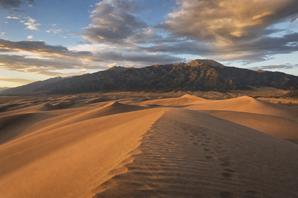
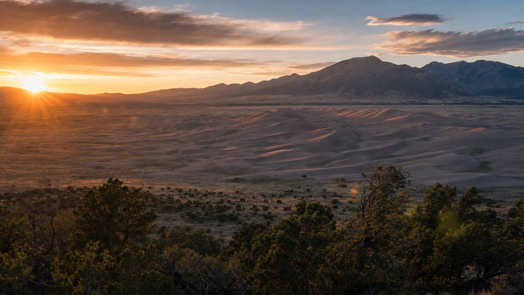
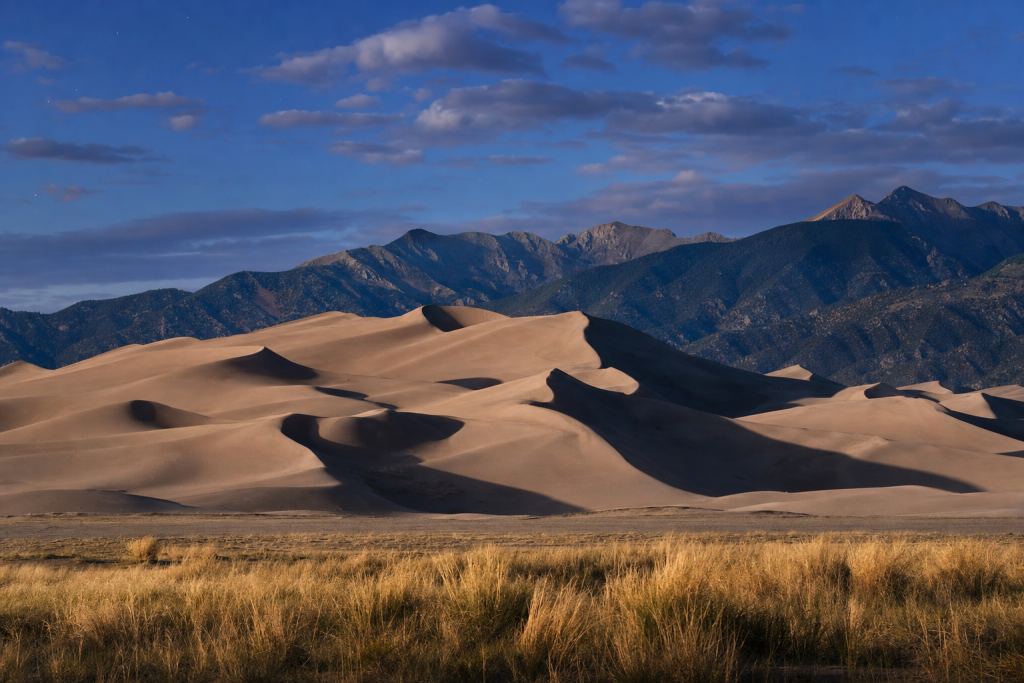
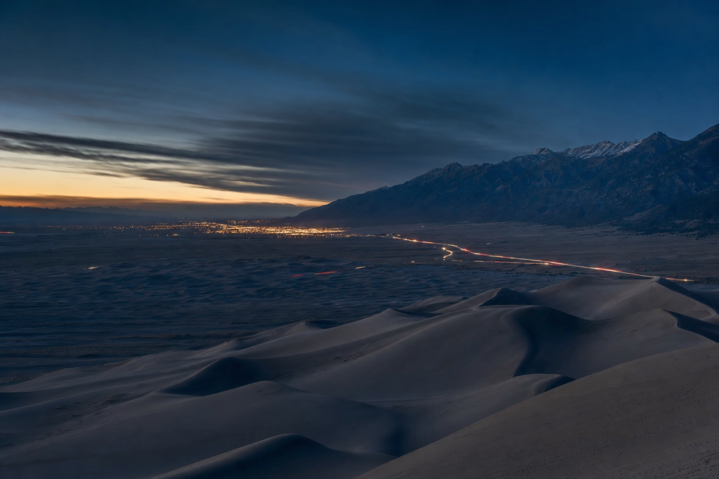
Great Sand Dunes National Park is one of the rare places in the U.S. where you can photograph alpine peaks, a massive dune sea, and seasonal creek reflections in the same frame – often with almost no light pollution once the sun drops behind the Sangre de Cristo Range. For practitioners, see our breakdown of dual-base ISO sensor. For practitioners, see our breakdown of radial mask for sun glow. For practitioners, see our breakdown of aperture and depth of field control.
shutyouraperture-20). Buying through these links costs you nothing extra and helps fund our free guides.
This guide is built for photographers: a quick map of GPS-verified shooting spots, when to visit by season, current entrance fees, permit notes, safety + ethics, and practical lens and editing advice – so you can arrive with a plan and leave with a portfolio.
Get the Great Sand Dunes Ultimate Photographer’s Guide
Every location below — pre-mapped with GPS, golden-hour timing, gear recommendations, cultural rules, and a 14-day itinerary. Downloaded by 200+ working photographers.
 Save
SaveQuick map: 14 photography spots (with GPS)
Use these GPS points as a starting list, then refine your exact compositions on-site. NPS notes there are no trails in the dunefield and that third-party hiking apps can be inaccurate. (NPS hiking info: https://www.nps.gov/grsa/planyourvisit/hiking.htm)
- Great Sand Dunes Visitor Center (start here for conditions): 11999 State Highway 150, Mosca, CO 81146. (NPS visitor center: https://www.nps.gov/grsa/planyourvisit/visitor-center.htm)
- Dunes Parking Lot (main access): 37.7306, -105.5136 (approx. parking area)
- High Dune (First Ridge): 37.74908, -105.532775 (NPS hiking info: https://www.nps.gov/grsa/planyourvisit/hiking.htm)
- Star Dune: 37.7517639, -105.5580583 (NPS hiking info: https://www.nps.gov/grsa/planyourvisit/hiking.htm)
- Hidden Dune: 37.775916, -105.531912 (NPS hiking info: https://www.nps.gov/grsa/planyourvisit/hiking.htm)
- Medano Creek corridor (seasonal reflections): 37.7379, -105.5220 (approx.)
- Point of No Return (Medano Creek high point): 37.7399, -105.5249 (approx.)
- Castle Creek Picnic Area (east-side access): 37.7840, -105.5475 (approx.)
- Sand Pit (4WD access edge): 37.7922, -105.5158 (approx.)
- Montville Nature Trail / Mosca Pass Trailhead area: 37.7435, -105.4930 (approx.)
- Pinon Flats Campground: 37.7441, -105.5178 (approx.)
- Zapata Falls trailhead (nearby, outside park): 37.5933, -105.5131 (approx.)
- San Luis Lakes SWA (nearby reflections): 37.6516, -105.7254 (approx.)
- CO-150 telephoto pull-off zone: 37.7040, -105.5420 (approx.)
 Save
SaveEntrance fees + permits + reservations (current)
The NPS fees page lists a standard entrance pass fee range of $15-25 (vehicle, motorcycle, or walk-in/bicycle, depending on entry type) and the Great Sand Dunes Annual Pass at $45. (NPS fees: https://www.nps.gov/grsa/planyourvisit/fees.htm)
NPS notes fees are charged only when the entrance station (spring-fall) or visitor center (winter) is open, and passes can be purchased in advance online. (NPS fees: https://www.nps.gov/grsa/planyourvisit/fees.htm)
The park’s Special Use Permit page notes permits are required for certain organized uses (including weddings) and for filming; contact the Permit Office at 719-378-6321 for specifics. (NPS permits: https://www.nps.gov/grsa/planyourvisit/special-use-permits.htm)
 Save
Save14 best photography spots in Great Sand Dunes (with GPS, lenses, and golden-hour notes)
Field rule: In warm months, start early. NPS warns the sand surface can reach 150F and afternoon thunderstorms/lightning can be dangerous. (NPS hiking info: https://www.nps.gov/grsa/planyourvisit/hiking.htm)
Dunes Parking Lot (main access) (37.7306, -105.5136)
Best light: Sunrise if you want clean ridgelines before footprints multiply.
Lens recommendation: 24-70mm for story; 70-200mm for ridge compression.
Hike/difficulty: Easy (flat walk)
Hazards + notes: Windblown sand; protect lens seals.
High Dune (First Ridge) (37.74908, -105.532775)
Best light: Late sunset for long shadows; step onto crest for S-curves.
Lens recommendation: 16-35mm for leading lines; 70-200mm for shadow geometry.
Hike/difficulty: Moderate (sand ascent)
Hazards + notes: No trail; heat + lightning risk. (NPS hiking info: https://www.nps.gov/grsa/planyourvisit/hiking.htm)
Star Dune (37.7517639, -105.5580583)
Best light: Sunset from summit for dune-ocean feel; sunrise for crisp texture.
Lens recommendation: 24-70mm for balanced ridge/peaks; 100-400mm for abstract layers.
Hike/difficulty: Hard (long sand hike)
Hazards + notes: No trail; allow extra time. (NPS hiking info: https://www.nps.gov/grsa/planyourvisit/hiking.htm)
Hidden Dune (37.775916, -105.531912)
Best light: Midday can work here if clouds add contrast; otherwise stay for low sun.
Lens recommendation: 70-200mm or 100-400mm for minimalist dune folds.
Hike/difficulty: Hard (very long)
Hazards + notes: Start early; no trail. (NPS hiking info: https://www.nps.gov/grsa/planyourvisit/hiking.htm)
Medano Creek corridor (seasonal) (37.7379, -105.5220)
Best light: Golden hour when water glows; blue hour for mirror effects.
Lens recommendation: 24-70mm; polarizer for sheen control.
Hike/difficulty: Easy-moderate
Hazards + notes: Water crossings; sand can be unstable.
Point of No Return (Medano Creek) (37.7399, -105.5249)
Best light: Low sun for reflective ribbon of water leading into dunes.
Lens recommendation: 16-35mm to exaggerate creek leading line.
Hike/difficulty: Moderate
Hazards + notes: Seasonal; watch footing.
Castle Creek Picnic Area (east access) (37.7840, -105.5475)
Best light: Sunrise for side-light on eastern ridges; good for emptier compositions.
Lens recommendation: 24-70mm; 70-200mm for tight ridge studies.
Hike/difficulty: Easy
Hazards + notes: 4WD access can vary; avoid soft sand.
Sand Pit access edge (37.7922, -105.5158)
Best light: Sunset as shadows climb; great for telephoto ridge patterns.
Lens recommendation: 70-200mm / 100-400mm.
Hike/difficulty: Easy-moderate
Hazards + notes: Soft sand; do not get stuck.
Montville Nature Trail / Mosca Pass area (37.7435, -105.4930)
Best light: Morning for cottonwood/creek light; use as context set before dunes.
Lens recommendation: 35mm/50mm prime for environmental details.
Hike/difficulty: Easy
Hazards + notes: Mosquitoes in season; stay on trail.
Pinon Flats Campground (37.7441, -105.5178)
Best light: Blue hour + night sky over dunes (from edges).
Lens recommendation: Fast 14-24mm + sturdy tripod.
Hike/difficulty: Easy
Hazards + notes: Respect quiet hours; protect gear from dew.
CO-150 telephoto pull-off zone (37.7040, -105.5420)
Best light: Sunset for peak alpenglow behind dune silhouettes.
Lens recommendation: 100-400mm for peaks+dunes compression.
Hike/difficulty: Easy
Hazards + notes: Roadside safety; traffic.
San Luis Lakes SWA (nearby) (37.6516, -105.7254)
Best light: Sunrise reflections on calm mornings; dunes appear as distant texture.
Lens recommendation: 70-200mm; polarizer.
Hike/difficulty: Easy
Hazards + notes: Wind; check access rules.
Zapata Falls (nearby canyon) (37.5933, -105.5131)
Best light: Midday shade works; long exposure in narrow light.
Lens recommendation: 16-35mm; ND optional.
Hike/difficulty: Moderate (short but rocky/wet)
Hazards + notes: Slippery rocks, cold water.
Visitor Center exterior / interpretive area (37.7300, -105.5120)
Best light: Late afternoon for warm architecture + peaks; use for arrival shots.
Lens recommendation: 24-70mm.
Hike/difficulty: Easy
Hazards + notes: Respect closures/hours.
 Save
SaveDrone rules
NPS policy (Memo 14-05) directs superintendents to prohibit launching, landing, or operating uncrewed aircraft on lands and waters administered by the NPS (with limited exceptions), and violations can be prosecuted as a misdemeanor with penalties up to six months in jail and a $5,000 fine. (NPS uncrewed aircraft policy: https://www.nps.gov/articles/uncrewed-aircraft-in-the-national-parks.htm)
Post-processing
- Texture first: apply clarity/texture locally, not globally.
- Color discipline: sand can go orange fast – pull saturation down and warm with subtle grading.
- Sky control: dunes are about shape; keep the sky secondary unless storms are special.
All links go to Viator (a TripAdvisor company), the world’s largest marketplace for guided experiences. Tagged as affiliate per FTC.
Luminar Neo’s Sky AI, atmosphere AI and SuperSharp are designed for landscape work — replace flat skies, add depth, and recover detail in seconds. Tagged as affiliate per FTC.
Quick Amazon shortcuts to the gear most useful for this kind of shot. Use them if Prime shipping or Amazon credit makes more sense than B&H. As an Amazon Associate ShutYourAperture earns from qualifying purchases.
Take Great Sand Dunes National Park home in your pocket.
Every shot location, every angle, every time of day worth shooting. Printable PDF + GPS-tagged map.
Instant download. Works on phone, tablet, and printed.
All links go to B&H Photo Video, the trusted pro source. Tagged as affiliate per FTC.
Related guides nearby
Other photography destinations to explore:
- Denver 230 km away · city · USA
- Arches 369 km away · national park · USA
- Mesa Verde 383 km away · national park · USA
The complete Great Sand Dunes guide is $47
All vantage points above + 5 bonus secret spots, printable map, gear pack list, and editing recipes. One-time payment, instant download, lifetime updates.
Common questions about the Great Sand Dunes guide
Is the Great Sand Dunes photography guide worth $47?
For most photographers, yes. The guide saves 8-12 hours of trip-planning research and prevents the most common mistake of Great Sand Dunes photography: shooting at the wrong time of day. If a single better frame is worth $47 to you, the guide pays for itself on day one. Buyers get every GPS coordinate, every golden-hour window, every cultural rule, and a printable shot list.
Does the Great Sand Dunes guide include GPS coordinates?
Yes — every vantage point in the guide has Google Maps-ready GPS coordinates so you can pin them before you fly. The guide also includes a printable map showing all locations clustered by walking distance, so you can build efficient half-day routes.
What's in the Great Sand Dunes PDF that isn't in this article?
The article shows the highlights. The PDF includes: 5 additional secret spots not published online, a 14-day itinerary with daily routes, the full camera-settings cheat sheet for every scenario in Great Sand Dunes, a printable gear packing list, post-processing recipes with screenshot examples, and a list of local guides we trust for portrait commissions.
Do I get the Lightroom presets too?
The $47 guide is the PDF only. The matching Great Sand Dunes preset pack is a separate $19 download — most buyers grab both as a bundle and save the editing time. Both are instant download, both work on Lightroom Classic and Lightroom Mobile.
Will the guide work for a Great Sand Dunes trip in 2026?
Yes. The guide is updated annually as fees, restrictions, and new vantage points change. All buyers get free lifetime updates. The 2026 edition includes the latest drone rules, museum photography policies, and seasonal light data for the year.
Visiting more than Great Sand Dunes?
Bundle multiple destination guides and save planning time across the trip:
- Yellowstone Photographer’s Guide ($47)
- Yosemite Photographer’s Guide ($47)
- Grand Canyon Photographer’s Guide ($47)
- Zion Photographer’s Guide ($47)
- Glacier Photographer’s Guide ($47)
Or get all 60+ destinations in one bundle: Photo Atlas — every guide, every map, $97.
 Save
SaveRelated photography spots in US National Parks
Other curated location guides in the same region:
Browse all photography spots in US National Parks →
What to Pack
A focused landscape kit handles every shot at Great Sand Dunes National Park without breaking your back. Here is the working photographer's pack list — every link goes to B&H Photo Video (our primary supplier) or Amazon (for accessories and same-day delivery in the US).
| What & Why | B&H | Amazon |
|---|---|---|
Wide-angle zoom (14-35mm range) The single most important lens for sweeping vistas. Pair with a circular polarizer for skies and water. | Shop B&H → | Shop Amazon → |
Sturdy travel tripod Carbon fiber, packs to 15 inches, holds steady in wind off the coast. Essential for blue-hour and long-exposure work. | Shop B&H → | Shop Amazon → |
Circular polarizer (77mm or 82mm) Cuts haze, deepens sky, reveals texture in water. Non-negotiable for landscape work. | Shop B&H → | Shop Amazon → |
10-stop ND filter For 30-second exposures that turn moving water and clouds into silk. | Shop B&H → | Shop Amazon → |
Extra batteries (3 minimum) Cold weather and long exposures eat batteries. Carry triple what you think you need. | Shop B&H → | Shop Amazon → |
Fast SD/CFexpress cards V90 or CFexpress depending on your body. Two cards minimum so a failure mid-trip is recoverable. | Shop B&H → | Shop Amazon → |
Microfiber lens cloths Salt spray, mist, and dust will ruin every shot if you don't carry a cloth. | Shop B&H → | Shop Amazon → |
B&H and Amazon links are affiliate links. We earn a small commission on purchases at no extra cost to you. We only recommend gear we use or would buy ourselves.